Category:Pestkreuz Neustifterstrasse (Schönberg am Kamp)
Jump to navigation
Jump to search
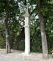
wayside shrine in Schönberg (Lower Austria)  | |||||
| Upload media | |||||
| Instance of | |||||
|---|---|---|---|---|---|
| Location | Schönberg am Kamp, Krems District, Lower Austria, Austria | ||||
| Heritage designation | |||||
| Inception |
| ||||
 | |||||
Media in category "Pestkreuz Neustifterstrasse (Schönberg am Kamp)"
The following 2 files are in this category, out of 2 total.
-
 Pestsäule an der Neustifterstraße.JPG 1,118 × 1,680; 1.09 MB
-
 Tabernakelpfeiler Schoenberg Neustifterstrasse 2020.jpg 3,426 × 3,962; 3.51 MB
