Category:Pfarrhaus Schlosswil
Jump to navigation
Jump to search
| Object location | | View all coordinates using: OpenStreetMap |
|---|
church building in Schlosswil in the municipality of Grosshöchstetten in the canton of Bern, Switzerland  | |||||
| Upload media | |||||
| Instance of | |||||
|---|---|---|---|---|---|
| Part of | |||||
| Location | Schlosswil, Grosshöchstetten, Bern-Mittelland administrative district, Bernese Mittelland administrative region, Bern, Switzerland | ||||
| Street address |
| ||||
| Heritage designation | |||||
| Inception |
| ||||
 | |||||
Media in category "Pfarrhaus Schlosswil"
The following 3 files are in this category, out of 3 total.
-
 CH-NB - Schlosswil, Pfarrhaus und Kirche - Collection Gugelmann - GS-GUGE-WEIBEL-D-120a.tif 6,260 × 4,278, 2 pages; 53.67 MB
-
 CH-NB - Schlosswil, Pfarrhaus und Kirche - Collection Gugelmann - GS-GUGE-WEIBEL-D-120b.tif 5,910 × 4,037, 2 pages; 52.99 MB
-
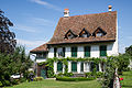 Schlosswil Pfarrhaus.jpg 5,453 × 3,635; 16.8 MB