Category:Pfarrkirche Höbersbrunn
Jump to navigation
Jump to search
| Object location | | View all coordinates using: OpenStreetMap |
|---|
church building in Gaweinstal, Austria .JPG) | |||||
| Upload media | |||||
| Instance of | |||||
|---|---|---|---|---|---|
| Location | Gaweinstal, Mistelbach District, Lower Austria, Austria | ||||
| Street address |
| ||||
| Heritage designation | |||||
 | |||||
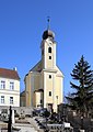
Deutsch: Pfarrkirche hl. Laurentius in Höbersbrunn (Gemeine Gaweinstal, Niederösterreich)
Media in category "Pfarrkirche Höbersbrunn"
The following 3 files are in this category, out of 3 total.
-
 Höbersbrunn - Kirche (1).JPG 2,785 × 3,937; 7.69 MB
-
 Höbersbrunn - Kirche (2).JPG 3,465 × 2,450; 6.05 MB
-
 Höbersbrunn Pfarrkirche Hl Laurentius.jpg 1,139 × 854; 310 KB
.JPG)
