Category:Pfarrkirche Tigring
Jump to navigation
Jump to search
| Object location | | View all coordinates using: OpenStreetMap |
|---|
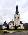
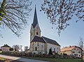
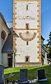
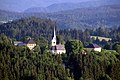
church building in Moosburg, Austria  | |||||
| Upload media | |||||
| Instance of | |||||
|---|---|---|---|---|---|
| Named after | |||||
| Location | Moosburg, Klagenfurt-Land District, Carinthia, Austria | ||||
| Heritage designation | |||||
 | |||||
Subcategories
This category has the following 2 subcategories, out of 2 total.
Media in category "Pfarrkirche Tigring"
The following 59 files are in this category, out of 59 total.
-
 Moosburg Tigring Friedhof Grabstein Alfons Edler von Emberger 03052017 8131.jpg 4,824 × 7,218; 17.5 MB
-
 Moosburg Tigring Friedhof Karner Pfarrkirche hl. Egyd mit Antoniuskapelle 04102022 3095.jpg 7,040 × 4,912; 19.75 MB
-
 Moosburg Tigring Karner Pfarrkirche hl. Egyd mit Antoniuskapelle 06112010 9207.jpg 4,288 × 2,848; 6.38 MB
-
 Moosburg Tigring Lindenweg Friedhof Kriegerdenkmal O-Ansicht 04102022 3098.jpg 7,360 × 4,912; 26.65 MB
-
 Moosburg Tigring Pfarrkirche Heiliger Egyd 01112010 02.jpg 2,784 × 3,536; 2.58 MB
-
 Moosburg Tigring Pfarrkirche hl Egyd 03052017 8155.jpg 3,971 × 6,479; 8.39 MB
-
 Moosburg Tigring Pfarrkirche hl Egyd Apsis und Langhaus N-Ansicht 31102016 5324.jpg 6,578 × 3,681; 12.05 MB
-
 Moosburg Tigring Pfarrkirche hl Egyd mit Antoniuskapelle und Karner 06112010 217.jpg 3,341 × 2,022; 3.92 MB
-
 Moosburg Tigring Pfarrkirche hl Egyd mit Antoniuskapelle und Karner 31102016 5310.jpg 5,414 × 4,833; 9.91 MB
-
 Moosburg Tigring Pfarrkirche hl Egyd mit Antoniuskapelle und Karner 31102016 5312.jpg 5,453 × 4,677; 9.7 MB
-
 Moosburg Tigring Pfarrkirche hl Egyd mit Friedhof und Karner O-Ansicht 31102016 5328.jpg 7,360 × 4,912; 20.71 MB
-
 Moosburg Tigring Pfarrkirche hl Egyd mit Friedhof und Pfarrhof 31102016 5331.jpg 4,896 × 3,645; 10 MB
-
 Moosburg Tigring Pfarrkirche hl Egyd mit Rundkarner 20022015 7683.jpg 2,832 × 4,256; 6.72 MB
-
 Moosburg Tigring Pfarrkirche hl Egyd Turmaufgang Ost-Ansicht 03052017 8124.jpg 7,360 × 4,912; 18.88 MB
-
 Moosburg Tigring Pfarrkirche hl Egyd Turmaufgang und Chorschluss 20022015 7707.jpg 4,169 × 2,774; 6.54 MB
-
 Moosburg Tigring Pfarrkirche hl. Egyd Chor NO-Ansicht 04102022 3075.jpg 4,600 × 6,853; 18.12 MB
-
 Moosburg Tigring Pfarrkirche hl. Egyd Chor NW-Ansicht 04102022 3074.jpg 4,577 × 7,360; 19.08 MB
-
 Moosburg Tigring Pfarrkirche hl. Egyd Chorschluss Fenster 04102022 3093.jpg 4,339 × 7,333; 18.61 MB
-
 Moosburg Tigring Pfarrkirche hl. Egyd Chorschluss NNO-Ansicht 04102022 3076.jpg 4,504 × 6,882; 15.44 MB
-
 Moosburg Tigring Pfarrkirche hl. Egyd Epitaph Alfons Edler von Emberger 04102022 3072.jpg 4,912 × 7,360; 18.76 MB
-
 Moosburg Tigring Pfarrkirche hl. Egyd Epitaph Franz Stromberger 04102022 3094.jpg 4,912 × 6,601; 14.64 MB
-
 Moosburg Tigring Pfarrkirche hl. Egyd Epitaph Katharina Biedermann 04102022 3092.jpg 4,912 × 7,360; 18.54 MB
-
 Moosburg Tigring Pfarrkirche hl. Egyd Epitaph Renata Edle von Emperger 04102022 3073.jpg 4,788 × 6,505; 16.42 MB
-
 Moosburg Tigring Pfarrkirche hl. Egyd Epitaph Theresia Ogertschnig 04102022 3077.jpg 4,912 × 6,551; 23.09 MB
-
 Moosburg Tigring Pfarrkirche hl. Egyd Freitreppe zur Orgelempore 04102022 3080.jpg 4,912 × 7,360; 21.52 MB
-
 Moosburg Tigring Pfarrkirche hl. Egyd Freitreppe zur Orgelgalerie 03052017 8135.jpg 4,912 × 7,360; 19.1 MB
-
 Moosburg Tigring Pfarrkirche hl. Egyd Glockenturm unterer Teil 04102022 3089.jpg 4,531 × 7,360; 18.78 MB
-
 Moosburg Tigring Pfarrkirche hl. Egyd mit Friedhof und Rundkarner 20022015 7684.jpg 2,832 × 4,256; 5.23 MB
-
 Moosburg Tigring Pfarrkirche hl. Egyd mit Rundkarner 20022015 7711.jpg 4,256 × 2,832; 8.08 MB
-
 Moosburg Tigring Pfarrkirche hl. Egyd NNW-Ansicht 04102022 3070.jpg 4,195 × 6,365; 12.5 MB
-
 Moosburg Tigring Pfarrkirche hl. Egyd NNW-Ansicht 04102022 3071.jpg 4,633 × 3,973; 11.92 MB
-
 Moosburg Tigring Pfarrkirche hl. Egyd Sonnenuhr und Turmaufgang 03052017 8139.jpg 7,248 × 4,912; 17.74 MB
-
 Moosburg Tigring Pfarrkirche hl. Egyd Turmaufgang 03052017 8146.jpg 4,912 × 7,360; 19.68 MB
-
 Moosburg Tigring Pfarrkirche hl. Egyd Turmaufgang S-Ansicht 04102022 3091.jpg 4,655 × 7,177; 21.47 MB
-

-
 Moosburg Tigring Pfarrkirche hl. Egyd W-Portal 04102022 3079.jpg 7,175 × 4,822; 21.91 MB
-
 Moosburg Tigring Pfarrkirche hl. Egyd W-Wand SW-Ansicht 04102022 3083.jpg 4,912 × 7,360; 23.19 MB
-
 Moosburg Tigring Pfarrkirche hl. Egyd West-Portal 31102016 5313.jpg 7,360 × 4,912; 20.49 MB
-
 Moosburg Tigring Volksschule und Pfarrkirche hl Egyd 05032015 0369.jpg 7,005 × 4,675; 15.37 MB
-
 Tigring 01.jpg 3,008 × 2,000; 1.38 MB
-
 Tigring Pfarrkirche hl Egyd HA Aedikula Figur hl Egyd 23092014 786.jpg 3,280 × 4,928; 13.82 MB
-
 Tigring Pfarrkirche hl Egyd Hochaltar mit Opfergangportalen 23092014 779.jpg 3,199 × 4,806; 10.91 MB
-
 Tigring Pfarrkirche hl Egyd Kanzel 23092014 793.jpg 3,280 × 4,928; 9.67 MB
-
 Tigring Pfarrkirche hl Egyd Langhaus Inneres 23092014 794.jpg 4,928 × 3,280; 10.68 MB
-
 Tigring Pfarrkirche hl Egyd li OG-Portal Figur hl Egyd 23092014 795.jpg 3,280 × 4,928; 10.18 MB
-
 Tigring Pfarrkirche hl Egyd mit Friedhof und Rundkarner 20022015 7720.jpg 3,278 × 2,194; 3.93 MB
-
 Tigring Pfarrkirche hl Egyd mit Rundkarner 23092014 401.jpg 3,280 × 4,928; 14.28 MB
-
 Tigring Pfarrkirche hl Egyd mit Rundkarner 23092014 947.jpg 3,280 × 4,928; 9.85 MB
-
 Tigring Pfarrkirche hl Egyd re OG-Portal Figur hl Egyd 23092014 788.jpg 3,280 × 4,928; 10.85 MB
-
 Tigring Pfarrkirche hl Egyd Turmaufgang und Chorschluss 20022015 7708.jpg 4,256 × 2,832; 6.92 MB
-
 Tigring Pfarrkirche hl. Egyd Turmaufgang und Chorschluss 20022015 7717.jpg 4,256 × 2,832; 6.54 MB
-
 Moosburg Tigring Karner und Pfarrkirche Nachtaufnahme 23082009 96.jpg 2,814 × 3,648; 1.07 MB
-
 Moosburg Tigring Pfarrkirche 16082009 444.jpg 2,304 × 2,783; 1.12 MB
-
 Moosburg Tigring Pfarrkirche Nachtaufnahme 23082009 91.jpg 2,748 × 3,054; 3.63 MB
-
 Tigring Deckenfresko.jpg 3,383 × 4,352; 2.04 MB
-
 Tigring Fresken.jpg 4,185 × 3,051; 2.06 MB
-
 Tigring Gerichtsplatz 01.jpg 3,008 × 2,000; 1.36 MB
-
 Tigring innen.JPG 4,878 × 3,648; 2.45 MB
-
 Tigring Pfarrkirche 01.jpg 1,720 × 2,368; 818 KB


Categories:
- 12th-century architecture in Carinthia
- Churches in Bezirk Klagenfurt Land
- Churches in Dekanat Klagenfurt-Land
- Churches in Moosburg (Carinthia)
- Cultural heritage monuments in Moosburg (Carinthia)
- Gothic architecture in Carinthia
- Gothic church towers in Carinthia
- History of Carinthia
- Saint Giles churches in Carinthia
- Tigring
- White churches in Carinthia