Category:Philippusfenne
Jump to navigation
Jump to search
| Object location | | View all coordinates using: OpenStreetMap |
|---|
 | |||||
| Upload media | |||||
| Instance of | |||||
|---|---|---|---|---|---|
| Part of | |||||
| Location | Kollum, Noardeast-Fryslân, Friesland, Netherlands | ||||
| Street address |
| ||||
| Heritage designation |
| ||||
 | |||||
|
This is a category about rijksmonumentcomplex number 529467
|
| Address |
|
Media in category "Philippusfenne"
The following 74 files are in this category, out of 74 total.
-

-

-

-

-
 Exterieur en park - Kollum - 20126643 - RCE.jpg 1,195 × 1,200; 481 KB
-
 Exterieur voorzijde - Kollum - 20126642 - RCE.jpg 1,192 × 1,200; 449 KB
-

-
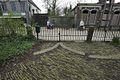
 Hekwerk bij Voorstraat 87, Kollum.JPG 3,420 × 2,370; 1.63 MB
-

-

-

-

-

-

-

-

-

-

-

-

-

-

-

-

-

-

-

-

-

-
 Interieur, overzicht keuken - Kollum - 20376921 - RCE.jpg 1,200 × 794; 159 KB
-
 Interieur, overzicht zolder (grenenhout) - Kollum - 20376986 - RCE.jpg 1,200 × 795; 161 KB
-

-

-

-

-

-
 Overzicht - Kollum - 20126640 - RCE.jpg 1,190 × 1,200; 333 KB
-
 Overzicht achtergevel - Kollum - 20376992 - RCE.jpg 1,200 × 796; 329 KB
-
 Overzicht achtergevel - Kollum - 20376993 - RCE.jpg 1,200 × 795; 252 KB
-

-

-

-

-
 Overzicht voorgevel - Kollum - 20126641 - RCE.jpg 1,200 × 1,200; 446 KB
-
 Overzicht voorgevel vanaf de Voorstraat gezien - Kollum - 20376862 - RCE.jpg 1,200 × 795; 293 KB
-

-
 Overzicht zijgevel vanaf de Andreaestraat - Kollum - 20376861 - RCE.jpg 1,200 × 794; 300 KB
-
 Park, achterzijde, glooiend vlak langs het pad - Kollum - 20376870 - RCE.jpg 1,200 × 796; 340 KB
-

-
 Park, achterzijde, ovale vijver met houtopstand - Kollum - 20376871 - RCE.jpg 1,200 × 794; 335 KB
-

-
 Park, achterzijde, splisting van het pad - Kollum - 20376868 - RCE.jpg 1,200 × 796; 329 KB
-

-

-
 Park, achterzijde, vijver met elegante voetbrug - Kollum - 20376872 - RCE.jpg 1,200 × 796; 342 KB
-

-

-

-
 Park, slingerend bospad - Kollum - 20376885 - RCE.jpg 1,200 × 795; 348 KB
-
 Park, smal slingerend bospad met stinzenplanten - Kollum - 20376875 - RCE.jpg 1,200 × 795; 325 KB
-
 Parkaanleg rondom het huis, zijde Voorstraat - Kollum - 20376889 - RCE.jpg 1,200 × 795; 326 KB
-
 Philippusfenne, Voorstraat 87, Kollum.JPG 4,608 × 3,456; 3.53 MB
-

-

-

-

-
-

-
 Voorgevel het huis, zijde Voorstraat - Kollum - 20376895 - RCE.jpg 794 × 1,200; 202 KB
-

-

-
 Voorstraat 87, hekwerk.jpg 4,928 × 3,264; 4.05 MB
-
 Voorstraat 87, Kollum.jpg 4,928 × 3,264; 4.03 MB
-
 Voortuin Philippusfenne Kollum.JPG 4,608 × 3,456; 2.81 MB


_-_Kollum_-_20376986_-_RCE.jpg)


