Category:Phillip Island, Victoria
Jump to navigation
Jump to search
island in Victoria, Australia   | |||||
| Upload media | |||||
| Instance of | |||||
|---|---|---|---|---|---|
| Named after | |||||
| Location | Bass Coast Shire, Victoria, AUS | ||||
| Located in or next to body of water | |||||
| Capital | |||||
| Width |
| ||||
| Length |
| ||||
| Population |
| ||||
| Area |
| ||||
| Elevation above sea level |
| ||||
| Different from | |||||
 | |||||
Subcategories
This category has the following 22 subcategories, out of 22 total.
B
C
- Cape Woolamai, Victoria (1 P, 30 F)
- Churchill Island (5 F)
G
M
N
- Newhaven, Victoria (15 F)
P
- Phillip Island Bridge (7 F)
- Pyramid Rock Festival (2 F)
R
- Rhyll, Victoria (8 F)
S
- Smiths Beach, Victoria (2 F)
- Sunderland Bay, Victoria (1 F)
- Sunset Strip, Victoria (2 F)
- Surf Beach, Victoria (3 F)
V
Media in category "Phillip Island, Victoria"
The following 32 files are in this category, out of 32 total.
-
 097 Phillip Island, Jan 1979 (52096689294).jpg 2,520 × 1,865; 1.83 MB
-
 098 Phillip Island, Jan 1979 (52096868852).jpg 1,920 × 2,560; 1.39 MB
-
 099 Phillip Island, Jan 1979 (52098394910).jpg 2,514 × 1,860; 1.54 MB
-
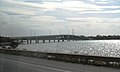 Australia - Phillip Island - Bridge.jpg 1,321 × 791; 262 KB
-
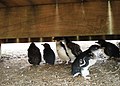 Australia - Phillip Island - Penguin (Eudyptula minor).jpg 1,946 × 1,392; 844 KB
-
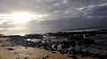
 Beach on Phillip Island.JPG 3,264 × 4,928; 8.52 MB
-
 Galah at Phillip Island (4782127143).jpg 2,048 × 1,536; 1.51 MB
-
 ISS-60 Melbourne, Australia on Port Philip Bay.jpg 5,568 × 3,712; 2.59 MB
-
Koala Feeding.webm 31 s, 2,160 × 3,840; 14.83 MB
-
 Map Woolamai Granite Distribution.jpg 587 × 329; 40 KB
-
 Newhaven Yacht Club in 2022.jpg 4,032 × 3,024; 3.98 MB
-
 Ocean view, Port Philip.jpg 1,920 × 1,080; 315 KB
-
 Pantaipulauphillip.jpg 1,280 × 960; 418 KB
-
 Phillip Island Rd, San Remo VIC 3925, Australia - panoramio.jpg 2,700 × 1,800; 637 KB
-
 Phillip island.jpg 2,448 × 3,264; 1.65 MB
-
 Phillip island1.jpg 4,896 × 3,672; 4.21 MB
-
 Pyramid Rock Lookout Phillip Island Victoria - panoramio.jpg 3,888 × 2,592; 5.02 MB
-
 Strong light - panoramio.jpg 1,200 × 1,200; 724 KB
-
 Stunning landscape of Philip Island.jpg 1,440 × 2,560; 1.05 MB
-
 Sun and clouds in Port Philip.jpg 3,264 × 2,448; 2.32 MB
-
 Sun and waves in Port Philip.jpg 3,264 × 2,448; 2.52 MB
-
 Sun beauty.jpg 3,264 × 2,448; 2.19 MB
-
 Sun from within in Port Philip.jpg 3,264 × 2,448; 2.4 MB
-
 Sun hidden in the clouds in Port Philip.jpg 1,920 × 1,080; 398 KB
-
 Sun within clouds in Philip Island.jpg 3,264 × 2,448; 2.45 MB
-
 Sunday Trip - Flickr - 3B's.jpg 7,952 × 5,304; 36.27 MB
-
 The beauty of the sun and ocean.jpg 3,264 × 2,448; 2.72 MB
-
 The Nobbies - Flickr - uphillblok.jpg 4,522 × 2,544; 2.03 MB
-
 The Nobbies Walk at Phillip Island VIC Australia.jpg 3,968 × 2,976; 2.26 MB
-
 The sun in Port Philip.jpg 3,264 × 2,448; 2.59 MB
-
 Thumbnail -2186248371243694720 IMG 0712.jpg 1,280 × 853; 272 KB
-
 Woolamai granite at Pyramid Rock.jpg 600 × 448; 98 KB
.jpg)
.jpg)
.jpg)

.jpg)

.jpg)


