Category:Plaça de Soler i Gustems
Jump to navigation
Jump to search
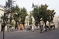
This is a category about a building listed in the Catalan heritage register as Bé Cultural d'Interès Local (BCIL) under the reference IPA-42818. |
| Object location | | View all coordinates using: OpenStreetMap |
|---|
.jpg) | |||||
| Upload media | |||||
| Instance of | |||||
|---|---|---|---|---|---|
| Location | Vilanova i la Geltrú, Barcelona Province, Catalonia | ||||
| Has part(s) | |||||
| Heritage designation |
| ||||
| Elevation above sea level |
| ||||
 | |||||
Subcategories
This category has only the following subcategory.
F
- Font de la plaça dels Carros (6 F)
Media in category "Plaça de Soler i Gustems"
The following 2 files are in this category, out of 2 total.
-
 Plaça de Soler i Gustems (Vilanova i la Geltrú).jpg 6,000 × 4,000; 8.81 MB
-
 Plaça de Soler i Gustems, plaça dels carros (Vilanova i la Geltrú).jpg 6,000 × 4,000; 9.53 MB
.jpg)