Category:Place Fell
Jump to navigation
Jump to search
hill in the United Kingdom  | |||||
| Upload media | |||||
| Instance of | |||||
|---|---|---|---|---|---|
| Location | Lake District, Cumbria, North West England, England | ||||
| Mountain range | |||||
| Elevation above sea level |
| ||||
| Parent peak | |||||
 | |||||
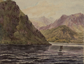
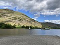
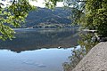
English: Place Fell is a hill in the English Lake District. It stands at the corner of the upper and middle reaches of Ullswater, with steep western flanks overlooking the villages of Glenridding and Patterdale.
Media in category "Place Fell"
The following 25 files are in this category, out of 25 total.
-
 Ascending Place Fell - geograph.org.uk - 1055781.jpg 640 × 480; 56 KB
-
 Cairn, Place Fell - geograph.org.uk - 651057.jpg 640 × 480; 72 KB
-
 Descending Place Fell in cloud - geograph.org.uk - 893068.jpg 640 × 425; 73 KB
-
 DV342 Place Fell.png 1,665 × 1,283; 6.12 MB
-
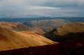
 From Place Fell - geograph.org.uk - 1055776.jpg 640 × 480; 78 KB
-
 From Place Fell - geograph.org.uk - 1742145.jpg 640 × 480; 74 KB
-
 Frozen Tarn, Place Fell - geograph.org.uk - 1742134.jpg 640 × 480; 76 KB
-
 On Place Fell - geograph.org.uk - 1742110.jpg 480 × 640; 85 KB
-
 On Place Fell - geograph.org.uk - 1742118.jpg 480 × 640; 78 KB
-
 On Place Fell - geograph.org.uk - 1742122.jpg 640 × 480; 60 KB
-
 On Place Fell - geograph.org.uk - 1742124.jpg 640 × 480; 62 KB
-
 Place Fell - geograph.org.uk - 1241311.jpg 640 × 483; 63 KB
-
 Place Fell - geograph.org.uk - 7749.jpg 640 × 480; 113 KB
-
 Place Fell above Ullswater (1571069952).jpg 1,600 × 1,200; 277 KB
-
 Place Fell from Ullswater.jpg 4,032 × 3,024; 4.03 MB
-
 Place Fell.jpg 2,048 × 1,536; 1.42 MB
-
 Summit of Place Fell - geograph.org.uk - 909270.jpg 640 × 558; 73 KB
-
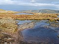 Tarns, Place Fell - geograph.org.uk - 1055786.jpg 640 × 480; 84 KB
-
 Temperature inversion Place Fell - geograph.org.uk - 1513162.jpg 640 × 480; 63 KB
-
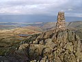 Trig Pillar, Place Fell - geograph.org.uk - 1055789.jpg 640 × 480; 76 KB
-
 Trig Pillar, Place Fell - geograph.org.uk - 651048.jpg 640 × 480; 50 KB
-
-

-
 Descending Place Fell - geograph.org.uk - 82534.jpg 640 × 480; 96 KB
-
 Place Fell viewed across Ullswater - geograph.org.uk - 192932.jpg 640 × 426; 140 KB


.jpg)


