Category:Plage de l'Argentière
Jump to navigation
Jump to search
| Object location | | View all coordinates using: OpenStreetMap |
|---|
 | |||||
| Upload media | |||||
| Instance of | |||||
|---|---|---|---|---|---|
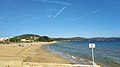
| Location | La Londe-les-Maures, Var, Provence-Alpes-Côte d'Azur, Metropolitan France, France | ||||
 | |||||
Media in category "Plage de l'Argentière"
The following 5 files are in this category, out of 5 total.
-
 Argentière.jpg 2,576 × 1,932; 684 KB
-
 L'Argentière.jpg 4,000 × 2,250; 3.48 MB
-
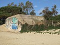 Plage de l'Argentière - blockhaus.jpg 2,816 × 2,112; 2.79 MB
-
 Plage de l'Argentière - vue vers l'est.jpg 2,816 × 2,112; 2.36 MB
-
 Plage de l'Argentière - vue vers l'ouest.jpg 2,816 × 2,112; 2.32 MB


