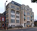
Category:Plaistow, Newham
Jump to navigation
Jump to search
urban area in the London Borough of Newham | |||||
| Upload media | |||||
| Instance of | |||||
|---|---|---|---|---|---|
| Location | London Borough of Newham, Greater London, London, England | ||||
| Different from | |||||
 | |||||
Subcategories
This category has the following 9 subcategories, out of 9 total.
G
M
- Memorial Community Church (5 F)
P
R
- Routemaster Close (4 F)
S
- St Andrew's Church, Plaistow (12 F)
- St. Mary's Hospital, Plaistow (16 F)
T
- The Earl of Derby, Plaistow (2 F)
Media in category "Plaistow, Newham"
The following 39 files are in this category, out of 39 total.
-
2024 LCY - View from KL982 (04).jpg 4,032 × 3,024; 5.44 MB
-
Assembles of God (Back to God) Church, Plaistow - geograph.org.uk - 3104032.jpg 4,288 × 3,216; 4.49 MB
-
Balaam Street - geograph.org.uk - 3282900.jpg 640 × 426; 87 KB
-
Balaam Street, Plaistow - geograph.org.uk - 5518850.jpg 640 × 480; 91 KB
-
Boundary Road at the junction of New City Road - geograph.org.uk - 3952734.jpg 2,560 × 1,920; 2 MB
-
Boundary Road, Plaistow - geograph.org.uk - 3952943.jpg 2,560 × 1,920; 1.99 MB
-
Buddhist Monastery - Buddha Vihara - Plaistow, E13.jpg 1,200 × 1,600; 338 KB
-
Carl Hans Lody grave.jpg 3,456 × 5,184; 7.35 MB
-
Cast iron street furniture, J.Blakeborough & Sons Ltd of Brighouse. Plaistow, E13.jpg 1,200 × 1,600; 413 KB
-
Chapel, Plaistow, E13.jpg 1,200 × 1,600; 208 KB
-
Christ Life Mission Church, Plaistow - geograph.org.uk - 3104021.jpg 4,288 × 3,216; 3.62 MB
-
Cobalt blue Victorian terraced house, Plaistow, E13.jpg 1,200 × 1,600; 287 KB
-
Corner Shop & Ghost Sign, Plaistow.jpg 4,193 × 2,796; 7.91 MB
-
Doorway, Plaistow, E13.jpg 1,200 × 1,600; 287 KB
-
Greengate House.jpg 3,072 × 2,601; 2.98 MB
-
Haig Road West, Plaistow - geograph.org.uk - 4465744.jpg 2,272 × 1,704; 826 KB
-
Hardware store, Plaistow, E13.jpg 1,600 × 2,133; 762 KB
-
High Street, Plaistow, London E13 - geograph.org.uk - 1471308.jpg 640 × 480; 78 KB
-
Inter-war housing, Plaistow, E13.jpg 2,133 × 1,600; 620 KB
-
Jedburgh Road, Plaistow - geograph.org.uk - 4465743.jpg 2,272 × 1,704; 834 KB
-
Khartoum Road, Plaistow - geograph.org.uk - 4465756.jpg 2,272 × 1,704; 733 KB
-
Liddon Road, Plaistow - geograph.org.uk - 4465770.jpg 2,272 × 1,704; 796 KB
-
New City Road at the junction of Boundary Road - geograph.org.uk - 3952725.jpg 2,560 × 1,920; 2 MB
-
New City Road, Plaistow - geograph.org.uk - 2876412.jpg 4,320 × 3,240; 3.81 MB
-
New City Road, Plaistow - geograph.org.uk - 3953432.jpg 2,560 × 1,920; 2.35 MB
-
Newman Road, Plaistow - geograph.org.uk - 4465769.jpg 2,272 × 1,704; 816 KB
-
Patrick Road, Plaistow - geograph.org.uk - 3953436.jpg 2,560 × 1,920; 2.01 MB
-
St. Andrews Road, Plaistow - geograph.org.uk - 4465766.jpg 2,272 × 1,704; 971 KB
-
Stone cladding, Plaistow, E13.jpg 2,133 × 1,600; 502 KB
-
Stone Cladding, Plaistow, E13.jpg 1,200 × 1,600; 419 KB
-
Sussex Street, Plaistow - geograph.org.uk - 4465764.jpg 2,272 × 1,704; 797 KB
-
The Abbey, Plaistow - geograph.org.uk - 4465776.jpg 2,272 × 1,704; 728 KB
-
The Armed and Navy, Public House, Plaistow - geograph.org.uk - 3104039.jpg 4,288 × 3,216; 3.7 MB
-
The building of Victoria docks.jpg 2,000 × 1,277; 432 KB
-
The Lord Stanley PH, Plaistow E13.jpg 2,133 × 1,600; 534 KB
-
The Swan, Plaistow - geograph.org.uk - 4465777.jpg 2,272 × 1,704; 797 KB
-
Upperton Road West, Plaistow - geograph.org.uk - 4465747.jpg 2,272 × 1,704; 935 KB


