Category:Plan de Vaugondy
Jump to navigation
Jump to search
Subcategories
This category has only the following subcategory.
P
Media in category "Plan de Vaugondy"
The following 13 files are in this category, out of 13 total.
-
 Plan de Vaugondy edited.jpg 1,515 × 1,239; 1.57 MB
-
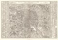
 Plan de Vaugondy.jpg 1,578 × 1,396; 756 KB
-
 Atlas des anciens plans de Paris - 095. Paris en 1760 - David Rumsey.jpg 24,827 × 17,328; 122.07 MB
-
 Atlas des anciens plans de Paris - Paris en 1760 - BHVP.jpg 5,178 × 3,474; 6.44 MB
-
 Atlas des anciens plans de Paris - Paris en 1760 - David Rumsey.jpg 20,600 × 14,000; 182.99 MB
-
 P1010299 Carte de Paris Vaugendy-1760 reductwk.JPG 2,000 × 1,487; 1.72 MB
-
 Paris en 1760, Fac-similé du Plan de Robert de Vaougondy - Paris Musées.jpg 12,456 × 8,416; 84.26 MB
-
 Paul Dujardin, Plan de la ville et des faubourgs de Paris (01) - Paris Musées.jpg 12,600 × 8,712; 85.72 MB
-
 Paul Dujardin, Plan de la ville et des faubourgs de Paris (02) - Paris Musées.jpg 4,932 × 3,384; 2.95 MB
-
 Plan de la ville et des faubourgs de Paris by Robert de Vaugondy, 1766 - Stanford Libraries.jpg 13,399 × 9,003; 25.5 MB
-
 Plan de la ville et des faubourgs de Paris by Robert de Vaugondy, 1766 - Stanford Libraries.tif 13,399 × 9,003; 115.07 MB
-

-
 Rue de Nazareth, Île de la Cité.jpg 988 × 814; 1.07 MB


_-_Paris_Mus%C3%A9es.jpg)
_-_Paris_Mus%C3%A9es.jpg)


