Category:Pluckley
Jump to navigation
Jump to search
English: Pluckley is a village and civil parish in the Ashford District of Kent, United Kingdom. It is located close to the North Downs, and is approximately 5 miles (8 km) west of Ashford. One part of the village is called Pluckley Thorne.
Suomi: Pluckley on noin 1 050 asukkaan ( 2001) kylä Kentissä, Englannissa. Paikka on tullut tunnetuksi siihen liitetyistä kummitushuhuista.
village in Kent  | |||||
| Upload media | |||||
| Instance of | |||||
|---|---|---|---|---|---|
| Location | Ashford, Kent, South East England, England | ||||
| Area |
| ||||
| official website | |||||
 | |||||
Subcategories
This category has the following 8 subcategories, out of 8 total.
B
- Black Horse, Pluckley (7 F)
C
- Chamber's Green (6 F)
- Cooper Farm, Kent (3 F)
D
- The Dering Arms, Pluckley (5 F)
N
O
P
- Pluckley Thorne (3 F)
Media in category "Pluckley"
The following 200 files are in this category, out of 436 total.
(previous page) (next page)-
 "The Countryside Around Pluckley" Noticeboard - geograph.org.uk - 4878185.jpg 2,592 × 1,944; 1.39 MB
-
 "The History of Pluckley Station" Noticeboard - geograph.org.uk - 4875438.jpg 2,592 × 1,944; 1.39 MB
-
 1, Chambers Green Cottage - geograph.org.uk - 5082272.jpg 2,448 × 3,264; 3.16 MB
-
 A line of trees - geograph.org.uk - 3952036.jpg 640 × 398; 67 KB
-

-

-
 An ex-orchard by the Greensand Way - geograph.org.uk - 2457395.jpg 640 × 430; 68 KB
-
 An old clay pit near Pluckley - geograph.org.uk - 4015770.jpg 640 × 430; 60 KB
-
 Apple Blossom - geograph.org.uk - 2450929.jpg 640 × 430; 72 KB
-
 Apple blossom - geograph.org.uk - 2457409.jpg 640 × 430; 71 KB
-
 Apple orchard, Pluckley - geograph.org.uk - 5225269.jpg 640 × 487; 136 KB
-
 Beauty Salon - geograph.org.uk - 3952084.jpg 640 × 430; 74 KB
-
 Bell Lane, near Dering Wood - geograph.org.uk - 1983426.jpg 2,048 × 1,536; 1.3 MB
-
 Bend, Mundy Bois Rd - geograph.org.uk - 3947674.jpg 640 × 430; 65 KB
-

-
 Blossom - geograph.org.uk - 3951944.jpg 640 × 430; 108 KB
-
 Bridleway from Elvey Farm - geograph.org.uk - 1292569.jpg 640 × 480; 123 KB
-
 Bridleway on Prebbles Hill - geograph.org.uk - 1292576.jpg 640 × 480; 119 KB
-
 Bungalow, Chambers Green Rd - geograph.org.uk - 3952055.jpg 640 × 430; 123 KB
-
 Bus stop, Pluckley - geograph.org.uk - 2450914.jpg 640 × 430; 103 KB
-
 By the Greensand Way - geograph.org.uk - 2444270.jpg 640 × 391; 74 KB
-
 By the railway line - geograph.org.uk - 2948830.jpg 640 × 430; 81 KB
-
 Cattle below the Greensand Ridge - geograph.org.uk - 5574295.jpg 4,000 × 3,000; 4.9 MB
-
 Chambers Green Rd - geograph.org.uk - 2444236.jpg 640 × 430; 73 KB
-
 Chambers Green Rd - geograph.org.uk - 3951936.jpg 640 × 430; 87 KB
-
 Chambers Green Rd - geograph.org.uk - 3952002.jpg 640 × 430; 119 KB
-
 Chambers Green Rd - geograph.org.uk - 3952016.jpg 640 × 430; 100 KB
-
 Chambers Green Rd - geograph.org.uk - 3952040.jpg 640 × 430; 114 KB
-
 Chambers Green Rd - geograph.org.uk - 3952052.jpg 640 × 430; 113 KB
-
 Chambers Green Road - geograph.org.uk - 6023526.jpg 1,024 × 684; 305 KB
-
 Church Gates Cottages (geograph 6773231).jpg 1,024 × 684; 177 KB
-
 Church of St Nicholas, Pluckley - geograph.org.uk - 2450918.jpg 640 × 430; 104 KB
-
 Coal yard, Pluckley - geograph.org.uk - 4015794.jpg 640 × 430; 85 KB
-
 Coal yard, Pluckley - geograph.org.uk - 4750741.jpg 640 × 426; 76 KB
-
 Coal yard, Pluckley Station - geograph.org.uk - 3958377.jpg 640 × 430; 120 KB
-
 Cooper's Cottage - geograph.org.uk - 2450879.jpg 640 × 430; 94 KB
-
 Coopers Farm - geograph.org.uk - 3951954.jpg 640 × 430; 70 KB
-
 Cottage near Pluckley Station - geograph.org.uk - 2444186.jpg 640 × 430; 97 KB
-
 Cottage, Stanford Bridge - geograph.org.uk - 6005278.jpg 1,024 × 681; 201 KB
-
 Cottages by Pluckley Station - geograph.org.uk - 6005257.jpg 1,024 × 681; 232 KB
-
-
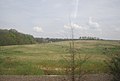
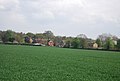
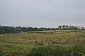
 Countryside near Pluckley - geograph.org.uk - 2448073.jpg 640 × 430; 57 KB
-
 Cricket ground at Pluckley - geograph.org.uk - 4945183.jpg 640 × 480; 294 KB
-
 Cricket Pavilion, Pluckley - geograph.org.uk - 1426363.jpg 640 × 480; 54 KB
-
 Crops, Mundy Bois Rd - geograph.org.uk - 3947663.jpg 640 × 398; 79 KB
-
 Cupola and weather vane, Sheerland farm, Pluckley.jpg 2,272 × 3,408; 2.77 MB
-
 Dering Arms - geograph.org.uk - 3952108.jpg 640 × 430; 93 KB
-
 Dering Close - geograph.org.uk - 3952082.jpg 640 × 430; 104 KB
-
 Dering windows, The Dering Arms - geograph.org.uk - 3952119.jpg 640 × 430; 111 KB
-
 Distance indicator, Pluckley Station - geograph.org.uk - 5805509.jpg 640 × 426; 85 KB
-
 Distance marker, Pluckley Station - geograph.org.uk - 3223613.jpg 640 × 430; 77 KB
-
 Ditch and hedge - geograph.org.uk - 3442090.jpg 640 × 430; 37 KB
-
 Dowle Street Farm - geograph.org.uk - 1736021.jpg 640 × 427; 64 KB
-
 DR Luckhurst (geograph 6773209).jpg 1,024 × 684; 126 KB
-
 E type - geograph.org.uk - 3952121.jpg 640 × 480; 81 KB
-
 East of Pluckley - geograph.org.uk - 3273670.jpg 640 × 430; 59 KB
-
 Egerton Road - geograph.org.uk - 6023435.jpg 1,024 × 684; 299 KB
-
 Egerton Road at Pivington Lane junction - geograph.org.uk - 6023434.jpg 1,024 × 684; 213 KB
-
 Ellinge House - geograph.org.uk - 3947708.jpg 640 × 430; 114 KB
-
 Ellinge House - geograph.org.uk - 3947711.jpg 640 × 430; 96 KB
-
 Elvey Lane - geograph.org.uk - 3947646.jpg 640 × 430; 106 KB
-
 Elvey Lane - geograph.org.uk - 3947647.jpg 640 × 415; 85 KB
-
 Elvey Lane - geograph.org.uk - 799646.jpg 480 × 640; 138 KB
-
 Entering Pluckley - geograph.org.uk - 6005266.jpg 1,024 × 681; 264 KB
-
 Entrance to landfill site - geograph.org.uk - 3952032.jpg 640 × 430; 114 KB
-
 Entrance, Catchpole and Rye - geograph.org.uk - 6026865.jpg 1,024 × 768; 500 KB
-
 Escarpment of the Greensand Ridge - geograph.org.uk - 4945169.jpg 640 × 480; 286 KB
-
 Escarpment of the Greensand Ridge - geograph.org.uk - 4945172.jpg 640 × 480; 277 KB
-
 Fallen apples, Pluckley - geograph.org.uk - 5225265.jpg 640 × 480; 161 KB
-
 Farmland by Mundy Bois Rd - geograph.org.uk - 3947662.jpg 640 × 430; 75 KB
-
 Farmland near March Wood - geograph.org.uk - 3223616.jpg 640 × 430; 70 KB
-
 Farmland near March Wood - geograph.org.uk - 4015820.jpg 640 × 430; 43 KB
-
 Farmland near Pluckley - geograph.org.uk - 2448076.jpg 640 × 430; 50 KB
-
 Farmland near Pluckley - geograph.org.uk - 4015810.jpg 640 × 430; 55 KB
-
 Farmland north of the railway line - geograph.org.uk - 2429323.jpg 640 × 430; 44 KB
-
 Farmland north of the railway line - geograph.org.uk - 2948835.jpg 640 × 430; 65 KB
-
 Farmland south of the railway line - geograph.org.uk - 2952200.jpg 640 × 430; 28 KB
-
 Farmland south of the railway line - geograph.org.uk - 2952203.jpg 640 × 430; 28 KB
-
 Farmland west of March Wood - geograph.org.uk - 2948842.jpg 640 × 430; 51 KB
-
 Farmland, Dowle Street Farm - geograph.org.uk - 2948841.jpg 640 × 430; 65 KB
-
 Farmland, Dowle Street Farm - geograph.org.uk - 4015816.jpg 640 × 430; 38 KB
-
 Farmland, Mundy Bois - geograph.org.uk - 3947644.jpg 640 × 430; 75 KB
-
 Farmland, Mundy Bois - geograph.org.uk - 3947654.jpg 640 × 430; 108 KB
-
 Farmland, Pluckley - geograph.org.uk - 4944054.jpg 640 × 426; 53 KB
-
 Field by Smarden Rd - geograph.org.uk - 3951916.jpg 640 × 430; 69 KB
-
 Field edge off New Road, Pluckley - geograph.org.uk - 4945153.jpg 640 × 480; 328 KB
-
 Field looking towards River Beult - geograph.org.uk - 6153256.jpg 1,024 × 768; 524 KB
-
 Field near Pluckley Thorne - geograph.org.uk - 1970349.jpg 2,048 × 1,536; 1.22 MB
-
 Field of oilseed rape at Pevington Farm - geograph.org.uk - 4945154.jpg 640 × 480; 334 KB
-
 Field, Coopers Farm - geograph.org.uk - 3951968.jpg 640 × 430; 68 KB
-
 Fields near Chambers' Green - geograph.org.uk - 4757415.jpg 640 × 480; 146 KB
-
 Fir Tree Cottage (geograph 6773260).jpg 1,024 × 684; 144 KB
-
 Flat farmland - geograph.org.uk - 3223615.jpg 640 × 430; 54 KB
-
 Flat farmland - geograph.org.uk - 4265155.jpg 640 × 430; 40 KB
-
 Flooded Clay Quarry - geograph.org.uk - 2429318.jpg 640 × 330; 42 KB
-
 Fold House - geograph.org.uk - 3951952.jpg 640 × 430; 85 KB
-
 Footbridge carrying the Greensand Way - geograph.org.uk - 4151591.jpg 4,000 × 3,000; 4.18 MB
-
 Footbridge near Elvey Farm - geograph.org.uk - 1291197.jpg 640 × 480; 143 KB
-
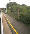
 Footbridge, Pluckley Station - geograph.org.uk - 3958367.jpg 640 × 398; 67 KB
-
 Footpath at Pluckley - geograph.org.uk - 4945181.jpg 480 × 640; 398 KB
-
 Footpath gate near Newhouse Farm - geograph.org.uk - 6153040.jpg 1,024 × 768; 525 KB
-
 Footpath gate near Newhouse Farm - geograph.org.uk - 6153045.jpg 1,024 × 768; 569 KB
-
 Footpath junction near Elvey Farm - geograph.org.uk - 1291202.jpg 640 × 480; 113 KB
-
 Footpath off Chambers Green Rd - geograph.org.uk - 3952005.jpg 640 × 430; 96 KB
-
 Footpath off Mundy Bois Rd - geograph.org.uk - 3947659.jpg 640 × 430; 130 KB
-
 Footpath off Pluckley Rd - geograph.org.uk - 6005274.jpg 1,024 × 681; 228 KB
-
 Footpath off Station Rd - geograph.org.uk - 2444215.jpg 640 × 430; 75 KB
-
 Footpath towards New House Lane - geograph.org.uk - 6153285.jpg 1,024 × 768; 480 KB
-
 Forest Gate - geograph.org.uk - 6005268.jpg 1,024 × 681; 240 KB
-
 Forest Gate Lodge, Pluckley.jpg 5,184 × 3,456; 10.39 MB
-
 Forge Cottage - geograph.org.uk - 2448094.jpg 640 × 430; 82 KB
-
 Forge Cottage - geograph.org.uk - 2450876.jpg 640 × 430; 86 KB
-
 Forge Hill House - geograph.org.uk - 2448098.jpg 640 × 430; 94 KB
-
 Forge Hill, Pluckley - geograph.org.uk - 2450883.jpg 640 × 430; 82 KB
-
 Former landfill site (old clay pit) - geograph.org.uk - 5805485.jpg 640 × 426; 45 KB
-
 Garden Cottage - geograph.org.uk - 2459665.jpg 640 × 369; 91 KB
-
 Gate Lodge (geograph 6773265).jpg 1,024 × 684; 229 KB
-
 Gate, Chambers Green Rd - geograph.org.uk - 3952057.jpg 640 × 407; 67 KB
-
 Gore Court, Pluckley - geograph.org.uk - 1427697.jpg 640 × 480; 118 KB
-
 Grass Airstrip near Frid Farm - geograph.org.uk - 1427856.jpg 640 × 480; 106 KB
-
 Grassland, East of Pluckley - geograph.org.uk - 3273672.jpg 640 × 430; 88 KB
-
 Greenhouses - geograph.org.uk - 3947706.jpg 640 × 430; 94 KB
-
 Greensand Ridge, West of Pluckley - geograph.org.uk - 2210349.jpg 1,061 × 734; 425 KB
-
 Greensand Way goes through a hedge - geograph.org.uk - 2450926.jpg 640 × 430; 99 KB
-
 Greensand Way link path - geograph.org.uk - 2445838.jpg 640 × 430; 79 KB
-
 Greensand Way link path - geograph.org.uk - 2448003.jpg 640 × 430; 83 KB
-
 Greensand Way link to Pluckley - geograph.org.uk - 2445834.jpg 640 × 393; 66 KB
-
 Greensand Way off Lambden Rd - geograph.org.uk - 2448031.jpg 640 × 430; 147 KB
-
 Greensand Way off Smarden Rd, Pluckley - geograph.org.uk - 2450877.jpg 640 × 430; 121 KB
-
 Hawthorn blossom near Lambden - geograph.org.uk - 2448008.jpg 640 × 430; 94 KB
-
 Hay ready to be baled - geograph.org.uk - 4151600.jpg 4,000 × 3,000; 4.38 MB
-
 Hedge and ditch - geograph.org.uk - 5448805.jpg 640 × 426; 44 KB
-
 Hedge and farmland - geograph.org.uk - 3958379.jpg 640 × 430; 51 KB
-
 Hill Cottage - geograph.org.uk - 1292580.jpg 640 × 480; 113 KB
-
 Hollies Farm - geograph.org.uk - 3947650.jpg 640 × 430; 104 KB
-
 Honey Farm - geograph.org.uk - 6023445.jpg 1,024 × 684; 200 KB
-
 Hoof-prints on Iden Lane - geograph.org.uk - 4945416.jpg 480 × 640; 430 KB
-
 Hop poles by the Greensand Way - geograph.org.uk - 2457396.jpg 640 × 430; 100 KB
-
 Hop-pickers huts at Pluckley - geograph.org.uk - 4945178.jpg 640 × 480; 339 KB
-
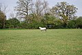 Horse by the Greensand Way - geograph.org.uk - 2448046.jpg 640 × 430; 106 KB
-
 Horse riding on Lambden Rd - geograph.org.uk - 2448034.jpg 640 × 430; 86 KB
-
 House at Chambers' Green - geograph.org.uk - 3952067.jpg 640 × 430; 78 KB
-
 House at Chambers' Green - geograph.org.uk - 3952073.jpg 640 × 430; 81 KB
-
 House by Chambers Green Rd - geograph.org.uk - 2444261.jpg 640 × 430; 81 KB
-
 House on Rose Farm Rd - geograph.org.uk - 3947705.jpg 640 × 430; 102 KB
-
 House on Station Rd - geograph.org.uk - 3952071.jpg 640 × 430; 86 KB
-
 House outside Pluckley Station - geograph.org.uk - 2444078.jpg 640 × 430; 83 KB
-
 House, Stanford Bridge - geograph.org.uk - 6005279.jpg 1,024 × 681; 224 KB
-
 Houses at Barnfield - geograph.org.uk - 4945210.jpg 640 × 480; 322 KB
-
 Houses at Fir Toll - geograph.org.uk - 2445840.jpg 640 × 430; 61 KB
-
 Houses on Station Rd - geograph.org.uk - 2445835.jpg 640 × 430; 63 KB
-
 Iden Lane - geograph.org.uk - 4150897.jpg 4,000 × 3,000; 4.38 MB
-
 Junction of the Egerton, Smarden roads and Swan Lane - geograph.org.uk - 3949561.jpg 3,133 × 2,077; 1.48 MB
-
 Kent Countryside - geograph.org.uk - 4015812.jpg 640 × 430; 48 KB
-

-
 Knowles Plantation - geograph.org.uk - 3442096.jpg 640 × 430; 101 KB
-
 Lambden Barn, Pluckley Thorne - geograph.org.uk - 1426329.jpg 640 × 480; 75 KB
-
 Lambden House - geograph.org.uk - 4044728.jpg 4,000 × 3,000; 4.09 MB
-
 Lambden Rd, Pluckley Thorne - geograph.org.uk - 2448024.jpg 640 × 430; 115 KB
-
 Lambden Road - geograph.org.uk - 4156333.jpg 640 × 480; 97 KB
-
 Landfill site (old clay pit) - geograph.org.uk - 4750734.jpg 640 × 426; 40 KB
-
 Landfill site near Pluckley - geograph.org.uk - 4015774.jpg 640 × 488; 61 KB
-
 Landfill site near Pluckley - geograph.org.uk - 4015778.jpg 640 × 367; 47 KB
-
 Landfill site, Pluckley - geograph.org.uk - 4188504.jpg 640 × 335; 52 KB
-
 Lane east of Sheerland Farm - geograph.org.uk - 2457433.jpg 640 × 430; 102 KB
-
 Lane to Pluckley - geograph.org.uk - 3431698.jpg 3,228 × 2,037; 3.68 MB
-
 Line of trees - geograph.org.uk - 5448803.jpg 640 × 426; 50 KB
-
 Line of trees, Mundy Bois - geograph.org.uk - 3947641.jpg 640 × 430; 94 KB
-
 Little Kingsland Cottage (geograph 6773119).jpg 1,024 × 685; 163 KB
-
 Little Orchard Cottage - geograph.org.uk - 2444224.jpg 640 × 380; 83 KB
-
 London bound - Pluckley Station - geograph.org.uk - 3153289.jpg 561 × 640; 72 KB
-
 Looking towards Pluckley - geograph.org.uk - 3947667.jpg 640 × 430; 72 KB
-
 Looking towards the Greensand Ridge near Pluckley - geograph.org.uk - 3049443.jpg 4,000 × 3,000; 4.18 MB
-
 Looking towards the Greensand Ridge near Pluckley - geograph.org.uk - 3049448.jpg 4,000 × 3,000; 4.29 MB
-
 Low Weald farmland - geograph.org.uk - 5230232.jpg 640 × 362; 34 KB
-
 Low Weald landscape - geograph.org.uk - 4188505.jpg 640 × 430; 61 KB
-
 Lower Thorne Oast - geograph.org.uk - 3951925.jpg 640 × 430; 66 KB
-
 Lower Thorne Oast - geograph.org.uk - 3951948.jpg 640 × 430; 60 KB
-
 Malmains Road - geograph.org.uk - 4156316.jpg 640 × 480; 84 KB
-
 Malmains Road - geograph.org.uk - 4757407.jpg 640 × 480; 143 KB
-
 Marshy pond by the Greensand Way - geograph.org.uk - 2448023.jpg 640 × 430; 139 KB
-
 Munday Bois Road, Egerton, Kent - geograph.org.uk - 968040.jpg 640 × 427; 60 KB
-
 Munday Farmhouse (geograph 6773134).jpg 1,024 × 684; 287 KB
-
 Mundy Bois Rd - geograph.org.uk - 3947657.jpg 640 × 430; 71 KB
-
 Mundy Bois Rd - geograph.org.uk - 3947671.jpg 640 × 430; 61 KB
-
 Mundy Bois Rd - geograph.org.uk - 3947693.jpg 640 × 430; 87 KB
-
 Near Pluckley - geograph.org.uk - 3952024.jpg 640 × 430; 80 KB
-

-
 Nettlepole Lane - geograph.org.uk - 4945192.jpg 480 × 640; 388 KB
-
 New House Lane - geograph.org.uk - 6005394.jpg 1,024 × 681; 205 KB
-

-
 Notice at Pluckley Station - geograph.org.uk - 4873853.jpg 1,944 × 2,592; 883 KB
-
 Old Avenue House - geograph.org.uk - 2450924.jpg 640 × 430; 46 KB
-
 Old brickworks, Pluckley - geograph.org.uk - 4015780.jpg 640 × 430; 83 KB
-
 Old Kingsland Cottage - geograph.org.uk - 4945164.jpg 640 × 480; 327 KB
-
 Old Kingsland Cottage - geograph.org.uk - 4945174.jpg 640 × 480; 338 KB
-
 Old landfill site - geograph.org.uk - 3273681.jpg 640 × 430; 58 KB
-
 Old landfill site - geograph.org.uk - 5230237.jpg 640 × 426; 35 KB
-
 Old Rose House - geograph.org.uk - 3947704.jpg 640 × 430; 98 KB
-
 Open space near Pluckley Station - geograph.org.uk - 3958361.jpg 640 × 430; 117 KB


.jpg)


.jpg)


.jpg)


_-_geograph.org.uk_-_5805485.jpg)

.jpg)


_-_geograph.org.uk_-_4750734.jpg)


.jpg)


.jpg)


