Category:Pole Moor
Jump to navigation
Jump to search
hamlet in West Yorkshire, England, UK  | |||||
| Upload media | |||||
| Instance of | |||||
|---|---|---|---|---|---|
| Location | Kirklees, West Yorkshire, Yorkshire and the Humber, England | ||||
 | |||||
Subcategories
This category has the following 3 subcategories, out of 3 total.
Media in category "Pole Moor"
The following 36 files are in this category, out of 36 total.
-
 Alternative eastern summit of Worts Hill, Slaithwaite - geograph.org.uk - 5812492.jpg 2,048 × 1,536; 1.03 MB
-
 Barn near Hardenby Farm - geograph.org.uk - 5966093.jpg 640 × 487; 77 KB
-
 Barn On Worts Hill Lane - geograph.org.uk - 5056543.jpg 1,200 × 799; 414 KB
-
 Bridge on New Hey Road (A640) - geograph.org.uk - 5966100.jpg 640 × 480; 64 KB
-
 Bungalow on New Hey Road - geograph.org.uk - 5966095.jpg 640 × 480; 81 KB
-
 Close up, Elizabeth II postbox on New Hey Road - geograph.org.uk - 5966279.jpg 2,149 × 3,804; 2.01 MB
-
 Communication Masts on Pole Moor - geograph.org.uk - 5055770.jpg 1,200 × 799; 255 KB
-
 Crimea Lane - geograph.org.uk - 1455731.jpg 640 × 480; 88 KB
-
-
 Driveway to the radio station and Moorside Edge - geograph.org.uk - 3606230.jpg 2,000 × 1,407; 869 KB
-
 Elizabeth II postbox on New Hey Road - geograph.org.uk - 5966276.jpg 4,590 × 3,330; 6.68 MB
-
 Former Chapel, Pole Moor - geograph.org.uk - 36760.jpg 640 × 571; 272 KB
-
 Former Pole Moor Baptist Chapel - geograph.org.uk - 1326860.jpg 480 × 640; 73 KB
-
 Former Pole Moor Baptist Chapel - geograph.org.uk - 1428921.jpg 640 × 480; 50 KB
-

-

-
 Hey Lane passes under the M62 motorway - geograph.org.uk - 4005024.jpg 1,600 × 1,200; 552 KB
-
 Junction of tracks on Pole Moor - geograph.org.uk - 5539486.jpg 640 × 480; 65 KB
-

-

-

-

-
 Old milestone on A640, New Hey Road (geograph 6757141).jpg 1,200 × 1,600; 556 KB
-
 Ordnance Survey Flush Bracket 747 - geograph.org.uk - 3360876.jpg 4,000 × 3,000; 4.17 MB
-
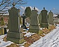 Pole Hill Cemetery.jpg 2,127 × 1,722; 3.84 MB
-
 Pole Hill Chapel (4401620972).jpg 2,418 × 1,782; 3.99 MB
-
 Pole Moor (4401619452).jpg 1,245 × 1,628; 1.44 MB
-
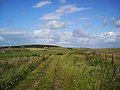
 Pole Moor - geograph.org.uk - 130268.jpg 640 × 480; 92 KB
-
 Pole Moor OS 1843 engraving.jpg 870 × 620; 721 KB
-
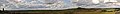 Pole Moor, Huddersfield (RLH).jpg 5,274 × 616; 1.45 MB
-
 Quebec Road, near Pole Moor - geograph.org.uk - 2264669.jpg 640 × 480; 61 KB
-
 Quebec Road, near Pole Moor - geograph.org.uk - 2264674.jpg 640 × 480; 55 KB
-
 Rochdale Road, Pole Moor - geograph.org.uk - 1652443.jpg 640 × 425; 83 KB
-

-

-


_-_geograph.org.uk_-_5966100.jpg)


_approaching_O%27Cot_-_geograph.org.uk_-_5965651.jpg)
_towards_Huddersfield_-_geograph.org.uk_-_5965630.jpg)
_towards_Huddersfield_-_geograph.org.uk_-_5966091.jpg)
_towards_Huddersfield_-_geograph.org.uk_-_5966094.jpg)
.jpg)


.jpg)
.jpg)


.jpg)