Category:Political maps of Crawford County, Ohio as of the 2000 United States Census
Jump to navigation
Jump to search
Media in category "Political maps of Crawford County, Ohio as of the 2000 United States Census"
The following 42 files are in this category, out of 42 total.
-
 Auburn Crawford.PNG 462 × 490; 15 KB
-
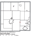
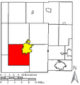 Bucyrus Crawford.PNG 462 × 490; 15 KB
-
 Chatfield Crawford.PNG 462 × 490; 15 KB
-
 Cranberry Crawford.PNG 462 × 490; 15 KB
-
 Dallas Crawford.PNG 462 × 490; 15 KB
-
 Holmes Crawford.PNG 462 × 490; 15 KB
-
 Jackson Crawford.PNG 462 × 490; 15 KB
-
 Jefferson Crawford.PNG 462 × 490; 15 KB
-
 Liberty Crawford.PNG 462 × 490; 15 KB
-
 Lykens Crawford.PNG 462 × 490; 15 KB
-
 Map of Crawford County Ohio Highlighting Auburn Township.png 457 × 497; 17 KB
-
 Map of Crawford County Ohio Highlighting Bucyrus City.png 457 × 497; 17 KB
-
 Map of Crawford County Ohio Highlighting Bucyrus Township.png 457 × 497; 17 KB
-
 Map of Crawford County Ohio Highlighting Chatfield Township.png 457 × 497; 17 KB
-
 Map of Crawford County Ohio Highlighting Chatfield Village.png 457 × 497; 17 KB
-
 Map of Crawford County Ohio Highlighting Cranberry Township.png 457 × 497; 17 KB
-
 Map of Crawford County Ohio Highlighting Crestline Village.png 457 × 497; 17 KB
-
 Map of Crawford County Ohio Highlighting Dallas Township.png 457 × 497; 17 KB
-
 Map of Crawford County Ohio Highlighting Galion City.png 457 × 497; 17 KB
-
 Map of Crawford County Ohio Highlighting Holmes Township.png 457 × 497; 17 KB
-
 Map of Crawford County Ohio Highlighting Jackson Township.png 457 × 497; 17 KB
-
 Map of Crawford County Ohio Highlighting Jefferson Township.png 457 × 497; 17 KB
-
 Map of Crawford County Ohio Highlighting Liberty Township.png 457 × 497; 17 KB
-
 Map of Crawford County Ohio Highlighting Lykens Township.png 457 × 497; 17 KB
-
 Map of Crawford County Ohio Highlighting New Washington Village.png 457 × 497; 17 KB
-
 Map of Crawford County Ohio Highlighting North Robinson Village.png 457 × 497; 17 KB
-
 Map of Crawford County Ohio Highlighting Polk Township.png 457 × 497; 17 KB
-
 Map of Crawford County Ohio Highlighting Sandusky Township.png 457 × 497; 17 KB
-
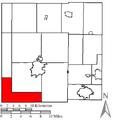
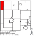
 Map of Crawford County Ohio Highlighting Texas Township.png 457 × 497; 17 KB
-
 Map of Crawford County Ohio Highlighting Tiro Village.png 457 × 497; 17 KB
-
 Map of Crawford County Ohio Highlighting Tod Township.png 457 × 497; 17 KB
-
 Map of Crawford County Ohio Highlighting Vernon Township.png 457 × 497; 17 KB
-
 Map of Crawford County Ohio Highlighting Whetstone Township.png 457 × 497; 17 KB
-
 Map of Crawford County Ohio With Municipal and Township Labels.PNG 457 × 497; 36 KB
-
 Map of Crawford County, Ohio No Text, Municipalities Distinct.png 457 × 497; 17 KB
-
 Map of Crawford County, Ohio No Text.png 457 × 497; 17 KB
-
 Polk Crawford.PNG 462 × 490; 15 KB
-
 Sandusky Crawford.PNG 462 × 490; 15 KB
-
 Texas Crawford.PNG 462 × 490; 15 KB
-
 Tod Crawford.PNG 462 × 490; 15 KB
-
 Vernon Crawford.PNG 462 × 490; 15 KB
-
 Whetstone Crawford.PNG 462 × 490; 15 KB


