Category:Political maps of Jefferson County, Ohio as of the 2000 United States Census
Jump to navigation
Jump to search
Media in category "Political maps of Jefferson County, Ohio as of the 2000 United States Census"
The following 36 files are in this category, out of 36 total.
-
 Map of Jefferson County Ohio Highlighting Adena Village.png 400 × 708; 29 KB
-
 Map of Jefferson County Ohio Highlighting Amsterdam Village.png 400 × 708; 29 KB
-
 Map of Jefferson County Ohio Highlighting Bergholz Village.png 400 × 708; 29 KB
-
 Map of Jefferson County Ohio Highlighting Bloomingdale Village.png 400 × 708; 29 KB
-
 Map of Jefferson County Ohio Highlighting Brush Creek Township.png 400 × 708; 29 KB
-
 Map of Jefferson County Ohio Highlighting Cross Creek Township.png 400 × 708; 29 KB
-
 Map of Jefferson County Ohio Highlighting Dillonvale Village.png 400 × 708; 29 KB
-
 Map of Jefferson County Ohio Highlighting Empire Village.png 400 × 708; 29 KB
-
 Map of Jefferson County Ohio Highlighting Irondale Village.png 400 × 708; 29 KB
-
 Map of Jefferson County Ohio Highlighting Island Creek Township.png 400 × 708; 29 KB
-
 Map of Jefferson County Ohio Highlighting Knox Township.png 400 × 708; 29 KB
-
 Map of Jefferson County Ohio Highlighting Mingo Junction Village.png 400 × 708; 29 KB
-
-
 Map of Jefferson County Ohio Highlighting Mount Pleasant Village.png 400 × 708; 29 KB
-
 Map of Jefferson County Ohio Highlighting New Alexandria Village.png 400 × 708; 29 KB
-
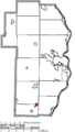
 Map of Jefferson County Ohio Highlighting Rayland Village.png 400 × 708; 29 KB
-
 Map of Jefferson County Ohio Highlighting Richmond Village.png 400 × 708; 29 KB
-
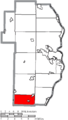
 Map of Jefferson County Ohio Highlighting Ross Township.png 400 × 708; 29 KB
-
 Map of Jefferson County Ohio Highlighting Salem Township.png 400 × 708; 29 KB
-
 Map of Jefferson County Ohio Highlighting Saline Township.png 400 × 708; 29 KB
-
 Map of Jefferson County Ohio Highlighting Smithfield Township.png 400 × 708; 29 KB
-
 Map of Jefferson County Ohio Highlighting Smithfield Village.png 400 × 708; 29 KB
-
 Map of Jefferson County Ohio Highlighting Springfield Township.png 400 × 708; 29 KB
-
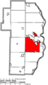
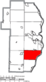
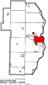 Map of Jefferson County Ohio Highlighting Steubenville City.png 400 × 708; 29 KB
-
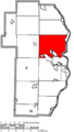
 Map of Jefferson County Ohio Highlighting Steubenville Township.png 400 × 708; 29 KB
-
 Map of Jefferson County Ohio Highlighting Stratton Village.png 400 × 708; 29 KB
-
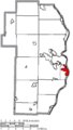
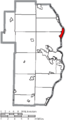
 Map of Jefferson County Ohio Highlighting Tiltonsville Village.png 400 × 708; 29 KB
-
 Map of Jefferson County Ohio Highlighting Toronto City.png 400 × 708; 29 KB
-
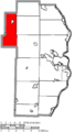
 Map of Jefferson County Ohio Highlighting Warren Township.png 400 × 708; 29 KB
-
 Map of Jefferson County Ohio Highlighting Wayne Township.png 400 × 708; 29 KB
-
 Map of Jefferson County Ohio Highlighting Wells Township.png 400 × 708; 29 KB
-
 Map of Jefferson County Ohio Highlighting Wintersville Village.png 400 × 708; 29 KB
-
 Map of Jefferson County Ohio Highlighting Yorkville Village.png 400 × 708; 29 KB
-
 Map of Jefferson County Ohio With Municipal and Township Labels.PNG 466 × 708; 57 KB
-
 Map of Jefferson County, Ohio No Text, Municipalities Distinct.png 466 × 708; 29 KB
-
 Map of Jefferson County, Ohio No Text.png 466 × 708; 29 KB


