Category:Political maps of Marion County, Ohio as of the 2000 United States Census
Jump to navigation
Jump to search
Media in category "Political maps of Marion County, Ohio as of the 2000 United States Census"
The following 27 files are in this category, out of 27 total.
-
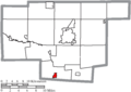
 Map of Marion County Ohio Highlighting Big Island Township.png 612 × 432; 20 KB
-
 Map of Marion County Ohio Highlighting Bowling Green Township.png 612 × 432; 20 KB
-
 Map of Marion County Ohio Highlighting Caledonia Village.png 612 × 432; 20 KB
-
 Map of Marion County Ohio Highlighting Claridon Township.png 612 × 432; 20 KB
-
 Map of Marion County Ohio Highlighting Grand Prairie Township.png 612 × 432; 20 KB
-
 Map of Marion County Ohio Highlighting Grand Township.png 612 × 432; 20 KB
-
 Map of Marion County Ohio Highlighting Green Camp Township.png 612 × 432; 20 KB
-
 Map of Marion County Ohio Highlighting Green Camp Village.png 612 × 432; 20 KB
-
 Map of Marion County Ohio Highlighting LaRue Village.png 612 × 432; 20 KB
-
 Map of Marion County Ohio Highlighting Marion City.png 612 × 432; 20 KB
-
 Map of Marion County Ohio Highlighting Marion Township.png 612 × 432; 20 KB
-
 Map of Marion County Ohio Highlighting Montgomery Township.png 612 × 432; 20 KB
-
 Map of Marion County Ohio Highlighting Morral Village.png 612 × 432; 20 KB
-
 Map of Marion County Ohio Highlighting New Bloomington Village.png 612 × 432; 20 KB
-
 Map of Marion County Ohio Highlighting Pleasant Township.png 612 × 432; 20 KB
-
 Map of Marion County Ohio Highlighting Prospect Township.png 612 × 432; 20 KB
-
 Map of Marion County Ohio Highlighting Prospect Village.png 612 × 432; 20 KB
-
 Map of Marion County Ohio Highlighting Richland Township.png 612 × 432; 20 KB
-
 Map of Marion County Ohio Highlighting Salt Rock Township.png 612 × 432; 20 KB
-
 Map of Marion County Ohio Highlighting Scott Township.png 612 × 432; 20 KB
-
 Map of Marion County Ohio Highlighting Tully Township.png 612 × 432; 20 KB
-
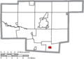
 Map of Marion County Ohio Highlighting Waldo Township.png 612 × 432; 20 KB
-
 Map of Marion County Ohio Highlighting Waldo Village.png 612 × 432; 20 KB
-
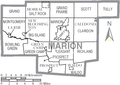 Map of Marion County Ohio With Municipal and Township Labels.PNG 612 × 432; 38 KB
-
 Map of Marion County, Ohio No Text, Municipalities Distinct.png 612 × 432; 20 KB
-
 Map of Marion County, Ohio No Text.png 612 × 432; 20 KB
-
 Waldo Marion.PNG 641 × 465; 22 KB


