Category:Political maps of Meigs County, Ohio as of the 2000 United States Census
Jump to navigation
Jump to search
Media in category "Political maps of Meigs County, Ohio as of the 2000 United States Census"
The following 20 files are in this category, out of 20 total.
-
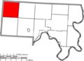
 Map of Meigs County Ohio Highlighting Bedford Township.png 644 × 473; 26 KB
-
 Map of Meigs County Ohio Highlighting Chester Township.png 644 × 473; 26 KB
-
 Map of Meigs County Ohio Highlighting Columbia Township.png 644 × 473; 26 KB
-
 Map of Meigs County Ohio Highlighting Lebanon Township.png 644 × 473; 26 KB
-
 Map of Meigs County Ohio Highlighting Letart Township.png 644 × 473; 26 KB
-
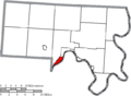 Map of Meigs County Ohio Highlighting Middleport Village.png 644 × 473; 26 KB
-
 Map of Meigs County Ohio Highlighting Olive Township.png 644 × 473; 26 KB
-
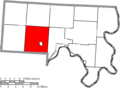
 Map of Meigs County Ohio Highlighting Orange Township.png 644 × 473; 26 KB
-
 Map of Meigs County Ohio Highlighting Pomeroy Village.png 644 × 473; 26 KB
-
 Map of Meigs County Ohio Highlighting Racine Village.png 644 × 473; 26 KB
-
 Map of Meigs County Ohio Highlighting Rutland Township.png 644 × 473; 26 KB
-
 Map of Meigs County Ohio Highlighting Rutland Village.png 644 × 473; 26 KB
-
 Map of Meigs County Ohio Highlighting Salem Township.png 644 × 473; 26 KB
-
 Map of Meigs County Ohio Highlighting Salisbury Township.png 644 × 473; 26 KB
-
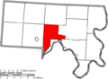
 Map of Meigs County Ohio Highlighting Scipio Township.png 644 × 473; 26 KB
-
 Map of Meigs County Ohio Highlighting Sutton Township.png 644 × 473; 26 KB
-
 Map of Meigs County Ohio Highlighting Syracuse Village.png 644 × 473; 26 KB
-
 Map of Meigs County Ohio With Municipal and Township Labels.PNG 644 × 473; 38 KB
-
 Map of Meigs County, Ohio No Text, Municipalities Distinct.png 644 × 473; 25 KB
-
 Map of Meigs County, Ohio No Text.png 644 × 473; 26 KB


