Category:Political maps of Ross County, Ohio as of the 2000 United States Census
Jump to navigation
Jump to search
Media in category "Political maps of Ross County, Ohio as of the 2000 United States Census"
The following 26 files are in this category, out of 26 total.
-
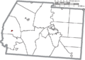
 Map of Ross County Ohio Highlighting Adelphi Village.png 723 × 504; 29 KB
-
 Map of Ross County Ohio Highlighting Bainbridge Village.png 723 × 504; 29 KB
-
 Map of Ross County Ohio Highlighting Buckskin Township.png 723 × 504; 29 KB
-
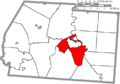
 Map of Ross County Ohio Highlighting Chillicothe City.png 723 × 504; 29 KB
-
 Map of Ross County Ohio Highlighting Clarksburg Village.png 723 × 504; 29 KB
-
 Map of Ross County Ohio Highlighting Colerain Township.png 723 × 504; 29 KB
-
 Map of Ross County Ohio Highlighting Concord Township.png 723 × 504; 29 KB
-
 Map of Ross County Ohio Highlighting Deerfield Township.png 723 × 504; 29 KB
-
 Map of Ross County Ohio Highlighting Frankfort Village.png 723 × 504; 29 KB
-
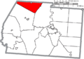
 Map of Ross County Ohio Highlighting Franklin Township.png 723 × 504; 29 KB
-
 Map of Ross County Ohio Highlighting Green Township.png 723 × 504; 29 KB
-
 Map of Ross County Ohio Highlighting Harrison Township.png 723 × 504; 29 KB
-
 Map of Ross County Ohio Highlighting Huntington Township.png 723 × 504; 29 KB
-
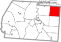
 Map of Ross County Ohio Highlighting Jefferson Township.png 723 × 504; 29 KB
-
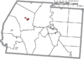
 Map of Ross County Ohio Highlighting Kingston Village.png 723 × 504; 29 KB
-
 Map of Ross County Ohio Highlighting Liberty Township.png 723 × 504; 29 KB
-
 Map of Ross County Ohio Highlighting Paint Township.png 723 × 504; 29 KB
-
 Map of Ross County Ohio Highlighting Paxton Township.png 723 × 504; 29 KB
-
 Map of Ross County Ohio Highlighting Scioto Township.png 723 × 504; 29 KB
-
 Map of Ross County Ohio Highlighting South Salem Village.png 723 × 504; 29 KB
-
 Map of Ross County Ohio Highlighting Springfield Township.png 723 × 504; 29 KB
-
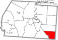
 Map of Ross County Ohio Highlighting Twin Township.png 723 × 504; 29 KB
-
 Map of Ross County Ohio Highlighting Union Township.png 723 × 504; 29 KB
-
 Map of Ross County Ohio With Municipal and Township Labels.PNG 723 × 504; 47 KB
-
 Map of Ross County, Ohio No Text, Municipalities Distinct.png 723 × 504; 29 KB
-
 Map of Ross County, Ohio No Text.png 723 × 504; 28 KB


