Category:Political maps of Stark County, Ohio as of the 2000 United States Census
Jump to navigation
Jump to search
Media in category "Political maps of Stark County, Ohio as of the 2000 United States Census"
The following 39 files are in this category, out of 39 total.
-
 Map of Stark County Ohio Highlighting Alliance City.png 624 × 535; 33 KB
-
 Map of Stark County Ohio Highlighting Beach City Village.png 624 × 535; 33 KB
-
 Map of Stark County Ohio Highlighting Bethlehem Township.png 624 × 535; 33 KB
-
 Map of Stark County Ohio Highlighting Brewster Village.png 624 × 535; 33 KB
-
 Map of Stark County Ohio Highlighting Canal Fulton City.png 624 × 535; 33 KB
-
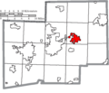
 Map of Stark County Ohio Highlighting Canton City.png 624 × 535; 33 KB
-
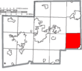
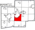 Map of Stark County Ohio Highlighting Canton Township.png 624 × 535; 33 KB
-
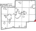
 Map of Stark County Ohio Highlighting East Canton Village.png 624 × 535; 33 KB
-
 Map of Stark County Ohio Highlighting East Sparta Village.png 624 × 535; 33 KB
-
 Map of Stark County Ohio Highlighting Hartville Village.png 624 × 535; 33 KB
-
 Map of Stark County Ohio Highlighting Hills and Dales Village.png 624 × 535; 33 KB
-
 Map of Stark County Ohio Highlighting Jackson Township.png 624 × 535; 33 KB
-
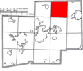
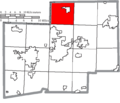 Map of Stark County Ohio Highlighting Lake Township.png 624 × 535; 33 KB
-
 Map of Stark County Ohio Highlighting Lawrence Township.png 624 × 535; 33 KB
-
 Map of Stark County Ohio Highlighting Lexington Township.png 624 × 535; 33 KB
-
 Map of Stark County Ohio Highlighting Limaville Village.png 624 × 535; 33 KB
-
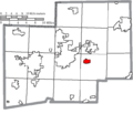
 Map of Stark County Ohio Highlighting Louisville City.png 624 × 535; 33 KB
-
 Map of Stark County Ohio Highlighting Magnolia Village.png 624 × 535; 33 KB
-
 Map of Stark County Ohio Highlighting Marlboro Township.png 624 × 535; 33 KB
-
 Map of Stark County Ohio Highlighting Massillon City.png 624 × 535; 33 KB
-
 Map of Stark County Ohio Highlighting Meyers Lake Village.png 624 × 535; 33 KB
-
 Map of Stark County Ohio Highlighting Minerva Village.png 624 × 535; 33 KB
-
 Map of Stark County Ohio Highlighting Navarre Village.png 624 × 535; 33 KB
-
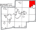
 Map of Stark County Ohio Highlighting Nimishillen Township.png 624 × 535; 33 KB
-
 Map of Stark County Ohio Highlighting North Canton City.png 624 × 535; 33 KB
-
 Map of Stark County Ohio Highlighting Osnaburg Township.png 624 × 535; 33 KB
-
 Map of Stark County Ohio Highlighting Paris Township.png 624 × 535; 33 KB
-
 Map of Stark County Ohio Highlighting Perry Township.png 624 × 535; 33 KB
-
 Map of Stark County Ohio Highlighting Pike Township.png 624 × 535; 33 KB
-
 Map of Stark County Ohio Highlighting Plain Township.png 624 × 535; 33 KB
-
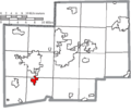
 Map of Stark County Ohio Highlighting Sandy Township.png 624 × 535; 33 KB
-
 Map of Stark County Ohio Highlighting Sugar Creek Township.png 624 × 535; 33 KB
-
 Map of Stark County Ohio Highlighting Tuscarawas Township.png 624 × 535; 33 KB
-
 Map of Stark County Ohio Highlighting Washington Township.png 624 × 535; 33 KB
-
 Map of Stark County Ohio Highlighting Waynesburg Village.png 624 × 535; 33 KB
-
 Map of Stark County Ohio Highlighting Wilmot Village.png 624 × 535; 33 KB
-
 Map of Stark County Ohio With Municipal and Township Labels.PNG 624 × 535; 62 KB
-
 Map of Stark County, Ohio No Text, Municipalities Distinct.png 624 × 535; 33 KB
-
 Map of Stark County, Ohio No Text.png 624 × 535; 33 KB


