Category:Political maps of Trumbull County, Ohio as of the 2000 United States Census
Jump to navigation
Jump to search
Media in category "Political maps of Trumbull County, Ohio as of the 2000 United States Census"
The following 39 files are in this category, out of 39 total.
-
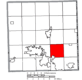
 Map of Trumbull County Ohio Highlighting Bazetta Township.png 600 × 592; 31 KB
-
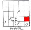
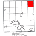
 Map of Trumbull County Ohio Highlighting Bloomfield Township.png 600 × 592; 31 KB
-
 Map of Trumbull County Ohio Highlighting Braceville Township.png 600 × 592; 31 KB
-
 Map of Trumbull County Ohio Highlighting Bristol Township.png 600 × 592; 31 KB
-
 Map of Trumbull County Ohio Highlighting Brookfield Township.png 600 × 592; 31 KB
-
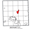
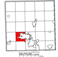
 Map of Trumbull County Ohio Highlighting Champion Township.png 600 × 592; 31 KB
-
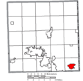
 Map of Trumbull County Ohio Highlighting Cortland City.png 600 × 592; 31 KB
-
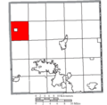 Map of Trumbull County Ohio Highlighting Farmington Township.png 600 × 592; 31 KB
-
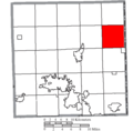
 Map of Trumbull County Ohio Highlighting Fowler Township.png 600 × 592; 31 KB
-
 Map of Trumbull County Ohio Highlighting Girard City.png 600 × 592; 31 KB
-
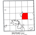
 Map of Trumbull County Ohio Highlighting Greene Township.png 600 × 592; 31 KB
-
 Map of Trumbull County Ohio Highlighting Gustavus Township.png 600 × 592; 31 KB
-
 Map of Trumbull County Ohio Highlighting Hartford Township.png 600 × 592; 31 KB
-
 Map of Trumbull County Ohio Highlighting Howland Township.png 600 × 592; 31 KB
-
 Map of Trumbull County Ohio Highlighting Hubbard City.png 600 × 592; 31 KB
-
 Map of Trumbull County Ohio Highlighting Hubbard Township.png 600 × 592; 31 KB
-
 Map of Trumbull County Ohio Highlighting Johnston Township.png 600 × 592; 31 KB
-
 Map of Trumbull County Ohio Highlighting Kinsman Township.png 600 × 592; 31 KB
-
 Map of Trumbull County Ohio Highlighting Liberty Township.png 600 × 592; 31 KB
-
 Map of Trumbull County Ohio Highlighting Lordstown Village.png 600 × 592; 31 KB
-
 Map of Trumbull County Ohio Highlighting McDonald Village.png 600 × 592; 31 KB
-
 Map of Trumbull County Ohio Highlighting Mecca Township.png 600 × 592; 31 KB
-
 Map of Trumbull County Ohio Highlighting Mesopotamia Township.png 600 × 592; 31 KB
-
 Map of Trumbull County Ohio Highlighting Newton Falls Village.png 600 × 592; 31 KB
-
 Map of Trumbull County Ohio Highlighting Newton Township.png 600 × 592; 31 KB
-
 Map of Trumbull County Ohio Highlighting Niles City.png 600 × 592; 31 KB
-
 Map of Trumbull County Ohio Highlighting Orangeville Village.png 600 × 592; 31 KB
-
 Map of Trumbull County Ohio Highlighting Southington Township.png 600 × 592; 31 KB
-
 Map of Trumbull County Ohio Highlighting Vernon Township.png 600 × 592; 31 KB
-
 Map of Trumbull County Ohio Highlighting Vienna Township.png 600 × 592; 31 KB
-
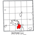
 Map of Trumbull County Ohio Highlighting Warren City.png 600 × 592; 31 KB
-
 Map of Trumbull County Ohio Highlighting Warren Township.png 600 × 592; 31 KB
-
 Map of Trumbull County Ohio Highlighting Weathersfield Township.png 600 × 592; 31 KB
-
 Map of Trumbull County Ohio Highlighting West Farmington Village.png 600 × 592; 31 KB
-
 Map of Trumbull County Ohio Highlighting Yankee Lake Village.png 600 × 592; 31 KB
-
 Map of Trumbull County Ohio Highlighting Youngstown City.png 600 × 592; 31 KB
-
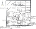 Map of Trumbull County Ohio With Municipal and Township Labels.PNG 742 × 592; 77 KB
-
 Map of Trumbull County, Ohio No Text, Municipalities Distinct.png 742 × 592; 33 KB
-
 Map of Trumbull County, Ohio No Text.png 742 × 592; 32 KB


