Category:Pontarddulais
Jump to navigation
Jump to search
town in the City and County of Swansea, Wales  | |||||
| Upload media | |||||
| Instance of | |||||
|---|---|---|---|---|---|
| Location | Pontarddulais, Swansea, Wales | ||||
 | |||||
Subcategories
This category has the following 2 subcategories, out of 2 total.
P
S
Media in category "Pontarddulais"
The following 200 files are in this category, out of 272 total.
(previous page) (next page)-
 2010 Wales Swansea Community Pontardulais map.svg 512 × 472; 632 KB
-
 2024 Wales Swansea Community Pontarddulais map.svg 512 × 472; 651 KB
-
 Abel Thomas ^ Sons in Pontarddulais - geograph.org.uk - 4348164.jpg 800 × 733; 104 KB
-
 Afon Llwchwr River - geograph.org.uk - 2147589.jpg 690 × 518; 140 KB
-
-
 Alltiago Road, Pontarddulais - geograph.org.uk - 4346892.jpg 800 × 500; 115 KB
-
 Autumn colours - geograph.org.uk - 6003602.jpg 2,448 × 3,264; 4.26 MB
-
 Barclays Bank, Pontarddulais - geograph.org.uk - 4358899.jpg 800 × 715; 123 KB
-

-
 Bleak house - geograph.org.uk - 6003597.jpg 2,048 × 1,536; 1.13 MB
-

-
 Bolgoed Road in Pontarddulais - geograph.org.uk - 4351975.jpg 800 × 595; 117 KB
-

-

-

-
 Bridge over Dulais, Pontarddulais - geograph.org.uk - 4346049.jpg 800 × 651; 166 KB
-

-

-

-
 Cairn on Graig Fawr - geograph.org.uk - 3213262.jpg 2,048 × 1,356; 713 KB
-
 Camffrwd. - geograph.org.uk - 405037.jpg 640 × 480; 113 KB
-
 Canolfan Y Bont in Pontarddulais - geograph.org.uk - 4349180.jpg 800 × 501; 90 KB
-
 Capel Hedd, Pontarddulais - geograph.org.uk - 4353566.jpg 800 × 503; 70 KB
-

-
 Carmel Apostolic Church in Pontarddulais - geograph.org.uk - 4372193.jpg 800 × 679; 121 KB
-
 Carreg y Pwlput - Pwlput y Geifr - geograph.org.uk - 6394479.jpg 1,024 × 768; 236 KB
-
 Cefn Drum - geograph.org.uk - 3804600.jpg 690 × 518; 151 KB
-

-
 Celynen. Holly Tree. - geograph.org.uk - 405045.jpg 640 × 480; 123 KB
-

-
 Changed Shopping Experience in April 2020 (geograph 6442560).jpg 1,600 × 900; 268 KB
-
 Chilli in Pontarddulais - geograph.org.uk - 4359050.jpg 760 × 800; 153 KB
-
 Clean it up in Pontarddulais - geograph.org.uk - 4353695.jpg 800 × 645; 102 KB
-
 Clos Banc y Berllan, Pontarddulais - geograph.org.uk - 4352016.jpg 800 × 471; 80 KB
-

-
 Clos Maes yr Ysgol, Pontarddulais - geograph.org.uk - 4352013.jpg 800 × 615; 105 KB
-
 Coral betting shop in Pontarddulais - geograph.org.uk - 4344788.jpg 800 × 672; 122 KB
-
 Corrugated shed - geograph.org.uk - 6003568.jpg 2,048 × 1,536; 1.4 MB
-
 Cross Street, Pontarddulais - geograph.org.uk - 4353659.jpg 800 × 590; 88 KB
-
 Cwmdulais - geograph.org.uk - 3803357.jpg 690 × 518; 124 KB
-
Cynllun Llifogydd Pontarddulais Flood Scheme.webm 2 min 24 s, 640 × 360; 13.71 MB
-
 Derelict Little India in Pontarddulais - geograph.org.uk - 4345018.jpg 800 × 555; 118 KB
-
 Direction signs in Pontarddulais - geograph.org.uk - 4353784.jpg 800 × 534; 101 KB
-
 Dismantled railway south of Pontarddulais - geograph.org.uk - 291897.jpg 480 × 640; 117 KB
-

-
 Downstream along Dulais, Pontarddulais - geograph.org.uk - 4370548.jpg 800 × 571; 127 KB
-

-
 Dulais from Dulais Road, Pontarddulais - geograph.org.uk - 4370432.jpg 800 × 692; 138 KB
-
 Dulais River - geograph.org.uk - 5591737.jpg 2,448 × 3,264; 2.4 MB
-

-

-

-
 End of cycle route in Pontarddulais - geograph.org.uk - 4344955.jpg 739 × 800; 159 KB
-

-
 Entrance to Bolgoed Quarry Nature Reserve - geograph.org.uk - 4691803.jpg 768 × 1,024; 251 KB
-
 Entrance to The Hollies in Pontarddulais - geograph.org.uk - 4355580.jpg 800 × 561; 132 KB
-
 Family Shopper in Pontarddulais - geograph.org.uk - 4358950.jpg 800 × 571; 112 KB
-
 Farm Gate - geograph.org.uk - 3213225.jpg 2,048 × 1,356; 722 KB
-
 Fenced-off church tower in Pontarddulais - geograph.org.uk - 4353802.jpg 600 × 800; 104 KB
-
 Ffynnon Binne - Ffynnon Binne Well - geograph.org.uk - 2638768.jpg 690 × 518; 239 KB
-
 Footpath and stream - geograph.org.uk - 6003594.jpg 2,048 × 1,536; 1.6 MB
-
 Footpath and stream at Pentrebach - geograph.org.uk - 6003593.jpg 2,048 × 1,536; 1.59 MB
-
 Footpath to Ebenezer Chapel - geograph.org.uk - 3213239.jpg 2,592 × 1,718; 989 KB
-

-

-
 Glynllwchwr Road, Pontarddulais - geograph.org.uk - 4348033.jpg 688 × 800; 128 KB
-
 Goppa Road houses in Pontarddulais - geograph.org.uk - 4344609.jpg 800 × 680; 119 KB
-
 Gorsaf y Glowr, Pontarddulais - geograph.org.uk - 4351802.jpg 800 × 621; 123 KB
-
 Hard Pressed in Pontarddulais - geograph.org.uk - 4349930.jpg 800 × 785; 143 KB
-

-

-
 Heol Dwr - geograph.org.uk - 3804190.jpg 640 × 429; 120 KB
-
 Heol Rhosilli Road - geograph.org.uk - 3804631.jpg 690 × 517; 130 KB
-
 High Society in Pontarddulais - geograph.org.uk - 4355585.jpg 800 × 553; 112 KB
-

-
 Highland Terrace houses, Pontarddulais - geograph.org.uk - 4344593.jpg 800 × 702; 168 KB
-
 Hope (1).jpg 3,648 × 2,736; 1.76 MB
-
 Hope Independent Chapel.jpg 3,240 × 4,320; 4.32 MB
-

-

-

-
 Information boards, Pontarddulais - geograph.org.uk - 4360478.jpg 800 × 512; 162 KB
-

-
 James Street houses in Pontarddulais - geograph.org.uk - 4353507.jpg 800 × 719; 132 KB
-

-
 James Street, Pontarddulais - geograph.org.uk - 4352019.jpg 800 × 544; 98 KB
-
 Jenkins and Siân's in Pontarddulais - geograph.org.uk - 4349957.jpg 782 × 800; 148 KB
-
 John Williams, commercial hotel & boarding house, Pontardulais.jpeg 700 × 573; 142 KB
-

-
 Junction for Pontarddulais Garden Centre - geograph.org.uk - 4348373.jpg 800 × 584; 120 KB
-

-

-
 King Fish Bar in Pontarddulais - geograph.org.uk - 4348194.jpg 800 × 688; 113 KB
-

-
 King Hotel - geograph.org.uk - 5591735.jpg 3,264 × 2,448; 2.45 MB
-
 King Hotel in Pontarddulais - geograph.org.uk - 4348192.jpg 800 × 505; 97 KB
-

-
 K^P Catering stall in Pontarddulais - geograph.org.uk - 4370406.jpg 800 × 692; 196 KB
-

-
 Lay-by off A48 - geograph.org.uk - 5980586.jpg 3,264 × 2,448; 3.19 MB
-
-
 Llandremor Ganol - geograph.org.uk - 3808912.jpg 690 × 518; 235 KB
-

-

-
 Lloyds Pharmacy, Pontarddulais - geograph.org.uk - 4344840.jpg 800 × 725; 146 KB
-
 Llwybr Tynybone Path - geograph.org.uk - 3860530.jpg 640 × 480; 83 KB
-
 Llwybr y Pentre Footpath - geograph.org.uk - 3844574.jpg 640 × 480; 103 KB
-
 Llwyncelyn Avenue in Pontarddulais - geograph.org.uk - 4355366.jpg 800 × 508; 112 KB
-
 Llys Gwyn Terrace - geograph.org.uk - 5980595.jpg 3,140 × 2,354; 1.3 MB
-
 Llysgwyn Terrace, Pontarddulais - geograph.org.uk - 4355359.jpg 800 × 615; 99 KB
-
 Looking north along Goppa Road - geograph.org.uk - 3244222.jpg 2,048 × 1,536; 675 KB
-
 Maesgwyn Road, Pontarddulais - geograph.org.uk - 4355597.jpg 800 × 529; 98 KB
-

-
 MOT garage on a riverbank, Pontarddulais - geograph.org.uk - 4415815.jpg 769 × 800; 135 KB
-
 Mrs Bucket in Pontarddulais - geograph.org.uk - 4344857.jpg 800 × 558; 91 KB
-
 Mynydd y Gopa - Gopa Hill - geograph.org.uk - 3803338.jpg 690 × 518; 143 KB
-
 Nant y Ffin, Pontarddulais - geograph.org.uk - 4351987.jpg 800 × 533; 111 KB
-

-

-
 North along Station Road, Pontarddulais - geograph.org.uk - 4344868.jpg 800 × 547; 119 KB
-

-

-

-
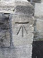
 Ordnance Survey Cut Mark - geograph.org.uk - 3698479.jpg 480 × 640; 134 KB
-
 Ordnance Survey Cut Mark - geograph.org.uk - 3698494.jpg 480 × 640; 101 KB
-
 Ordnance Survey Cut Mark - geograph.org.uk - 3698504.jpg 480 × 640; 63 KB
-
 Ordnance Survey Cut Mark - geograph.org.uk - 3698531.jpg 480 × 640; 93 KB
-
 Ordnance Survey Cut Mark - geograph.org.uk - 3698550.jpg 480 × 640; 125 KB
-
 Ordnance Survey Cut Mark - geograph.org.uk - 3698575.jpg 480 × 640; 85 KB
-
 Ordnance Survey Cut Mark - geograph.org.uk - 3698586.jpg 480 × 640; 91 KB
-
 Ordnance Survey Cut Mark - geograph.org.uk - 3863697.jpg 480 × 640; 111 KB
-
 Ordnance Survey Cut Mark - geograph.org.uk - 3863713.jpg 416 × 640; 98 KB
-
 Ordnance Survey Cut Mark - geograph.org.uk - 3863719.jpg 480 × 640; 136 KB
-
 Ordnance Survey Cut Mark - geograph.org.uk - 4174682.jpg 480 × 640; 104 KB
-
 Ordnance Survey Cut Mark - geograph.org.uk - 4763946.jpg 480 × 640; 102 KB
-

-
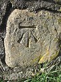
 Ordnance Survey Rivet - geograph.org.uk - 3863683.jpg 640 × 480; 125 KB
-
 Ordnance Survey Rivet - geograph.org.uk - 3863689.jpg 640 × 480; 89 KB
-
 Ordnance Survey Rivet - geograph.org.uk - 3994248.jpg 640 × 480; 151 KB
-

-
 Pant y Ddraenen - geograph.org.uk - 3816926.jpg 690 × 518; 268 KB
-
 Pantiago Road houses in Pontarddulais - geograph.org.uk - 4346047.jpg 800 × 517; 118 KB
-
 Parc Coed Bach - geograph.org.uk - 1410776.jpg 640 × 480; 100 KB
-
 Parc Coedbach Park Woods, Pontarddulais - geograph.org.uk - 2147546.jpg 690 × 518; 287 KB
-

-

-
 Pleser in Pontarddulais - geograph.org.uk - 4358968.jpg 772 × 800; 111 KB
-
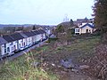
 Pontarddulais from the north - geograph.org.uk - 2172937.jpg 2,048 × 1,536; 536 KB
-
 Pontarddulais Library - geograph.org.uk - 4349847.jpg 800 × 555; 105 KB
-
 Pontarddulais MOT Centre - geograph.org.uk - 4344596.jpg 800 × 618; 119 KB
-

-
 Pontarddulais railway station name sign - geograph.org.uk - 4360622.jpg 800 × 600; 158 KB
-
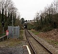
 Pontarddulais railway station platform - geograph.org.uk - 4360613.jpg 800 × 600; 202 KB
-
 Pontarddulais railway station, Carmarthenshire - geograph.org.uk - 3994736.jpg 1,024 × 768; 288 KB
-
 Pontarddulais railway station, Carmarthenshire - geograph.org.uk - 3994738.jpg 1,024 × 768; 164 KB
-

-
 Pontarddulais Service Station - geograph.org.uk - 4344807.jpg 800 × 469; 80 KB
-
 Pontarddulais station - geograph.org.uk - 6059685.jpg 1,536 × 2,048; 1.2 MB
-
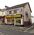
 Pontarddulais Stores, Pontarddulais - geograph.org.uk - 4346858.jpg 800 × 703; 115 KB
-
 Pontarddulais War Memorial - geograph.org.uk - 4358954.jpg 800 × 714; 112 KB
-
 Pontarddulais, St Teilo Street - geograph.org.uk - 184974.jpg 640 × 427; 160 KB
-
 Pontardulais Conservative Club - geograph.org.uk - 4349868.jpg 800 × 684; 127 KB
-

-
 Pontardulais Workingmen's Club - geograph.org.uk - 4344777.jpg 800 × 578; 104 KB
-
 Postbox on a corner in Pontarddulais - geograph.org.uk - 4346826.jpg 800 × 643; 112 KB
-
 Presbyterian Church of Wales - geograph.org.uk - 3698562.jpg 640 × 480; 51 KB
-

-

-
-
 Railway Bridge - geograph.org.uk - 3210484.jpg 1,280 × 720; 311 KB
-

-

-
 Reflections on the Loughor - geograph.org.uk - 3212818.jpg 2,560 × 1,920; 1.21 MB
-
 Reflections on the Loughor 2 - geograph.org.uk - 3212819.jpg 2,560 × 1,920; 1.08 MB
-
 Rhydgoch Cemetery, Pontarddulais - geograph.org.uk - 177124.jpg 640 × 480; 160 KB
-

-
 Road bridge over the Heart of Wales line - geograph.org.uk - 1334192.jpg 640 × 480; 101 KB
-
 Rock Face in Bolgoed Quarry Nature Reserve - geograph.org.uk - 4691814.jpg 1,080 × 810; 211 KB
-
 Rocky outcrop - geograph.org.uk - 3213253.jpg 2,048 × 1,356; 411 KB
-
 Ross Car Sales in Pontarddulais - geograph.org.uk - 4344475.jpg 800 × 614; 131 KB
-

-

-

-
 SE boundary of Pontarddulais - geograph.org.uk - 4370379.jpg 640 × 416; 89 KB
-

-
 Seahorse in Pontarddulais - geograph.org.uk - 4348009.jpg 800 × 731; 139 KB
-
 Shops in Pontarddulais - geograph.org.uk - 5591736.jpg 3,264 × 2,448; 2.22 MB
-
 Short Bark 'n' Side in Pontarddulais - geograph.org.uk - 4351960.jpg 800 × 508; 119 KB
-

-

-
 Small Cairn on Graig Fawr. - geograph.org.uk - 4210313.jpg 640 × 480; 85 KB
-

-
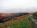
 Sprawling mountain road junction - geograph.org.uk - 6002530.jpg 3,264 × 2,448; 2.06 MB
-

-
 St Brides Close, Pontarddulais - geograph.org.uk - 4353642.jpg 800 × 427; 74 KB
-

-
 St Teilo Street, Pontarddulais - geograph.org.uk - 4349886.jpg 800 × 530; 97 KB
-
 St Teilo's Church - geograph.org.uk - 3698557.jpg 640 × 480; 65 KB
-
 St Teilo's Church in Pontarddulais - geograph.org.uk - 4353752.jpg 800 × 576; 100 KB
-
 St Teilo's churchyard, Pontarddulais - geograph.org.uk - 4353792.jpg 800 × 651; 103 KB


.jpg)


.jpg)


_-_geograph.org.uk_-_3698517.jpg)


_-_geograph.org.uk_-_3550230.jpg)


