Category:Pontweg 152, De Koog
Jump to navigation
Jump to search
| Object location | | View all coordinates using: OpenStreetMap |
|---|
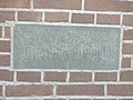
Nederlands: Boerderij Aurora - anno 1902
Media in category "Pontweg 152, De Koog"
The following 4 files are in this category, out of 4 total.
-
 Pontweg 152 - De Koog - 1.jpg 4,640 × 3,480; 5.37 MB
-
 Pontweg 152 - De Koog - 2.jpg 4,640 × 3,480; 5.46 MB
-
 Pontweg 152 - De Koog - 3.jpg 3,480 × 4,640; 5.08 MB
-
 Pontweg 152 - De Koog - 4.jpg 4,640 × 3,480; 7.51 MB


