Category:Pontymoel
Jump to navigation
Jump to search

suburb of Pontypool and a community in Torfaen County Borough in south east Wales   | |||||
| Upload media | |||||
| Pronunciation audio | |||||
|---|---|---|---|---|---|
| Instance of | |||||
| Location | Torfaen, Wales | ||||
| Population |
| ||||
| Area |
| ||||
 | |||||
Subcategories
This category has the following 10 subcategories, out of 10 total.
Media in category "Pontymoel"
The following 200 files are in this category, out of 839 total.
(previous page) (next page)-

-
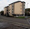 21st century Ty Llwyd flats, Pontypool - geograph.org.uk - 5707918.jpg 800 × 785; 137 KB
-
 7 Osborne Road, Pontypool - geograph.org.uk - 3785232.jpg 800 × 631; 141 KB
-

-

-

-

-

-
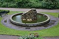 A small pond in Pontypool - geograph.org.uk - 3996459.jpg 1,600 × 1,064; 747 KB
-

-

-
 A.C.Puddle, Pontypool - geograph.org.uk - 2394742.jpg 640 × 582; 78 KB
-
 A4043 at Pontypool - geograph.org.uk - 3999855.jpg 1,600 × 1,465; 565 KB
-

-
 A4043 looking north - geograph.org.uk - 3790116.jpg 640 × 481; 46 KB
-
 A472 and Rockhill Road, Pontypool - geograph.org.uk - 2460612.jpg 640 × 480; 82 KB
-

-

-
 A472 at Pontymoel - geograph.org.uk - 5922710.jpg 2,980 × 2,062; 1.67 MB
-
 A472 between two bridges, Pontypool - geograph.org.uk - 2451763.jpg 640 × 480; 72 KB
-
-

-
 A472 east of Albion Road, Pontypool - geograph.org.uk - 2427139.jpg 640 × 592; 101 KB
-

-
 A472 near Old Furnace - geograph.org.uk - 2751534.jpg 640 × 480; 62 KB
-
 A472 near Old Furnace - geograph.org.uk - 6178210.jpg 1,024 × 770; 150 KB
-
 Abandoned roadside site, Old Furnace - geograph.org.uk - 2427894.jpg 640 × 480; 106 KB
-

-
 Across Forge Lane, Pontypool - geograph.org.uk - 4731326.jpg 800 × 600; 126 KB
-
 Across Town Bridge, Pontypool - geograph.org.uk - 5707972.jpg 800 × 577; 132 KB
-
 Afon Llwyd, Pontypool - geograph.org.uk - 4636366.jpg 4,770 × 3,451; 6.02 MB
-
 Afon Lwyd - geograph.org.uk - 3750591.jpg 1,024 × 680; 278 KB
-
 Afon Lwyd below leisure centre, Pontypool - geograph.org.uk - 5700625.jpg 5,179 × 3,451; 5.04 MB
-
 Afon Lwyd Close, Pontypool - geograph.org.uk - 2392984.jpg 640 × 496; 82 KB
-

-

-
 Afon Lwyd flows through Pontypool Park - geograph.org.uk - 2251379.jpg 640 × 480; 103 KB
-

-

-
 Afon Lwyd, Trosnant Street, Pontypool - geograph.org.uk - 5700610.jpg 5,179 × 3,451; 4.2 MB
-
 Albion Road flats, Pontypool - geograph.org.uk - 2426792.jpg 640 × 481; 92 KB
-

-
 Allegretto at the Junction.jpg 5,472 × 3,648; 10.67 MB
-
 Amberley Place, Pontypool - geograph.org.uk - 3369978.jpg 430 × 640; 83 KB
-
 Amgueddfa Pontypool Museum - geograph.org.uk - 1950687.jpg 1,500 × 1,000; 143 KB
-
 Aneurin Bevan Court, Pontypool - geograph.org.uk - 4328799.jpg 800 × 566; 106 KB
-

-
 Aqueduct Cruisers.jpg 5,472 × 3,648; 10.28 MB
-
 Argos, Pontypool - geograph.org.uk - 2437305.jpg 480 × 640; 69 KB
-

-
 Art deco shop in Pontypool - geograph.org.uk - 3179137.jpg 640 × 480; 77 KB
-
 Asiana in Pontypool - geograph.org.uk - 5707911.jpg 800 × 527; 84 KB
-

-
 Auto Service, Pontypool - geograph.org.uk - 5739082.jpg 800 × 508; 90 KB
-

-
 Backstop of Victorian rifle range, Cwm Lickey - geograph.org.uk - 2884949.jpg 3,772 × 2,504; 3.17 MB
-
 Barclays Bank, Pontypool - geograph.org.uk - 2291549.jpg 3,000 × 4,000; 2.31 MB
-
 Barclays Pontypool - geograph.org.uk - 1853886.jpg 490 × 640; 74 KB
-
 Barclays Pontypool - geograph.org.uk - 4727530.jpg 800 × 600; 160 KB
-
 Bargain Box, Pontypool - geograph.org.uk - 4325895.jpg 714 × 800; 132 KB
-

-

-
 Bellamy's Pad, 22 Clarence Street, Pontypool - geograph.org.uk - 6337052.jpg 1,488 × 1,600; 323 KB
-
 Belle Femme and Asiana in Pontypool - geograph.org.uk - 5445386.jpg 800 × 707; 128 KB
-
 Belle Femme, Pontypool - geograph.org.uk - 4728888.jpg 800 × 592; 112 KB
-
 Benches and trees in Pontypool Park - geograph.org.uk - 6026040.jpg 1,000 × 1,024; 328 KB
-
 Best Butties, Pontypool - geograph.org.uk - 4728953.jpg 800 × 642; 152 KB
-
 Betfred in Pontypool town centre - geograph.org.uk - 5216362.jpg 800 × 759; 150 KB
-
 Betfred Pontypool - geograph.org.uk - 3474376.jpg 708 × 800; 154 KB
-
 Betty's Cafe, Pontypool - geograph.org.uk - 2505619.jpg 640 × 500; 76 KB
-
 Bigham's Row, Upper Race, Pontypool - geograph.org.uk - 2452305.jpg 640 × 572; 80 KB
-
 Bilingual direction sign, Pontypool - geograph.org.uk - 5758412.jpg 800 × 675; 131 KB
-
-
 Black signpost on a Pontypool corner - geograph.org.uk - 5541954.jpg 699 × 800; 191 KB
-
 Blaenavon TV Services, Pontypool - geograph.org.uk - 4726427.jpg 800 × 667; 98 KB
-

-
 Blaendare Road houses, Pontypool - geograph.org.uk - 2451885.jpg 640 × 512; 72 KB
-

-
 Blaendare Road, Upper Race, Pontypool - geograph.org.uk - 3996505.jpg 1,600 × 1,064; 421 KB
-
 Blissfully Vintage in Pontypool - geograph.org.uk - 5445411.jpg 800 × 754; 109 KB
-

-
 Bluebells and Stone Circle - geograph.org.uk - 1913218.jpg 1,024 × 576; 252 KB
-

-
 Boarded-up Up ^ Under, Pontypool - geograph.org.uk - 2392798.jpg 640 × 436; 73 KB
-
 Boarded-up White Hart, Pontypool - geograph.org.uk - 2393312.jpg 544 × 640; 78 KB
-
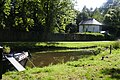
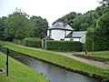
 Boats moored on the canal, Pontymoel - geograph.org.uk - 2291587.jpg 3,990 × 2,620; 4.38 MB
-
 Bowling Green pavilion, Pontypool Park - geograph.org.uk - 3195378.jpg 640 × 480; 111 KB
-
 Bradbury House, Pontypool - geograph.org.uk - 2392814.jpg 640 × 480; 66 KB
-
 Bread of Heaven, Pontypool - geograph.org.uk - 3329414.jpg 549 × 640; 84 KB
-
 Brexit Party office on a town centre corner, Pontypool - geograph.org.uk - 6336873.jpg 1,600 × 1,229; 343 KB
-

-
 Bridge carrying the A472 - geograph.org.uk - 3750586.jpg 1,024 × 680; 238 KB
-

-

-
 BrightHouse, Pontypool - geograph.org.uk - 5216522.jpg 800 × 600; 104 KB
-

-
 Broadway houses, Pontypool - geograph.org.uk - 3370142.jpg 640 × 472; 69 KB
-

-
 Bryngwyn Road houses, Pontypool - geograph.org.uk - 2417278.jpg 640 × 480; 63 KB
-
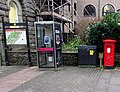
 BT phonebox, Rockhill Road, Pontypool - geograph.org.uk - 5739149.jpg 800 × 735; 140 KB
-
 Budget Furniture, Pontypool - geograph.org.uk - 3474497.jpg 778 × 800; 173 KB
-
-

-
 Bus stop in Tesco's car park, Pontypool - geograph.org.uk - 4328581.jpg 800 × 490; 122 KB
-

-

-
 Buzz in Pontypool - geograph.org.uk - 4325894.jpg 690 × 800; 117 KB
-
 Campus building, Pontypool - geograph.org.uk - 2452301.jpg 640 × 427; 58 KB
-
 Canal Cafe - geograph.org.uk - 2616813.jpg 800 × 600; 226 KB
-
 Canal side Junction Cottage, Pontymoel - geograph.org.uk - 5860124.jpg 5,179 × 3,451; 5.17 MB
-
 Canal toll house, Mon ^ Brec Canal - geograph.org.uk - 3665870.jpg 1,024 × 768; 150 KB
-
 Capel Street, Pontypool - geograph.org.uk - 4325403.jpg 749 × 800; 146 KB
-

-
 Card Factory shop, Pontypool - geograph.org.uk - 5216541.jpg 769 × 800; 144 KB
-

-

-
-

-
 Chaintree Cottage, Penyrheol - geograph.org.uk - 2666992.jpg 640 × 406; 74 KB
-
 Cherrytree Cottage, Penyrheol - geograph.org.uk - 2666995.jpg 640 × 471; 76 KB
-
 Chevroflex Ultra, A4042, Pontypool - geograph.org.uk - 4324286.jpg 800 × 506; 151 KB
-
 Christian Bookshop, Pontypool - geograph.org.uk - 3329309.jpg 640 × 513; 85 KB
-
 Christmas tree in Pontypool town centre - geograph.org.uk - 6347270.jpg 1,404 × 1,600; 430 KB
-
 Church Wood houses, Pontypool - geograph.org.uk - 2429706.jpg 640 × 477; 96 KB
-
 Churchwood Close, Pontypool - geograph.org.uk - 2429727.jpg 640 × 480; 93 KB
-
 Citizens Advice Bureau in Pontypool - geograph.org.uk - 5267423.jpg 800 × 779; 103 KB
-
-
 Civil Defences War Memorial, Pontypool - geograph.org.uk - 5226722.jpg 746 × 800; 190 KB
-
 Civil Defences War Memorial, Pontypool - geograph.org.uk - 6025872.jpg 936 × 1,024; 261 KB
-
 Clarence Corner car park, Pontypool - geograph.org.uk - 4726452.jpg 800 × 531; 153 KB
-
 Clarence Road Pontypool - geograph.org.uk - 2438282.jpg 640 × 480; 87 KB
-

-
 Clarence Street roundabout - geograph.org.uk - 6230635.jpg 3,024 × 1,701; 1.24 MB
-
 Clock tower, Rockhill Road, Pontypool - geograph.org.uk - 5739780.jpg 792 × 800; 112 KB
-
 Clos Afon Llwyd, Pontypool - geograph.org.uk - 4636389.jpg 640 × 418; 98 KB
-
 Closeup view of rugby mosaic, Pontypool - geograph.org.uk - 2393145.jpg 640 × 591; 118 KB
-
-
 Coat of Arms on Pontypool Town Hall - geograph.org.uk - 2590029.jpg 440 × 640; 43 KB
-
 Coed Cae Place, Pontypool - geograph.org.uk - 4325434.jpg 800 × 698; 145 KB
-
 Cold Soul Collective, Pontypool - geograph.org.uk - 4728838.jpg 798 × 800; 126 KB
-
 Colourful van in Pontypool town centre - geograph.org.uk - 5445433.jpg 800 × 751; 139 KB
-

-
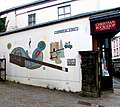 Commercial Street mural, Pontypool - geograph.org.uk - 5846417.jpg 1,024 × 912; 229 KB
-
 Commercial Street, Pontypool - geograph.org.uk - 4730005.jpg 800 × 600; 124 KB
-
 Commercial Street, Pontypool - geograph.org.uk - 5226629.jpg 728 × 800; 119 KB
-
 Construction of footbridge, Afon Lwyd, Pontypool - geograph.org.uk - 5799257.jpg 5,179 × 3,451; 4.99 MB
-
 Construction of new path, Pontypool Park - geograph.org.uk - 5799282.jpg 5,179 × 3,451; 5.06 MB
-
 Contrasts in central Pontypool - geograph.org.uk - 2484856.jpg 621 × 640; 77 KB
-

-

-
 Crumlin Street, Pontypool - geograph.org.uk - 4325446.jpg 800 × 595; 137 KB
-
 Cwm Farm, Pontypool - geograph.org.uk - 2460685.jpg 640 × 480; 69 KB
-
 Cwm Fields area of Pontypool - geograph.org.uk - 2665860.jpg 640 × 588; 122 KB
-
 Cwmynyscoy Hall, Pontypool - geograph.org.uk - 2461805.jpg 640 × 509; 72 KB
-
 Cwmynyscoy Road, Pontypool - geograph.org.uk - 2889282.jpg 640 × 486; 85 KB
-

-
 Cymru Chiropractic Clinic, Pontypool - geograph.org.uk - 3329287.jpg 441 × 640; 80 KB
-
 Dam wall of the Cwm Lickey pond reservoir - geograph.org.uk - 2884972.jpg 4,000 × 3,000; 4.96 MB
-
 Darren Lewis, Pontypool - geograph.org.uk - 4726349.jpg 800 × 679; 127 KB
-

-
 December 5th 2019 Tesco fuel prices, Pontypool - geograph.org.uk - 6337011.jpg 1,024 × 832; 233 KB
-
 Derelict former Blaenavon TV Services shop, Pontypool - geograph.org.uk - 6337077.jpg 1,276 × 1,600; 469 KB
-

-

-

-

-

-
 Dereliction in Pontypool town centre - geograph.org.uk - 5445436.jpg 800 × 739; 129 KB
-
 Destan's Cafe ^ Takeaway, Pontypool - geograph.org.uk - 5707908.jpg 800 × 708; 137 KB
-
 Directions at the edge of Pontypool Park, Pontypool - geograph.org.uk - 6347275.jpg 1,600 × 1,589; 501 KB
-

-
 Directions sign in Pontypool town centre - geograph.org.uk - 5445428.jpg 740 × 800; 122 KB
-

-
 Disused George V postbox, Penyrheol - geograph.org.uk - 2666985.jpg 302 × 640; 76 KB
-
 Do not walk under barrier, Pontypool - geograph.org.uk - 4328593.jpg 800 × 535; 113 KB
-

-

-

-

-

-

-
 East side of Pontypool Workingmens Club - geograph.org.uk - 4325884.jpg 800 × 498; 107 KB
-
-

-

-

-

-

-
 Entrance to Glanwern House, Pontypool - geograph.org.uk - 2417268.jpg 640 × 574; 114 KB
-

-

-
 Entrance to Pontypool Police Station - geograph.org.uk - 2505463.jpg 640 × 480; 74 KB
-

-

-

-
 Entrance to Torfaen Museum, Pontypool - geograph.org.uk - 6025908.jpg 1,024 × 885; 185 KB
-
 Entrance to Tramway tunnel, Pontypool - geograph.org.uk - 5785010.jpg 5,179 × 3,451; 4.75 MB
-

-

-
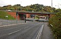
 Entry slip road to the A472, Pontypool - geograph.org.uk - 5758426.jpg 800 × 739; 144 KB


