Category:Population maps of the European Union
Jump to navigation
Jump to search
Media in category "Population maps of the European Union"
The following 10 files are in this category, out of 10 total.
-
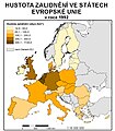 Choropleth map.jpg 700 × 800; 228 KB
-
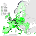
 Population density european union.png 1,046 × 842; 101 KB
-
 EU NUTS 2 population density 2007 Diagonal continental.svg 451 × 451; 2.32 MB
-
 EU NUTS 2 population density 2007.svg 850 × 600; 2.09 MB
-
 Density of Population in EU 2014-it.svg 609 × 600; 2.15 MB
-
 Density of Population in EU 2014.svg 609 × 600; 2.15 MB
-
 Population density by NUTS 3 region (2017).svg 950 × 830; 9.06 MB
-
 EU Pop2008 1024-not contiguity.svg 600 × 620; 271 KB
-
 EU Pop2008 1024.PNG 1,536 × 1,534; 249 KB
-
 EU-metropoles-sans-bordures.png 1,220 × 1,012; 93 KB


.svg)


