Category:Port of London
Aller à la navigation
Aller à la recherche
port de commerce anglais  | |||||
| Téléverser des médias | |||||
| Nature de l’élément | |||||
|---|---|---|---|---|---|
| Lieu |
| ||||
| Baigné par | |||||
| Comprend | |||||
| site officiel | |||||
 | |||||
Sous-catégories
Cette catégorie comprend 48 sous-catégories, dont les 48 ci-dessous.
A
- Angerstein Wharf, London (32 F)
- Port of London in art (35 F)
B
- Barking Power Station (10 F)
- Belvedere Incinerator (15 F)
- Blackwall Basin (22 F)
C
- Chambers Wharf (5 F)
- Coryton Refinery (23 F)
D
- Deptford Power Station (11 F)
E
- Enderby's Wharf (14 F)
F
- Fresh Wharf (9 F)
- Fulham Power Station (7 F)
G
- Globe Wharf (16 F)
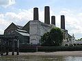
- Greenwich Power Station (59 F)
H
I
- Irongate Wharf (2 F)
L
- Littlebrook Power Station (8 F)
- London Gateway (39 F)
- Lots Road Power Station (59 F)
M
- Old maps of the Docks of London (44 F)
- Metropolitan Wharf, Wapping (18 F)
N
- New Crane Wharf, Wapping (17 F)
- Northfleet Power Station (4 F)
O
- Oliver's Wharf, Wapping (25 F)
P
- Pool of London (17 F)
- Prospect of Whitby (42 F)
S
- Stoneness Light (8 F)
T
- Tilbury Power Station (54 F)
W
- Walbrook Wharf (27 F)
- West Ham Power Station (3 F)
- West Thurrock Power Station (1 F)
Média dans la catégorie « Port of London »
Cette catégorie comprend 480 fichiers, dont les 200 ci-dessous.
(page précédente) (page suivante)-
 A bold statement of ownership, 1960 - geograph.org.uk - 1610062.jpg 640 × 427 ; 67 kio
-
 A Creekmouth Jetty - geograph.org.uk - 50921.jpg 640 × 482 ; 64 kio
-

-
 A London View - geograph.org.uk - 303999.jpg 640 × 480 ; 241 kio
-
 A muddy foreshore, Grays - geograph.org.uk - 636520.jpg 640 × 482 ; 121 kio
-
 Aberdeen Wharf, Wapping - geograph.org.uk - 108057.jpg 640 × 423 ; 157 kio
-

-
 Aerial Conveyor, West Thurrock - geograph.org.uk - 1594121.jpg 640 × 430 ; 102 kio
-

-
 Aggregates Depot, North Greenwich - geograph.org.uk - 1468444.jpg 640 × 428 ; 65 kio
-
 Aggregates Depot, North Greenwich - geograph.org.uk - 1468448.jpg 640 × 428 ; 52 kio
-
 Amylum works, Greenwich Peninsula (1) - geograph.org.uk - 1571816.jpg 640 × 480 ; 40 kio
-
 Amylum works, Greenwich Peninsula (2) - geograph.org.uk - 1571825.jpg 640 × 480 ; 38 kio
-
 Amylum works, Greenwich Peninsula (3) - geograph.org.uk - 1571829.jpg 640 × 480 ; 42 kio
-
 Asphalt Making Factory, Purfleet - geograph.org.uk - 1593962.jpg 640 × 430 ; 57 kio
-
 Asphalt Making Factory, Purfleet - geograph.org.uk - 1593973.jpg 640 × 498 ; 58 kio
-
 Ballast Quay, Greenwich - geograph.org.uk - 1469969.jpg 640 × 428 ; 97 kio
-
 Banning Street, Greenwich - geograph.org.uk - 1164005.jpg 640 × 480 ; 122 kio
-
 Barges and Canaries - geograph.org.uk - 766358.jpg 640 × 203 ; 38 kio
-
 Barges at the ADM Pura jetty, Purfleet. - geograph.org.uk - 1213931.jpg 640 × 429 ; 55 kio
-
 Battersea, Grove Wharf and Falcon Wharf Dock - geograph.org.uk - 826984.jpg 640 × 480 ; 100 kio
-
 Battsea freight.jpg 2 120 × 1 411 ; 1,05 Mio
-
 Bell Wharf - geograph.org.uk - 1558113.jpg 640 × 427 ; 58 kio
-
 BERTINA at West Thurrock - geograph.org.uk - 1143760.jpg 640 × 480 ; 94 kio
-
 Blackwall basin 1.jpg 640 × 486 ; 153 kio
-
 Blackwall Point Power Station 2.jpg 770 × 566 ; 78 kio
-
 London Tilbury Union Castle's 'Bloemfontein Castle' geograph-3080502-by-Ben-Brooksbank.jpg 2 394 × 1 391 ; 1,39 Mio
-
 Boat repair yard at South Dock (2) - geograph.org.uk - 1494177.jpg 640 × 480 ; 76 kio
-
 Boat repair yard at South Dock - geograph.org.uk - 1494166.jpg 640 × 480 ; 76 kio
-
 Boatyard at Badcock's Wharves (1) - geograph.org.uk - 1987565.jpg 640 × 480 ; 46 kio
-
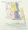
 Botolph and Nicholsons Wharf plan 1857.jpg 2 454 × 1 699 ; 535 kio
-
 Brenntag distribution centre, East Greenwich - geograph.org.uk - 1572277.jpg 640 × 480 ; 75 kio
-
 Broadness Lighthouse - geograph.org.uk - 1558162.jpg 640 × 427 ; 51 kio
-
 Brunswick Wharf Power Sta.jpg 649 × 600 ; 113 kio
-
 Canals of Wapping - geograph.org.uk - 221766.jpg 640 × 480 ; 118 kio
-
 Canary W.JPG 2 048 × 1 536 ; 1,56 Mio
-
 Canary Wharf - Rotherhithe Ferry.jpg 2 840 × 1 894 ; 373 kio
-
 Canary Wharf 1.JPG 3 264 × 2 448 ; 2,73 Mio
-
 Canary Wharf 200810.jpg 1 024 × 685 ; 204 kio
-
 Canary Wharf 2010-08a.jpg 1 024 × 683 ; 1,04 Mio
-
 Canary Wharf Area waterfront buildings.jpg 1 120 × 784 ; 389 kio
-
 Canary Wharf, early evening (2007).jpg 2 048 × 1 536 ; 1,44 Mio
-
 Canvey Island banner Hole Haven and British Falcon.jpg 2 513 × 359 ; 747 kio
-
 Captain Kidd public house, Wapping - geograph.org.uk - 99790.jpg 640 × 440 ; 91 kio
-
 Carpathia Unloading at Tilbury docks - geograph.org.uk - 2091919.jpg 800 × 531 ; 85 kio
-
 Chelsea Bridge Wharf - geograph.org.uk - 1573665.jpg 640 × 480 ; 52 kio
-
 Chelsea Wharf - geograph.org.uk - 1380735.jpg 640 × 480 ; 68 kio
-
 Chelsea Wharf, SW10 - geograph.org.uk - 827295.jpg 640 × 480 ; 71 kio
-
 Chemical Distribution Depot, Greenwich - geograph.org.uk - 377579.jpg 640 × 480 ; 103 kio
-
 Christmas at Grays Beach - geograph.org.uk - 299258.jpg 640 × 432 ; 77 kio
-
 City Cruises - geograph.org.uk - 197063.jpg 640 × 480 ; 79 kio
-
 Coal Lift at Tilbury Power Station - geograph.org.uk - 4401.jpg 640 × 420 ; 38 kio
-
 Coaster at Lovell's Wharf, Greenwich - geograph.org.uk - 668803.jpg 638 × 344 ; 121 kio
-

-
 Coldharbour Light - geograph.org.uk - 49366.jpg 640 × 482 ; 50 kio
-
 Coldharbour Point - geograph.org.uk - 1022454.jpg 480 × 628 ; 96 kio
-
 Columbia Wharf - geograph.org.uk - 1762916.jpg 3 432 × 2 266 ; 675 kio
-
 Columbia Wharf - geograph.org.uk - 237666.jpg 640 × 480 ; 73 kio
-
 Container Stack - geograph.org.uk - 36898.jpg 640 × 482 ; 75 kio
-
 Conveyor at North Greenwich - geograph.org.uk - 1468453.jpg 640 × 428 ; 56 kio
-
 Conveyor, Stone Cement Works 1974 - geograph.org.uk - 133793.jpg 640 × 404 ; 67 kio
-
 Coryton 191007.jpg 3 504 × 1 990 ; 1,32 Mio
-
 Coryton Flares - geograph.org.uk - 758986.jpg 640 × 426 ; 49 kio
-
 Coryton Oil Refinery - geograph.org.uk - 1052275.jpg 640 × 425 ; 70 kio
-
 Coryton Oil Refinery - geograph.org.uk - 169474.jpg 640 × 220 ; 46 kio
-
 Coryton Oil Refinery through morning mist - geograph.org.uk - 1111728.jpg 640 × 311 ; 38 kio
-
 Coryton oil terminal - geograph.org.uk - 1166208.jpg 640 × 427 ; 79 kio
-
 CorytonRefineryFlares - geograph.org.uk - 758986.jpg 593 × 427 ; 31 kio
-
 Cox & Hammonds Quay plan 1857 (cropped).jpg 1 325 × 1 438 ; 662 kio
-
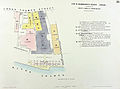 Cox & Hammonds Quay plan 1857.jpg 2 326 × 1 725 ; 1,29 Mio
-
 Crabtree Wharf - geograph.org.uk - 2109013.jpg 640 × 430 ; 117 kio
-
 Crane Boat in the River Thames - geograph.org.uk - 1558172.jpg 640 × 427 ; 44 kio
-
 Creekmouth, River Road - geograph.org.uk - 321623.jpg 640 × 480 ; 67 kio
-
 Cringle Wharf - geograph.org.uk - 1162522.jpg 640 × 422 ; 58 kio
-
 Cutty Sark. Greenwich. London. - geograph.org.uk - 69797.jpg 621 × 466 ; 112 kio
-
 Dagenham Dock - geograph.org.uk - 1278384.jpg 640 × 426 ; 67 kio
-
 Dagenham Dock - geograph.org.uk - 57614.jpg 640 × 462 ; 43 kio
-
 Dagenham Ford Motor Works geograph-3080284-by-Ben-Brooksbank.jpg 2 394 × 1 397 ; 1,79 Mio
-
 Demolition of Delta Wharf (1) - geograph.org.uk - 1571674.jpg 640 × 480 ; 85 kio
-
 Demolition of Delta Wharf (2) - geograph.org.uk - 1571678.jpg 640 × 480 ; 72 kio
-
 Deptford Creek at low tide - geograph.org.uk - 632847.jpg 640 × 480 ; 56 kio
-
 Deptford Creek bridge - geograph.org.uk - 42416.jpg 480 × 640 ; 169 kio
-
 Deptford Creekside Sluice Gate.jpg 2 272 × 1 704 ; 1,07 Mio
-
 Deptford Power Station 1970 - geograph.org.uk - 1742937.jpg 2 062 × 1 492 ; 198 kio
-
 Deptford Power Station 40 years on. - geograph.org.uk - 1742953.jpg 3 504 × 2 336 ; 3,21 Mio
-
 Deptford Strond.jpg 2 000 × 1 417 ; 165 kio
-
 Deptford Yard.jpg 1 243 × 609 ; 292 kio
-
 Deptford, England in 1800 by William Crotch.jpg 948 × 712 ; 206 kio
-
 DeptfordCreekside.JPG 2 560 × 1 920 ; 3,3 Mio
-
-
 Disused and derelict - geograph.org.uk - 912545.jpg 640 × 480 ; 76 kio
-

-
 Disused lock and weir on River Darenth - geograph.org.uk - 1170816.jpg 640 × 481 ; 80 kio
-
 Docks near Canary Wharf - geograph.org.uk - 1285433.jpg 640 × 427 ; 63 kio
-
 Duchess M - geograph.org.uk - 48199.jpg 640 × 482 ; 58 kio
-
 East Greenwich gasometer, Blackwall Lane - geograph.org.uk - 355137.jpg 640 × 411 ; 89 kio
-
 Entrance to Minoco Wharf - geograph.org.uk - 1497159.jpg 640 × 480 ; 62 kio
-
 Erith Oil Works - geograph.org.uk - 1023159.jpg 640 × 480 ; 66 kio
-
 Erith Oil Works - geograph.org.uk - 1278410.jpg 640 × 374 ; 64 kio
-
 ESSO Oil Storage Depot, Purfleet - geograph.org.uk - 1594002.jpg 640 × 430 ; 36 kio
-
 Ferro-concrete barges, Rainham waterfront - geograph.org.uk - 1022440.jpg 640 × 480 ; 111 kio
-
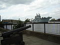
 Flickr - davehighbury - Naval Gun Woolwich London (20).jpg 3 147 × 2 103 ; 797 kio
-
 Flickr - davehighbury - River Thames Woolwich London 299.jpg 2 858 × 2 144 ; 690 kio
-
 Flickr - davehighbury - River Thames Woolwich London 301.jpg 4 576 × 1 248 ; 635 kio
-
 Flickr - davehighbury - River Thames Woolwich London 302.jpg 2 874 × 2 144 ; 938 kio
-
 Flickr - davehighbury - Thames Woolwich London 314.jpg 4 288 × 3 216 ; 1,21 Mio
-
 Flickr - davehighbury - Woolwich Gun shop London (19).jpg 2 853 × 1 939 ; 819 kio
-
 Flickr - Duncan~ - City Sunset.jpg 3 008 × 2 000 ; 728 kio
-
 Flickr - Duncan~ - Docklands from Woolwich.jpg 2 937 × 1 966 ; 639 kio
-
 Ford Dagenham.jpg 3 072 × 2 304 ; 2,99 Mio
-
 Ford Works, 1973 - geograph.org.uk - 133724.jpg 640 × 556 ; 59 kio
-
 Ford's of Dagenham - geograph.org.uk - 57611.jpg 640 × 444 ; 75 kio
-
 Frederick william scarborough Wapping Reach, London.jpg 1 024 × 700 ; 164 kio
-
 Freight ferry Aquiline at Dartford - geograph.org.uk - 1099113.jpg 640 × 457 ; 67 kio
-
 From rainham marshes 11-01-2009.jpg 3 072 × 2 304 ; 1,04 Mio
-
 Fuel Barge - geograph.org.uk - 1762678.jpg 3 440 × 2 280 ; 1,13 Mio
-
 Gantry Crane, Purfleet Thames Terminal - geograph.org.uk - 1593980.jpg 640 × 430 ; 53 kio
-
 Gasworks wharf - geograph.org.uk - 898950.jpg 640 × 426 ; 68 kio
-
 GLAM MB Porta Helicóptero Atlântico no Porto de Londres (28330481097).jpg 5 760 × 3 840 ; 6,52 Mio
-
 Gravesend banner Royal Terrace Pier.JPG 3 500 × 500 ; 420 kio
-
 Gravesend Reach - geograph.org.uk - 1390595.jpg 640 × 480 ; 66 kio
-
 Gravesend Reach - geograph.org.uk - 1390596.jpg 640 × 480 ; 39 kio
-
 Gravesend Reach - geograph.org.uk - 794695.jpg 640 × 480 ; 50 kio
-
 GravesendNewTavern3320.JPG 2 848 × 2 136 ; 1,48 Mio
-
 GravesendThames3332.JPG 2 848 × 2 136 ; 1,48 Mio
-
 GravesendThames3333.JPG 2 848 × 2 136 ; 1,54 Mio
-
 GravesendThames3336.JPG 2 848 × 2 136 ; 1,46 Mio
-
 GravesendThames3346.JPG 2 750 × 1 748 ; 404 kio
-
 GravesendThames3382.JPG 2 848 × 2 136 ; 1,45 Mio
-
 GravesendThames3389.JPG 2 848 × 2 136 ; 1,41 Mio
-
 GravesendThames3393.JPG 2 848 × 2 136 ; 1,53 Mio
-
 GravesendThames3395.JPG 2 848 × 2 136 ; 1,49 Mio
-
 GravesendThames3401.JPG 2 848 × 2 136 ; 1,48 Mio
-
 GravesendThames3403.JPG 2 848 × 2 136 ; 1,43 Mio
-
 GravesendThames3448.JPG 2 847 × 1 708 ; 422 kio
-
 Grays Thurrockmap 1946.jpg 1 568 × 1 408 ; 313 kio
-
 Grays Town Wharf.jpeg 640 × 430 ; 106 kio
-
 Greenhithe Slipway - geograph.org.uk - 896941.jpg 640 × 481 ; 59 kio
-
 Greenhithe, Johnson's Wharf conveyor (1) - geograph.org.uk - 719952.jpg 640 × 480 ; 59 kio
-
 Greenhithe, Johnson's Wharf conveyor (2) - geograph.org.uk - 719965.jpg 640 × 480 ; 83 kio
-
 GreenlandDockPier.jpg 500 × 375 ; 100 kio
-
 Greenpeace ship "Esperanza" off Gravesend.jpg 3 269 × 1 813 ; 799 kio
-
 Greenwich Peninsula 1973.jpg 735 × 488 ; 75 kio
-
 Greenwich Pier - geograph.org.uk - 1154404.jpg 640 × 426 ; 58 kio
-
 Greenwich Pier - geograph.org.uk - 477393.jpg 640 × 474 ; 94 kio
-
 Greenwich Pier - geograph.org.uk - 976040.jpg 640 × 480 ; 67 kio
-
 Greenwich Pier landing stage - geograph.org.uk - 1742984.jpg 3 504 × 2 336 ; 469 kio
-
 Greenwich power station from Royal Observatory.jpg 2 592 × 1 944 ; 1,13 Mio
-
 Greenwich power station jetty from the west - geograph.org.uk - 1164162.jpg 640 × 480 ; 174 kio
-
 Greenwich Reach - geograph.org.uk - 883797.jpg 640 × 457 ; 323 kio
-
 Greenwich Reach - geograph.org.uk - 883807.jpg 640 × 457 ; 293 kio
-
 Greenwich Reach - geograph.org.uk - 883809.jpg 640 × 457 ; 297 kio
-
 Greenwich Reach - geograph.org.uk - 883814.jpg 640 × 457 ; 298 kio
-
 Greenwich Reach - geograph.org.uk - 883821.jpg 640 × 457 ; 88 kio
-
 Greenwich Reach in 1959 - geograph.org.uk - 344786.jpg 640 × 400 ; 99 kio
-
 Greenwich Riverfront, 1973 - geograph.org.uk - 477402.jpg 640 × 501 ; 89 kio
-
 Greenwich Wharves - geograph.org.uk - 1152567.jpg 640 × 426 ; 50 kio
-
 Greenwich Yacht Club - geograph.org.uk - 26685.jpg 640 × 480 ; 22 kio
-
 Greenwichpowerstation.jpg 3 648 × 2 736 ; 2,29 Mio
-
 Gun Wharves, Wapping, luxury flats.jpg 2 080 × 1 544 ; 996 kio
-
 Halfway Reach - geograph.org.uk - 1278372.jpg 640 × 388 ; 53 kio
-
 Hanson Aggregates, North Greenwich (1) - geograph.org.uk - 1571705.jpg 640 × 480 ; 59 kio
-
 Hay's Wharf c1960 - geograph.org.uk - 64173.jpg 640 × 425 ; 167 kio
-
 High Bridge Wharf - geograph.org.uk - 881052.jpg 640 × 457 ; 261 kio
-
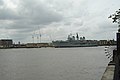
 HMS Ark Royal R07 Greenwich.jpg 2 048 × 1 536 ; 1,16 Mio
-
 HMS Illustrious at Deptford - geograph.org.uk - 1042083.jpg 640 × 480 ; 69 kio
-
 HMS Illustrious, Greenwich, May 2009.01.JPG 2 304 × 1 728 ; 1,48 Mio
-
 HMS Illustrious, Greenwich, May 2009.02.jpg 1 879 × 1 252 ; 180 kio
-
 HMS Illustrious, Greenwich, May 2009.04.JPG 2 304 × 1 728 ; 1,49 Mio
-
 HMS Illustrious, Greenwich, May 2009.05.JPG 2 304 × 1 728 ; 1,6 Mio
-
 HMS Illustrious, Greenwich, May 2009.06.JPG 2 304 × 1 728 ; 1,55 Mio
-
 HMS Illustrious, Greenwich, May 2009.07.JPG 2 304 × 1 728 ; 1,55 Mio
-
 HMS Illustrious, Greenwich, May 2009.08.JPG 2 304 × 1 728 ; 1,69 Mio
-
 HMS Ocean, moored in Greenwich at dusk.JPG 3 296 × 1 904 ; 1,13 Mio
-
 HMS Ocean, moored in Greenwich, London for the 2012 Olympic games.jpg 3 944 × 2 248 ; 945 kio
-
 HMSExeterSailingDownTheThamesInLondon.jpg 3 072 × 2 048 ; 3,03 Mio
-
 Hole Haven and British Falcon.jpg 2 521 × 1 656 ; 2,38 Mio
-

-
 Hoppers at Pier Wharf - geograph.org.uk - 773862.jpg 489 × 640 ; 72 kio
-
 Hoppers at Pier Wharf - geograph.org.uk - 773875.jpg 640 × 480 ; 66 kio
-
 In and Out - geograph.org.uk - 1207128.jpg 640 × 480 ; 43 kio
-

-
 Invicta Wharf - geograph.org.uk - 1145205.jpg 640 × 426 ; 51 kio
-
 Invicta Wharf - geograph.org.uk - 1154343.jpg 640 × 426 ; 63 kio
-
 James Arthur Messenger -poster.png 617 × 887 ; 125 kio
-
 Jetty on the north bank of the River thames - geograph.org.uk - 1594919.jpg 640 × 430 ; 101 kio
-
 Jetty, ESSO Oil Storage Depot, Purfleet - geograph.org.uk - 1594009.jpg 640 × 430 ; 40 kio
-
 Jetty, West Thurrock Electricity Sub Station - geograph.org.uk - 1594110.jpg 640 × 430 ; 114 kio
-
 Jetty, West Thurrock Electricity Sub Station - geograph.org.uk - 1594114.jpg 640 × 430 ; 113 kio
-
 KING EDWIN at Coryton oil terminal - geograph.org.uk - 1147211.jpg 640 × 427 ; 98 kio
-
 King Henry Storage and Warehousing Company.jpg 3 024 × 4 032 ; 1,96 Mio
-
 Landing stage, Greenwich Reach (2) - geograph.org.uk - 1503512.jpg 640 × 480 ; 46 kio
-
 Landing stage, Greenwich Reach (4) - geograph.org.uk - 1498328.jpg 640 × 480 ; 82 kio
-
 Landing stage, Greenwich Reach - geograph.org.uk - 1498318.jpg 640 × 480 ; 60 kio
-
 Landing stage, Greenwich Reach - geograph.org.uk - 1503504.jpg 640 × 480 ; 67 kio
-
 Landing stage, Palmer's Wharf (2) - geograph.org.uk - 1496507.jpg 640 × 480 ; 65 kio
-
 Landing stage, Palmer's Wharf - geograph.org.uk - 1492428.jpg 640 × 480 ; 51 kio
-
-
 Last riverside factories - geograph.org.uk - 216521.jpg 640 × 480 ; 34 kio
-
 Leach and Co, Pottersfield, Southwark. Mark Browns Wharf RMG PV5003.tiff 3 029 × 4 622 ; 40,05 Mio


_-_geograph.org.uk_-_1571816.jpg)
_-_geograph.org.uk_-_1571825.jpg)
_-_geograph.org.uk_-_1571829.jpg)


_-_geograph.org.uk_-_1494177.jpg)

_-_geograph.org.uk_-_1987565.jpg)


.jpg)


.jpg)


_-_geograph.org.uk_-_1571674.jpg)
_-_geograph.org.uk_-_1571678.jpg)


.jpg)


.jpg)


.jpg)


_-_geograph.org.uk_-_719952.jpg)
_-_geograph.org.uk_-_719965.jpg)


_-_geograph.org.uk_-_1571705.jpg)


_-_geograph.org.uk_-_1503512.jpg)
_-_geograph.org.uk_-_1498328.jpg)


_-_geograph.org.uk_-_1496507.jpg)


