Category:Porthallow, St Keverne
Jump to navigation
Jump to search
hamlet in St Keverne, Cornwall, England, UK  | |||||
| Upload media | |||||
| Instance of | |||||
|---|---|---|---|---|---|
| Location | St Keverne, Cornwall, South West England, England | ||||
 | |||||
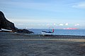
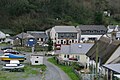
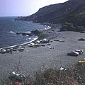
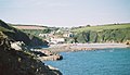
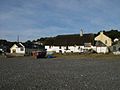
English: Porthallow is a small fishing village on the east coast of the The Lizard peninsula to the south of the Helford River, in Cornwall, England, United Kingdom. It sits between the two neighbouring villages of St Keverne and Roskorwell. One road runs through the village, and there is a post office and public house, the Five Pilchards, named for the pilchard fishery. The South West Coast Path passes through Porthallow which lies within the Cornwall Area of Outstanding Natural Beauty (AONB). Almost a third of Cornwall has AONB designation, with the same status and protection as a National Park.

Subcategories
This category has only the following subcategory.
F
Media in category "Porthallow, St Keverne"
The following 36 files are in this category, out of 36 total.
-
 Beach at Porthallow - geograph.org.uk - 1261529.jpg 640 × 425; 47 KB
-
 Boats on Porthallow beach (8474).jpg 4,288 × 2,848; 6.57 MB
-
 Coast to the north of Porthallow - geograph.org.uk - 2108921.jpg 1,024 × 768; 240 KB
-
 Cornish Sea Salt Company, Porthkerris Point - geograph.org.uk - 3210342.jpg 1,600 × 1,200; 501 KB
-
 Dilapidated farm building, Porthallow - geograph.org.uk - 2101468.jpg 1,024 × 768; 256 KB
-
 Fishing sheds, Porthallow - geograph.org.uk - 1826377.jpg 640 × 426; 104 KB
-
 Houses in Porthallow - geograph.org.uk - 1815308.jpg 1,024 × 682; 233 KB
-
 Porth pic.jpg 960 × 638; 132 KB
-
 Porthallow (8465).jpg 4,288 × 2,848; 6.69 MB
-
 Porthallow - geograph.org.uk - 227706.jpg 640 × 480; 108 KB
-
 Porthallow - geograph.org.uk - 2354385.jpg 640 × 491; 83 KB
-
 Porthallow beach (8475).jpg 4,288 × 2,848; 6.38 MB
-
 Porthallow Beach - geograph.org.uk - 1823797.jpg 3,456 × 2,304; 4.34 MB
-
 Porthallow Beach - geograph.org.uk - 1823817.jpg 3,456 × 2,304; 4.52 MB
-
 Porthallow Beach - geograph.org.uk - 1891643.jpg 1,024 × 682; 214 KB
-
 Porthallow beach - geograph.org.uk - 481214.jpg 640 × 638; 98 KB
-
-
 Porthallow Cove, Cornwall - geograph.org.uk - 5571345.jpg 1,600 × 1,052; 328 KB
-
 Porthallow Cove, Cornwall - geograph.org.uk - 5571351.jpg 1,600 × 1,049; 479 KB
-
 Porthallow road signs (8463).jpg 4,288 × 2,848; 6.45 MB
-
 Porthallow Rooftops - geograph.org.uk - 1815331.jpg 1,024 × 682; 176 KB
-
 Porthallow Village Hall - geograph.org.uk - 3210390.jpg 1,600 × 1,200; 414 KB
-
 Porthallow, Coastal view looking north - geograph.org.uk - 1823747.jpg 3,456 × 2,304; 4.71 MB
-
 Porthallow, Coastal view looking south - geograph.org.uk - 1823767.jpg 3,456 × 2,304; 4.58 MB
-
 Porthallow, General view to south - geograph.org.uk - 1823810.jpg 3,456 × 2,304; 4.67 MB
-
 Porthallow, Steps on the Coastal Path - geograph.org.uk - 1823787.jpg 3,456 × 2,304; 4.15 MB
-
 Porthkerris Dive center beach - panoramio.jpg 1,600 × 1,200; 519 KB
-

-
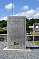
 South West Coast Path halfway marker (8464).jpg 2,848 × 4,288; 6.79 MB
-
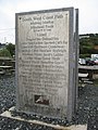
 South West Coast Path halfway marker.jpg 2,754 × 4,131; 4.87 MB
-
 Thatched cottage in Porthallow (8473).jpg 4,288 × 2,848; 6.81 MB
-
 The coast north of Porthallow - geograph.org.uk - 6135117.jpg 1,024 × 768; 296 KB
-
 The half way point... - geograph.org.uk - 2109111.jpg 768 × 1,024; 219 KB
-
 Unnamed road junction south of Porthallow Vineyard - geograph.org.uk - 3210854.jpg 3,648 × 2,048; 1.37 MB
-
 Coast near Porthallow, Cornwall - geograph.org.uk - 580944.jpg 640 × 502; 133 KB
-
 Porthallow from the beach - geograph.org.uk - 35175.jpg 640 × 480; 63 KB

.jpg)


.jpg)


.jpg)


.jpg)


.jpg)

.jpg)


