Category:Porthleven
Jump to navigation
Jump to search
town, civil parish and fishing port in Cornwall, England, UK  | |||||
| Upload media | |||||
| Instance of |
| ||||
|---|---|---|---|---|---|
| Location | Cornwall, South West England, England | ||||
| Population |
| ||||
 | |||||
Brezhoneg: Rummad:Kêrioù Breizh-Veur
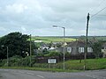
English: Porthleven is a town, civil parish and fishing port in Cornwall, United Kingdom, near Helston. It is the most southerly port on the island of Great Britain and was originally developed as a harbour of refuge, when this part of the Cornish coastline was recognised as a black spot for wrecks in days of sail. Nearby Loe Bar was particularly infamous, with swimmers and surfers being warned off the area to this day.
Subcategories
This category has the following 15 subcategories, out of 15 total.
B
- Bar Lodge, Porthleven (17 F)
H
- HMS Anson Memorial, Loe Bar (5 F)
L
- Loe Pool, Cornwall (39 F)
M
- Porthleven Methodist Church (2 F)
P
S
- The Ship Inn, Porthleven (13 F)
- Sithney Common (6 F)
T
- Tremearne Cliff, Cornwall (8 F)
W
Media in category "Porthleven"
The following 200 files are in this category, out of 441 total.
(previous page) (next page)-
 . . Shellfish shop. - panoramio.jpg 4,000 × 2,672; 5.79 MB
-
 19th C Fisherman's cabin - geograph.org.uk - 3214690.jpg 3,648 × 2,048; 956 KB
-
 2. 1880 Thomas Bowden born 1853 working on a half model.jpg 1,742 × 1,206; 418 KB
-
 A gentle section of the coast path - geograph.org.uk - 5444855.jpg 1,024 × 768; 270 KB
-
 A short terrace of new houses, Highburrow - geograph.org.uk - 4882158.jpg 1,600 × 1,200; 350 KB
-
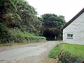
 A394 at Porthleven junction - geograph.org.uk - 4041573.jpg 640 × 427; 53 KB
-
 A394 bridge over River Leven, inland from Porthleven - geograph.org.uk - 4882056.jpg 1,600 × 1,201; 238 KB
-
 Ahead is Shute Lane - geograph.org.uk - 3039273.jpg 1,024 × 768; 205 KB
-
 Along the beach Porthleven - geograph.org.uk - 2792877.jpg 4,000 × 3,000; 3.55 MB
-
 Approaching crossroads near Sithney - geograph.org.uk - 4041577.jpg 640 × 482; 44 KB
-
 Arable fields north of Porthleven - geograph.org.uk - 3683546.jpg 800 × 450; 215 KB
-
 B3304 descends Penrose Hill - geograph.org.uk - 3206888.jpg 2,743 × 1,975; 746 KB
-
 B3304 enters Porthleven - geograph.org.uk - 3206891.jpg 3,648 × 2,048; 1.06 MB
-
 B3304 north of Higher Lanner - geograph.org.uk - 3206884.jpg 3,648 × 2,048; 1.06 MB
-
 Bath house, Penrose Estate - geograph.org.uk - 6137300.jpg 1,024 × 680; 268 KB
-
 Bay View Terrace - geograph.org.uk - 2671312.jpg 425 × 640; 73 KB
-
 BayView.jpg 3,905 × 2,603; 4.83 MB
-
 Beach at Porthleven - geograph.org.uk - 2096402.jpg 1,024 × 768; 140 KB
-
 Beach below Vellin-glûz Rocks - geograph.org.uk - 4071688.jpg 3,753 × 2,502; 2.7 MB
-
 Beach, Porthleven - geograph.org.uk - 6343763.jpg 2,000 × 983; 1.88 MB
-
 Bench mark on cottage - geograph.org.uk - 4398257.jpg 640 × 480; 108 KB
-
 Bench overlooking The Loe - geograph.org.uk - 4069590.jpg 3,872 × 2,592; 6.33 MB
-
 Bend in B3304 south-west of Helston - geograph.org.uk - 4882695.jpg 1,282 × 1,600; 561 KB
-
 Bickford-Smith Institute, Porthleven (9591166929).jpg 2,564 × 3,866; 7.52 MB
-
 Bird hide overlooking The Loe - geograph.org.uk - 4069405.jpg 3,872 × 2,592; 6.3 MB
-
 Bluebells at Penrose - geograph.org.uk - 6136441.jpg 1,024 × 680; 268 KB
-
 Bluebells in flower on Penrose Estate - geograph.org.uk - 6136432.jpg 1,024 × 680; 266 KB
-
 Bluebells on the Penrose Estate - geograph.org.uk - 6136365.jpg 1,024 × 680; 285 KB
-
 Boat off Porthleven (7829).jpg 4,288 × 2,848; 4.99 MB
-
 Bodyboarders at Porthleven Cornwall - geograph.org.uk - 3330075.jpg 2,551 × 1,377; 1.21 MB
-
 Boggy land in Loe Valley - geograph.org.uk - 4069382.jpg 3,872 × 2,592; 6.47 MB
-
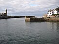
 Breakwater - Porthleven harbour - geograph.org.uk - 5409070.jpg 640 × 480; 74 KB
-
 Breakwater at Porthleven - geograph.org.uk - 6498552.jpg 1,799 × 1,199; 328 KB
-
 Breakwater, Porthleven (4943065852).jpg 1,306 × 1,963; 1.89 MB
-
 Bridge at Penrose - geograph.org.uk - 4912776.jpg 1,600 × 1,064; 522 KB
-
 Buildings north of Porthleven harbour (7816).jpg 4,288 × 2,848; 6.05 MB
-
 Buildings on Parc-an-als Cliff (7834).jpg 4,288 × 2,848; 6.34 MB
-
 Bullion Cliff - geograph.org.uk - 4715401.jpg 1,044 × 782; 388 KB
-
 Bus shelter and stop, Wellington Road, Porthleven - geograph.org.uk - 4882091.jpg 1,600 × 1,198; 456 KB
-
 Bus stop near the edge of Porthleven - geograph.org.uk - 4220040.jpg 3,872 × 2,592; 5.24 MB
-
 Cannon and Ship Inn, Porthleven Harbour - geograph.org.uk - 498345.jpg 640 × 426; 133 KB
-
 Cannon in Porthleven harbour (7821).jpg 4,288 × 2,848; 6.4 MB
-
 Cannon In Porthleven Harbour - geograph.org.uk - 3039167.jpg 1,024 × 768; 283 KB
-
 Cannon on the harbour at Porthleven - geograph.org.uk - 3232792.jpg 2,272 × 1,704; 915 KB
-
 Cannon, Porthleven (9538509913).jpg 3,127 × 2,234; 4.8 MB
-
 Carminowe Creek - geograph.org.uk - 1826538.jpg 640 × 426; 44 KB
-
 China Clay Store - geograph.org.uk - 3206909.jpg 3,072 × 2,048; 1.58 MB
-
 Clifftop near Loe Bar (4284896939).jpg 2,445 × 1,630; 4.03 MB
-
 Closed Path - geograph.org.uk - 6021320.jpg 640 × 427; 176 KB
-
 Coast at Highburrow (Parc-an-als Cliff) - geograph.org.uk - 4882150.jpg 1,600 × 1,200; 397 KB
-
 Coast path above Pargodonnel Rocks - geograph.org.uk - 4716850.jpg 1,112 × 832; 385 KB
-
 Coast path and Tregear Point - geograph.org.uk - 4716847.jpg 1,142 × 857; 428 KB
-
 Coast path near Porthleven - geograph.org.uk - 2107370.jpg 1,024 × 768; 275 KB
-
 Coastal path above Parc Trammel Cove - geograph.org.uk - 4716842.jpg 857 × 1,142; 394 KB
-
 Coastal path on Bullion Cliff - geograph.org.uk - 4219254.jpg 3,872 × 2,592; 4.59 MB
-
 Coastline at Tremearne (9503430921).jpg 4,000 × 3,000; 7.3 MB
-
 Coastline near Porthleven (3486018263).jpg 2,498 × 1,648; 2.92 MB
-
 Coastline towards Tregear Point - geograph.org.uk - 3206912.jpg 3,072 × 2,048; 1.34 MB
-
 Construction site on Loe Bar - geograph.org.uk - 6137244.jpg 1,024 × 680; 192 KB
-
 Corner cottage - geograph.org.uk - 3683559.jpg 800 × 450; 208 KB
-
 Cornish lane - geograph.org.uk - 3683552.jpg 800 × 450; 307 KB
-
 Cornish pilot gig - geograph.org.uk - 6161869.jpg 1,600 × 1,200; 682 KB
-
 Cornwall , The A394 - geograph.org.uk - 4608237.jpg 4,288 × 2,848; 5.16 MB
-
 Cottages at Highburrow - geograph.org.uk - 2781219.jpg 640 × 427; 186 KB
-
 Cyclists on Loe Bar - geograph.org.uk - 2565967.jpg 640 × 427; 190 KB
-
 Daffodil Field - geograph.org.uk - 124042.jpg 640 × 427; 162 KB
-
 Dark and light - geograph.org.uk - 6162543.jpg 2,048 × 1,536; 786 KB
-
 Drainage works on Loe Bar - geograph.org.uk - 6343740.jpg 2,000 × 763; 1.36 MB
-
 Drive on Penrose Estate - geograph.org.uk - 6137284.jpg 1,024 × 680; 261 KB
-
 Drive through Penrose estate - geograph.org.uk - 6136353.jpg 1,024 × 680; 201 KB
-
 Dropping into Porthleven - geograph.org.uk - 4716853.jpg 1,142 × 857; 403 KB
-
 DSC 6716-HDR-Edit-1.jpg 3,951 × 5,926; 12.39 MB
-
 Early evening in Porthleven - geograph.org.uk - 2110674.jpg 640 × 480; 63 KB
-
 Entering Porthleven - geograph.org.uk - 2781215.jpg 640 × 395; 209 KB
-
 Entering Porthleven - geograph.org.uk - 2781230.jpg 640 × 427; 148 KB
-
 Entrance drive to Penrose Estate - geograph.org.uk - 4882684.jpg 1,200 × 1,600; 572 KB
-
 Entrance to Gala Parc, home of Portheleven Football Club - geograph.org.uk - 2381441.jpg 1,600 × 1,200; 319 KB
-
-
 Entrance to Porthleven Harbour - geograph.org.uk - 5444829.jpg 1,024 × 768; 165 KB
-

-
 Farm track on Penrose Estate - geograph.org.uk - 4882285.jpg 1,600 × 1,200; 534 KB
-
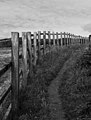 Fence on the coastal footpath (9541314532).jpg 2,954 × 3,899; 6.35 MB
-
 Field with a view towards housing estates, Porthleven - geograph.org.uk - 4882127.jpg 1,600 × 1,200; 469 KB
-
 Fishermen's memorial - geograph.org.uk - 4219392.jpg 3,872 × 2,592; 4.06 MB
-
 Fishing vessel - Porthleven harbour - geograph.org.uk - 5427445.jpg 640 × 480; 83 KB
-
 Footpath approaching Loe Bar - geograph.org.uk - 4071813.jpg 3,872 × 2,592; 5.01 MB
-
 Footpath from Gypsy Lane - geograph.org.uk - 3683568.jpg 800 × 450; 234 KB
-
 Footpath in Bar Walk Plantation - geograph.org.uk - 4882252.jpg 1,200 × 1,600; 635 KB
-
 Footpath on northern side of Loe Pool - geograph.org.uk - 4882240.jpg 1,600 × 1,200; 362 KB
-
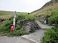 Footpath to National Trust Penrose - geograph.org.uk - 5451443.jpg 640 × 480; 91 KB
-
 Fore Street, Porthleven - geograph.org.uk - 4882085.jpg 1,600 × 1,200; 308 KB
-
 Full range of hazards, Loe Bar - geograph.org.uk - 4904836.jpg 1,600 × 1,064; 427 KB
-
 Gala Parc, home of Portheleven Football Club - geograph.org.uk - 2381438.jpg 1,600 × 1,200; 601 KB
-
 Gala Parc, home of Porthleven Football Club - geograph.org.uk - 2381440.jpg 1,600 × 1,200; 486 KB
-
 Gateway to the Penrose estate - geograph.org.uk - 4882115.jpg 1,600 × 1,200; 516 KB
-
 GrandadsNetLoft.jpg 4,708 × 3,139; 6.54 MB
-
 Guy Penrose Gibson VC - Porthleven - geograph.org.uk - 5699561.jpg 1,024 × 768; 346 KB
-
 Harbour Inn Porthleven Cornwall - geograph.org.uk - 2792865.jpg 4,000 × 3,000; 2.55 MB
-
 Harbour Inn, Porthleven - geograph.org.uk - 992764.jpg 640 × 427; 100 KB
-
 Harbour mouth Porthleven - geograph.org.uk - 5427436.jpg 640 × 480; 76 KB
-
 Harbour pier, Porthleven - geograph.org.uk - 6343769.jpg 2,000 × 1,012; 1.79 MB
-
 Harbour Road, Porthleven - geograph.org.uk - 6478248.jpg 1,280 × 841; 628 KB
-
 Hazlephron Cliff from Porthleven (7826).jpg 4,288 × 2,848; 5.26 MB
-
 Helston Lodge - geograph.org.uk - 4904757.jpg 1,600 × 1,064; 533 KB
-
 Helston Lodge - geograph.org.uk - 6136459.jpg 1,024 × 680; 251 KB
-
 High seas at Porthleven pier - geograph.org.uk - 2275365.jpg 1,024 × 670; 110 KB
-
 Hightown and Sky - geograph.org.uk - 3039280.jpg 1,024 × 768; 146 KB
-
 Horse riders on the Penrose Estate - geograph.org.uk - 5434592.jpg 1,024 × 768; 767 KB
-
 Horseshoe Playing Field - geograph.org.uk - 4220742.jpg 3,872 × 2,592; 4.42 MB
-
 House and bungalow in Gibson Way, Porthleven - geograph.org.uk - 4882097.jpg 1,600 × 1,200; 299 KB
-
 House, valley and bridge, Penrose - geograph.org.uk - 4912783.jpg 1,600 × 1,064; 462 KB
-
 Houses and bungalows in Highburrow - geograph.org.uk - 4882155.jpg 1,600 × 1,200; 336 KB
-
 Houses overlooking the Harbour - geograph.org.uk - 3039223.jpg 1,024 × 768; 120 KB
-

-
 Inner harbour at Porthleven, Cornwall - geograph.org.uk - 4988729.jpg 1,500 × 1,125; 750 KB
-

-
 Inner Harbour, Porthleven - geograph.org.uk - 6343779.jpg 2,000 × 921; 1.76 MB
-
 Leaving Penrose Hill car park - geograph.org.uk - 4748741.jpg 4,896 × 3,672; 6.85 MB
-
 Lime kiln (4942488935).jpg 2,312 × 1,455; 2.86 MB
-
 Limited space for a run - geograph.org.uk - 4719567.jpg 1,142 × 857; 388 KB
-
 Little Trigg Rocks, Porthleven - geograph.org.uk - 5186080.jpg 1,600 × 1,200; 353 KB
-
 Looking down Cliff Rd - geograph.org.uk - 1895321.jpg 640 × 480; 74 KB
-
 Looking towards Porthleven - geograph.org.uk - 6021328.jpg 640 × 427; 148 KB
-
 Looking towards Portleven - geograph.org.uk - 3038032.jpg 1,024 × 768; 276 KB
-
 Mackerel Loft, Porthleven - geograph.org.uk - 5443043.jpg 1,024 × 768; 554 KB
-
 Megiliggar Rocks - geograph.org.uk - 3736514.jpg 640 × 424; 89 KB
-
 Memorial at Porthleven - geograph.org.uk - 2781262.jpg 640 × 436; 189 KB
-
 Methleigh Bottoms - geograph.org.uk - 3039252.jpg 1,024 × 768; 238 KB
-
 Methleigh Bottoms - geograph.org.uk - 3039261.jpg 1,024 × 768; 217 KB
-
 Mill Lane, Porthleven - geograph.org.uk - 4882074.jpg 1,600 × 1,065; 413 KB
-
 Mine shaft on Vellin-gluz Rocks - geograph.org.uk - 4882212.jpg 1,600 × 1,200; 448 KB
-

-
 Mud, daffodils and a stone guide post - geograph.org.uk - 4882722.jpg 1,600 × 1,200; 289 KB
-
 New housing development on the edge of Porthleven - geograph.org.uk - 4220330.jpg 3,872 × 2,592; 3.31 MB
-
 New roof for Kota - geograph.org.uk - 2781281.jpg 640 × 427; 219 KB
-
 No parking - geograph.org.uk - 2781251.jpg 640 × 427; 206 KB
-

-

-
 Old Pillbox - geograph.org.uk - 4780161.jpg 640 × 480; 56 KB
-
 Old Smoke house Porthleven - geograph.org.uk - 2792859.jpg 4,000 × 3,000; 2.53 MB
-
 On the edge of Porthleven - geograph.org.uk - 5444865.jpg 1,024 × 768; 228 KB
-
 Ordnance Survey Cut Mark - geograph.org.uk - 5293883.jpg 640 × 407; 88 KB
-
 Ordnance Survey Cut Mark - geograph.org.uk - 5293885.jpg 640 × 344; 104 KB
-
 Ordnance Survey Flush Bracket (S1476) - geograph.org.uk - 5293884.jpg 612 × 640; 172 KB
-
 Ordnance Survey flush bracket - geograph.org.uk - 3861183.jpg 1,632 × 1,224; 409 KB
-
 Ordnance Survey Flush Bracket S1476 - geograph.org.uk - 5428428.jpg 4,000 × 3,000; 3.74 MB
-
-
 OS Flush Bracket - Porthleven - geograph.org.uk - 4716860.jpg 782 × 1,044; 493 KB
-
 OS rivet - Porthleven harbour wall - geograph.org.uk - 4719467.jpg 734 × 979; 497 KB
-
 Outskirts of Porthleven Village Sign - geograph.org.uk - 5020507.jpg 640 × 480; 61 KB
-
 Parallel Patterns - geograph.org.uk - 6021334.jpg 640 × 199; 92 KB
-
 Parc-an-als car park and road to Highburrow - geograph.org.uk - 4882182.jpg 1,600 × 1,200; 346 KB
-
 Parc-an-als car park, Highburrow - geograph.org.uk - 4882180.jpg 1,600 × 1,200; 380 KB
-
 Parc-an-als-Cliff, Porthleven - geograph.org.uk - 5185247.jpg 1,600 × 1,200; 361 KB
-
 Parkland at Penrose - geograph.org.uk - 4748750.jpg 4,896 × 3,672; 6.9 MB
-
 Part of Loe Marsh - geograph.org.uk - 2110645.jpg 640 × 480; 144 KB
-
 Path alongside The Loe - geograph.org.uk - 4748755.jpg 1,600 × 1,200; 793 KB
-
 Path at Penrose - geograph.org.uk - 4748752.jpg 1,600 × 1,200; 656 KB
-
 Path past Oak Grove - geograph.org.uk - 4069358.jpg 3,872 × 2,592; 5.51 MB
-
 Path, Porthleven (4973899678).jpg 1,530 × 2,354; 4.26 MB
-
 Pebble sculpture, Loe Bar (4285985274).jpg 1,591 × 2,387; 3.88 MB
-
 Pednagwinian from Porthleven (7830).jpg 4,288 × 2,848; 4.9 MB
-
 Penrose estate valley, from Shadywalk Wood - geograph.org.uk - 4882291.jpg 1,600 × 1,200; 399 KB
-
 Penrose House - geograph.org.uk - 6136337.jpg 1,024 × 680; 237 KB
-
 Penrose House - geograph.org.uk - 6136345.jpg 1,024 × 680; 223 KB
-
 Peregrines on Parc-an-als Cliff (7837).jpg 4,288 × 2,848; 6.45 MB
-
 Peregrines on Parc-an-als Cliff (7838).jpg 4,288 × 2,848; 6.35 MB
-
 Peregrines on Parc-an-als Cliff (7839).jpg 4,288 × 2,848; 5.99 MB
-
 Peregrines on Parc-an-als Cliff (7842).jpg 4,288 × 2,848; 6.31 MB
-
 Pier and harbour wall, Porthleven - geograph.org.uk - 5444834.jpg 768 × 1,024; 272 KB
-
 Pillbox near Porthleven Sands - geograph.org.uk - 2111760.jpg 1,024 × 768; 174 KB
-
 Pillbox overlooking Porthleven Sands - geograph.org.uk - 4882225.jpg 1,600 × 1,200; 358 KB
-
 Pinkerton Headstone Porthleven.jpg 2,026 × 3,025; 3.1 MB
-
 Porth Sulinces, near Porthleven - geograph.org.uk - 523333.jpg 640 × 480; 110 KB
-
 Porth Sulinces, Porthleven (2805996661).jpg 2,560 × 1,712; 3.46 MB
-
 Porthleven (2403151593).jpg 2,246 × 1,358; 1.72 MB
-
 Porthleven (4885280717).jpg 2,547 × 1,698; 3.66 MB
-
 Porthleven (4943079348).jpg 2,278 × 1,519; 2.9 MB
-
 Porthleven (4949536466).jpg 2,452 × 1,920; 3.99 MB
-
 Porthleven (9620232627).jpg 3,000 × 4,000; 6.9 MB
-
 Porthleven , Bay View - geograph.org.uk - 6350478.jpg 6,000 × 4,000; 3.78 MB
-
 Porthleven , Breakwater - geograph.org.uk - 6350477.jpg 6,000 × 4,000; 4.96 MB
-
 Porthleven , Car Park - geograph.org.uk - 6349757.jpg 6,000 × 4,000; 3.63 MB
-
 Porthleven , Cliff Road - geograph.org.uk - 6350475.jpg 4,000 × 6,000; 3.55 MB
-
 Porthleven , Coastal Scenery - geograph.org.uk - 6349731.jpg 6,000 × 4,000; 4.18 MB
-
 Porthleven , Coastal Scenery - geograph.org.uk - 6349743.jpg 6,000 × 4,000; 4.85 MB
-
 Porthleven , Coastal Scenery - geograph.org.uk - 6349744.jpg 6,000 × 4,000; 4.6 MB
-
 Porthleven , Coastal Scenery - geograph.org.uk - 6349753.jpg 6,000 × 4,000; 4.25 MB
-
 Porthleven , Coastal Scenery - geograph.org.uk - 6349767.jpg 6,000 × 4,000; 3.93 MB
-
 Porthleven , Coastal Scenery - geograph.org.uk - 6349780.jpg 6,000 × 4,000; 5.14 MB
-
 Porthleven , Coastal Scenery - geograph.org.uk - 6350470.jpg 6,000 × 4,000; 4.45 MB
-
 Porthleven , Coastal Scenery - geograph.org.uk - 6350471.jpg 6,000 × 4,000; 3.58 MB
-
 Porthleven , Coastal Scenery - geograph.org.uk - 6350480.jpg 6,000 × 4,000; 5.24 MB
-
 Porthleven , Harbour - geograph.org.uk - 6350488.jpg 6,000 × 4,000; 5.23 MB
-
 Porthleven , Harbour - geograph.org.uk - 6352402.jpg 6,000 × 4,000; 4.8 MB
-
 Porthleven , Harbour - geograph.org.uk - 6352406.jpg 6,000 × 4,000; 6.52 MB
-
 Porthleven , Harbour Road - geograph.org.uk - 6350483.jpg 6,000 × 4,000; 3.95 MB
-
 Porthleven , Harbour Road - geograph.org.uk - 6350484.jpg 6,000 × 4,000; 4.12 MB
-
 Porthleven , Harbour Road - geograph.org.uk - 6352404.jpg 6,000 × 4,000; 4.82 MB
-
 Porthleven , Harbour Road - geograph.org.uk - 6352407.jpg 6,000 × 4,000; 5.23 MB


.jpg)


.jpg)


.jpg)

.jpg)
.jpg)


.jpg)


.jpg)


.jpg)

_-_geograph.org.uk_-_4882150.jpg)


.jpg)
.jpg)


.jpg)


.jpg)


.jpg)


_-_geograph.org.uk_-_5293884.jpg)


.jpg)
.jpg)
.jpg)


.jpg)
.jpg)
.jpg)
.jpg)


.jpg)
.jpg)
.jpg)
.jpg)
.jpg)
.jpg)


