Category:Potter Heigham
Jump to navigation
Jump to search
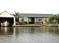
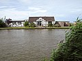
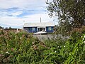
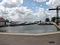
English: Potter Heigham is a village and civil parish on the River Thurne in the English county of Norfolk. It is situated some north-east of the city of Norwich on the A149 road, and on The Broads.
village and civil parish in Norfolk, England, UK  | |||||
| Upload media | |||||
| Instance of | |||||
|---|---|---|---|---|---|
| Location | North Norfolk, Norfolk, East of England, England | ||||
| Population |
| ||||
| Area |
| ||||
 | |||||
Subcategories
This category has the following 14 subcategories, out of 14 total.
B
C
- Cafés in Potter Heigham (1 F)
H
P
- Potter Heigham new bridge (2 F)
- Potter Heigham Old Bridge (32 F)
- Potter Heigham Village Sign (6 F)
- Potter Heigham War Memorial (1 F)
R
S
- Shops in Potter Heigham (3 F)
T
- River Thurne at Potter Heigham (19 F)
Media in category "Potter Heigham"
The following 200 files are in this category, out of 414 total.
(previous page) (next page)-
 'Bridge Convenience Stores', Bostwick - geograph.org.uk - 2944467.jpg 1,600 × 1,083; 321 KB
-
 1930s bungalow beside the River Thurne - geograph.org.uk - 4618475.jpg 640 × 480; 184 KB
-
 1930s bungalow beside the River Thurne - geograph.org.uk - 4618476.jpg 640 × 480; 342 KB
-
 1930s bungalow beside the River Thurne - geograph.org.uk - 4618478.jpg 640 × 480; 316 KB
-
 1930s bungalow beside the River Thurne - geograph.org.uk - 4621782.jpg 640 × 477; 210 KB
-
 1930s bungalow beside the River Thurne - geograph.org.uk - 4621783.jpg 640 × 611; 452 KB
-
 1930s bungalow beside the River Thurne - geograph.org.uk - 4621785.jpg 640 × 545; 433 KB
-
 1930s bungalow beside the River Thurne - geograph.org.uk - 4621787.jpg 640 × 463; 348 KB
-
 A 18th century barn - geograph.org.uk - 4611659.jpg 640 × 480; 475 KB
-
 A 19th century barn (interior) - geograph.org.uk - 4611663.jpg 640 × 487; 433 KB
-
 A 19th century barn (interior) - geograph.org.uk - 4611668.jpg 640 × 577; 515 KB
-
 A 19th century barn (interior) - geograph.org.uk - 4611669.jpg 509 × 640; 453 KB
-
 A bend in Candle Dyke - geograph.org.uk - 4603338.jpg 625 × 640; 448 KB
-
 A boat yard on the River Thurne - geograph.org.uk - 2681846.jpg 800 × 600; 220 KB
-
 A little-used field gate - geograph.org.uk - 4544099.jpg 1,024 × 768; 379 KB
-
 A small motor boat emerges at Potter Heigham - geograph.org.uk - 3660341.jpg 3,249 × 2,137; 903 KB
-
 A149 towards Great Yarmouth - geograph.org.uk - 5875447.jpg 1,024 × 684; 202 KB
-
 A149 towards Great Yarmouth - geograph.org.uk - 5875459.jpg 1,024 × 684; 231 KB
-
 A149 towards Great Yarmouth - geograph.org.uk - 5876060.jpg 1,024 × 684; 218 KB
-
 Access denied - geograph.org.uk - 3648061.jpg 800 × 451; 207 KB
-
 Air quality measuring station at Heigham Holmes - geograph.org.uk - 4596449.jpg 3,456 × 2,592; 3.95 MB
-
 Anglian Water pumping station at Potter Heigham - geograph.org.uk - 4543788.jpg 1,024 × 768; 428 KB
-
 Approaching the Sound Plantation - geograph.org.uk - 3648053.jpg 800 × 451; 203 KB
-
 Asphalted track on Heigham Holmes - geograph.org.uk - 4595986.jpg 640 × 360; 274 KB
-
 Baled hay by Glebe Farm - geograph.org.uk - 4603189.jpg 640 × 568; 464 KB
-
 Baled hay north of the River Thurne - geograph.org.uk - 4603214.jpg 640 × 480; 451 KB
-
 Bales of marsh hay - geograph.org.uk - 4603176.jpg 640 × 360; 309 KB
-
 Barley crop field beside Long Lane - geograph.org.uk - 4068325.jpg 640 × 480; 157 KB
-
 Bastwick - panoramio (1).jpg 2,048 × 1,360; 1.4 MB
-

-
 Boat at the quay - geograph.org.uk - 3008206.jpg 2,272 × 1,704; 2.39 MB
-

-
 Boat on the Thurne - geograph.org.uk - 3648027.jpg 800 × 451; 209 KB
-

-
 Boat shed on the River Thurne - geograph.org.uk - 4621677.jpg 640 × 590; 455 KB
-
 Boat Yard ^ River Thurne at Potter Heigham - geograph.org.uk - 3286159.jpg 1,024 × 768; 107 KB
-
 Boathouse by the Thurne - geograph.org.uk - 3648043.jpg 800 × 451; 200 KB
-
 Boats moored on the River Thurne - geograph.org.uk - 5413117.jpg 640 × 480; 52 KB
-
 Boats on Candle Dyke - geograph.org.uk - 4603317.jpg 640 × 557; 346 KB
-
 Bridge Road and entrance to Lathams, Potter Heigham - geograph.org.uk - 2899716.jpg 3,264 × 2,448; 1.75 MB
-
 Bridge Road, Potter Heigham - geograph.org.uk - 5876052.jpg 1,024 × 684; 198 KB
-
 Bridleway along Piccamore Loke, Potter Heigham - geograph.org.uk - 4544086.jpg 1,024 × 768; 402 KB
-
 Bridleway to Marsh Road, Potter Heigham - geograph.org.uk - 4603184.jpg 640 × 480; 404 KB
-
 Broadland House - geograph.org.uk - 806284.jpg 640 × 462; 195 KB
-

-
-

-

-

-
 Bungalow beside the River Thurne - geograph.org.uk - 4618287.jpg 640 × 480; 360 KB
-
 Bungalow beside the River Thurne - geograph.org.uk - 4618302.jpg 640 × 480; 451 KB
-
 Bungalow beside the River Thurne - geograph.org.uk - 4618336.jpg 640 × 507; 390 KB
-
 Bungalow beside the River Thurne - geograph.org.uk - 4618338.jpg 640 × 482; 312 KB
-
 Bungalow beside the River Thurne - geograph.org.uk - 4618366.jpg 640 × 480; 390 KB
-
 Bungalow beside the River Thurne - geograph.org.uk - 4618454.jpg 640 × 480; 445 KB
-
 Bungalow beside the River Thurne - geograph.org.uk - 4618489.jpg 640 × 480; 329 KB
-
 Bungalow beside the River Thurne - geograph.org.uk - 4621609.jpg 640 × 480; 406 KB
-
 Bungalow beside the River Thurne - geograph.org.uk - 4621642.jpg 640 × 522; 392 KB
-
 Bungalow beside the River Thurne - geograph.org.uk - 4621673.jpg 640 × 532; 475 KB
-
 Bungalow beside the River Thurne - geograph.org.uk - 4621675.jpg 640 × 622; 561 KB
-
 Bungalow beside the River Thurne - geograph.org.uk - 4621689.jpg 640 × 471; 328 KB
-
 Bungalow beside the River Thurne - geograph.org.uk - 4621693.jpg 640 × 516; 339 KB
-
 Bungalow beside the River Thurne - geograph.org.uk - 4621857.jpg 640 × 480; 383 KB
-
 Bungalows alongside the River Thurne - geograph.org.uk - 4603081.jpg 640 × 480; 465 KB
-

-
 Bungalows beside the River Thurne - geograph.org.uk - 4618306.jpg 640 × 480; 310 KB
-
 Calving shed - geograph.org.uk - 4596070.jpg 640 × 480; 375 KB
-
 Campsite at Repps - geograph.org.uk - 359678.jpg 640 × 480; 108 KB
-
 Car driving along footpath - geograph.org.uk - 4603104.jpg 640 × 480; 372 KB
-
 Car park and boatyard, Potter Heigham - geograph.org.uk - 3648013.jpg 800 × 450; 184 KB
-
 Caspian Tern (47176089182).jpg 1,806 × 1,355; 579 KB
-
 Caspian Tern (47176090302).jpg 1,806 × 1,354; 446 KB
-
 Cattle feeder in pasture - geograph.org.uk - 4596059.jpg 640 × 480; 380 KB
-
 Cattle grazing on Heigham Holmes - geograph.org.uk - 4596093.jpg 640 × 480; 277 KB
-
 Cattle grazing on Heigham Holmes - geograph.org.uk - 4596096.jpg 640 × 480; 259 KB
-
 Cattle on Heigham Holmes - geograph.org.uk - 4596003.jpg 640 × 629; 376 KB
-
 Cattle pasture on Heigham Holmes - geograph.org.uk - 4596063.jpg 640 × 559; 432 KB
-

-
 Chalet beside the River Thurne - geograph.org.uk - 4621778.jpg 640 × 480; 347 KB
-
 Church Lane, Potter Heigham - geograph.org.uk - 4544078.jpg 1,024 × 768; 368 KB
-
 Coin in the slot machine - geograph.org.uk - 2279940.jpg 320 × 480; 25 KB
-

-
 Common poppy (Papaver rhoeas) - geograph.org.uk - 4068396.jpg 640 × 600; 261 KB
-
 Concreted track leading past a farm shed - geograph.org.uk - 4596068.jpg 640 × 480; 369 KB
-
 Corner of Church Lane - geograph.org.uk - 3008217.jpg 2,272 × 1,704; 2.29 MB
-
 Corrugated iron shed - geograph.org.uk - 3008189.jpg 2,272 × 1,704; 1.98 MB
-
 Cottages in Church Road - geograph.org.uk - 3648075.jpg 800 × 450; 212 KB
-
 Cottages on Marsh Road - geograph.org.uk - 3648071.jpg 800 × 451; 211 KB
-

-

-
 Dairy cows grazing on Heigham Holmes - geograph.org.uk - 4595993.jpg 640 × 360; 296 KB
-
 Dairy cows grazing on Heigham Holmes - geograph.org.uk - 4596023.jpg 640 × 567; 448 KB
-

-
 Dead and dying oaks - geograph.org.uk - 3648055.jpg 800 × 451; 192 KB
-
 Drain near Potter Heigham - geograph.org.uk - 882711.jpg 640 × 480; 110 KB
-
 Drainage ditch by High's windpump - geograph.org.uk - 4603165.jpg 640 × 360; 318 KB
-
 Drainage ditch in marsh pastures - geograph.org.uk - 4603084.jpg 640 × 360; 370 KB
-

-

-
 Drainage ditch on Heigham Holmes - geograph.org.uk - 4596017.jpg 640 × 480; 458 KB
-
 Entering Coll's Plantation - geograph.org.uk - 3648063.jpg 800 × 451; 203 KB
-
 Falgate Inn at Potter Heigham - geograph.org.uk - 5330017.jpg 3,456 × 2,592; 3.69 MB
-
 Farm building on Heigham Holmes (detail) - geograph.org.uk - 4611692.jpg 640 × 532; 280 KB
-

-

-

-

-

-
 Farm building on Higham Holmes (detail) - geograph.org.uk - 4596956.jpg 640 × 480; 420 KB
-
 Farm building on Higham Holmes - geograph.org.uk - 4596075.jpg 640 × 480; 326 KB
-
 Farm buildings on Heigham Holmes - geograph.org.uk - 4596052.jpg 640 × 545; 377 KB
-
 Farm buildings on Heigham Holmes - geograph.org.uk - 4596069.jpg 640 × 480; 387 KB
-
 Farm buildings on Higham Holmes - geograph.org.uk - 4595442.jpg 640 × 480; 326 KB
-
 Farm road on Heigham Holmes - geograph.org.uk - 4595976.jpg 640 × 408; 296 KB
-
 Farm road on Heigham Holmes - geograph.org.uk - 4596028.jpg 640 × 395; 316 KB
-
 Farm road on Heigham Holmes - geograph.org.uk - 4596045.jpg 640 × 480; 398 KB
-
 Farm road on Heigham Holmes - geograph.org.uk - 4596055.jpg 640 × 480; 342 KB
-
 Farm track on Heigham Holmes - geograph.org.uk - 4596090.jpg 640 × 480; 362 KB
-
 Footbridge at Herbert Woods' boatyard - geograph.org.uk - 4621864.jpg 624 × 629; 381 KB
-
 Footbridge at Herbert Woods' boatyard - geograph.org.uk - 4621865.jpg 640 × 579; 357 KB
-
 Footbridge by Herbert Woods' boatyard - geograph.org.uk - 4621863.jpg 640 × 530; 330 KB
-
 Footpath along Candle Dyke - geograph.org.uk - 4603304.jpg 640 × 360; 279 KB
-
 Footpath along Candle Dyke - geograph.org.uk - 4603305.jpg 640 × 360; 276 KB
-
 Footpath along the River Thurne - geograph.org.uk - 4621840.jpg 640 × 480; 349 KB
-

-

-
 Footpath through the marshes - geograph.org.uk - 4603210.jpg 640 × 360; 253 KB
-
 Footpath to Candle Dyke - geograph.org.uk - 4603048.jpg 640 × 360; 276 KB
-
 Footpath to Candle Dyke - geograph.org.uk - 4603090.jpg 640 × 360; 329 KB
-
 Footpath to Candle Dyke - geograph.org.uk - 4603154.jpg 640 × 360; 255 KB
-
 Footpath to the A149 road - geograph.org.uk - 4603057.jpg 640 × 360; 337 KB
-
 Friesian heifer enjoying the marsh grass - geograph.org.uk - 4596084.jpg 640 × 590; 451 KB
-
 Gantry Crane - geograph.org.uk - 802460.jpg 640 × 426; 85 KB
-
 Gate into a marsh pasture - geograph.org.uk - 4603071.jpg 640 × 360; 287 KB
-
 Gate into a marsh pasture - geograph.org.uk - 4603233.jpg 640 × 480; 356 KB
-

-
 Gathering bales of hay - geograph.org.uk - 4603191.jpg 640 × 499; 421 KB
-
 Gathering bales of hay - geograph.org.uk - 4603194.jpg 640 × 562; 529 KB
-
 Gathering bales of hay - geograph.org.uk - 4603198.jpg 640 × 506; 453 KB
-
 Gathering bales of hay - geograph.org.uk - 4603202.jpg 640 × 586; 460 KB
-

-

-
 Great Crested Grebe (Podiceps cristatus) - geograph.org.uk - 2131825.jpg 804 × 1,024; 319 KB
-
 Great Crested Grebe (Podiceps cristatus) - geograph.org.uk - 2131830.jpg 1,024 × 962; 470 KB
-

-

-
 Greylag geese taking off over cows - geograph.org.uk - 4595635.jpg 3,456 × 2,592; 3.74 MB
-
 Hay bales by Glebe Farm - geograph.org.uk - 4603186.jpg 640 × 480; 400 KB
-
 Heigham Bridge - geograph.org.uk - 5294969.jpg 3,648 × 2,736; 3.41 MB
-
 Heigham Bridge over the River Thurne - geograph.org.uk - 3635716.jpg 1,600 × 1,200; 497 KB
-
 Heigham Bridge, Potter Heigham - geograph.org.uk - 2681847.jpg 800 × 600; 211 KB
-
 Heigham Bridge, Potter Heigham - geograph.org.uk - 2681851.jpg 800 × 600; 218 KB
-
 Heigham Bridge, Potter Heigham - geograph.org.uk - 5413111.jpg 640 × 480; 59 KB
-
 Heigham Holmes (document) - geograph.org.uk - 4649707.jpg 953 × 1,400; 1.56 MB
-
 Heigham Holmes (document) - geograph.org.uk - 4649710.jpg 974 × 1,024; 335 KB
-
 Heigham Holmes (document) - geograph.org.uk - 4649715.jpg 800 × 694; 159 KB
-
 Heigham Holmes (parchment) - geograph.org.uk - 4649682.jpg 1,000 × 563; 656 KB
-
 Heigham Holmes (parchment) - geograph.org.uk - 4649685.jpg 1,200 × 900; 1.25 MB
-
 Heigham Holmes (parchment) - geograph.org.uk - 4649689.jpg 1,200 × 900; 1.24 MB
-
 Heigham Holmes (parchment) - geograph.org.uk - 4649691.jpg 700 × 606; 404 KB
-
 Heigham Holmes (parchment) - geograph.org.uk - 4649695.jpg 1,200 × 886; 1.29 MB
-
 Heigham Holmes (parchment) - geograph.org.uk - 4649698.jpg 1,200 × 900; 1.22 MB
-
 Heigham Holmes - geograph.org.uk - 4595638.jpg 2,651 × 1,080; 707 KB
-
 Heigham Holmes - geograph.org.uk - 4596653.jpg 1,013 × 573; 343 KB
-
 Heigham Holmes drainage mill - geograph.org.uk - 1096220.jpg 640 × 480; 170 KB
-
 Heigham Holmes Drainage Mill - geograph.org.uk - 1862930.jpg 1,280 × 914; 386 KB
-
 Heigham Holmes drainage mill - geograph.org.uk - 2821354.jpg 480 × 640; 41 KB
-
 Heigham Holmes drainage mill - geograph.org.uk - 2821357.jpg 480 × 640; 56 KB
-
 Heigham Holmes Drainage Mill - geograph.org.uk - 6678292.jpg 1,024 × 768; 78 KB
-
 Heigham Holmes drainage pump - geograph.org.uk - 4595532.jpg 1,200 × 1,600; 536 KB
-
 Heigham Holmes drainage windpump - geograph.org.uk - 4596108.jpg 640 × 480; 298 KB
-
 Heigham Holmes drainage windpump - geograph.org.uk - 4596111.jpg 640 × 596; 348 KB
-
 Heigham Holmes drainage windpump - geograph.org.uk - 4616856.jpg 640 × 616; 318 KB
-
 Heigham Holmes drainage windpump - geograph.org.uk - 4616858.jpg 554 × 640; 311 KB
-
 Heigham Sound - geograph.org.uk - 2300890.jpg 800 × 600; 79 KB
-
 Heigham Sound - geograph.org.uk - 6485818.jpg 1,024 × 768; 124 KB
-
 Helter-skelter house - geograph.org.uk - 2313002.jpg 640 × 419; 94 KB
-
 Herbert Woods boatyard - geograph.org.uk - 806210.jpg 640 × 480; 141 KB
-

-

-
 Hickling Broad - geograph.org.uk - 6485806.jpg 1,024 × 768; 120 KB
-
 High's drainage windpump, Potter Heigham - geograph.org.uk - 4603115.jpg 630 × 640; 502 KB
-
 High's drainage windpump, Potter Heigham - geograph.org.uk - 4603117.jpg 634 × 640; 552 KB
-
 Inside the look-out - geograph.org.uk - 4596961.jpg 640 × 605; 447 KB
-

-
 Lavatera by the track near Cherry Farm - geograph.org.uk - 882776.jpg 480 × 640; 140 KB
-
 Life jacket store - geograph.org.uk - 802466.jpg 640 × 426; 112 KB
-

-
 Livestock shelter in marsh pasture - geograph.org.uk - 4603254.jpg 640 × 480; 402 KB
-
 Livestock shelter in marsh pasture - geograph.org.uk - 4603258.jpg 640 × 480; 412 KB
-
 Livestock shelter in marsh pasture - geograph.org.uk - 4603260.jpg 640 × 509; 410 KB
-
 Livestock shelter in marsh pasture - geograph.org.uk - 4603265.jpg 640 × 480; 454 KB
-
 M&GN new rail car service.png 440 × 585; 410 KB
-
 Market Road and Fritton Road crossroads - geograph.org.uk - 4543769.jpg 1,024 × 768; 313 KB
-
 Marsh pasture north of the River Thurne - geograph.org.uk - 4596105.jpg 640 × 480; 377 KB
-
 Marsh pasture on Heigham Holmes - geograph.org.uk - 4596021.jpg 640 × 527; 427 KB
-
 Marsh pasture on Heigham Holmes - geograph.org.uk - 4596088.jpg 640 × 480; 386 KB
-
 Marsh pastures by Candle Dyke - geograph.org.uk - 4603208.jpg 640 × 360; 322 KB
-
 Marsh pastures east of Candle Dyke - geograph.org.uk - 4596012.jpg 640 × 480; 459 KB
-
 Marsh pastures on Heigham Holmes - geograph.org.uk - 4595990.jpg 640 × 480; 464 KB


_-_geograph.org.uk_-_4611663.jpg)
_-_geograph.org.uk_-_4611668.jpg)
_-_geograph.org.uk_-_4611669.jpg)


.jpg)


.jpg)
.jpg)


_-_geograph.org.uk_-_4603292.jpg)
_-_geograph.org.uk_-_4068396.jpg)


_-_geograph.org.uk_-_4611692.jpg)
_-_geograph.org.uk_-_4611676.jpg)
_-_geograph.org.uk_-_4611680.jpg)
_-_geograph.org.uk_-_4611681.jpg)
_-_geograph.org.uk_-_4611684.jpg)
_-_geograph.org.uk_-_4611687.jpg)
_-_geograph.org.uk_-_4596956.jpg)


,_RP-F-2001-7-1162-54.jpg)
,_RP-F-2001-7-1162-50.jpg)
_-_geograph.org.uk_-_2131825.jpg)
_-_geograph.org.uk_-_2131830.jpg)


_-_geograph.org.uk_-_4649707.jpg)
_-_geograph.org.uk_-_4649710.jpg)
_-_geograph.org.uk_-_4649715.jpg)
_-_geograph.org.uk_-_4649682.jpg)
_-_geograph.org.uk_-_4649685.jpg)
_-_geograph.org.uk_-_4649689.jpg)
_-_geograph.org.uk_-_4649691.jpg)
_-_geograph.org.uk_-_4649695.jpg)
_-_geograph.org.uk_-_4649698.jpg)


