Category:Pre-Worboys road signs in London
Jump to navigation
Jump to search
Media in category "Pre-Worboys road signs in London"
The following 76 files are in this category, out of 76 total.
-
 12 Theobald's Road, Holborn, May 2024.jpg 3,024 × 4,032; 3.62 MB
-
 13' 6" headroom Fairfield Rd. E3.jpg 2,133 × 1,600; 368 KB
-
 A1000 and Old Signpost - geograph.org.uk - 1255683.jpg 430 × 640; 169 KB
-
 Ancient sign, E17.jpg 864 × 1,152; 180 KB
-
 Bounds Green pre-Worboys sign - geograph.org.uk - 1078790.jpg 640 × 480; 80 KB
-
 Bramley Road pre-Worboys sign - geograph.org.uk - 1078783.jpg 640 × 480; 77 KB
-
 Cat Hill Roundabout - geograph.org.uk - 1264238.jpg 640 × 419; 140 KB
-
 Cat Hill Roundabout, Cockfosters - geograph.org.uk - 1230785.jpg 640 × 480; 96 KB
-
 Chase Side pre-Worboys sign - geograph.org.uk - 1078768.jpg 640 × 480; 81 KB
-
 Church Lane, Enfield - geograph.org.uk - 1084635.jpg 481 × 640; 114 KB
-
-
 Crossroads sign Belmont Hill - geograph.org.uk - 1080619.jpg 640 × 480; 103 KB
-
 Drapers Road pre-Worboys sign - geograph.org.uk - 1078788.jpg 640 × 480; 89 KB
-
-
 En route (8341816982).jpg 3,552 × 2,368; 3.35 MB
-

-
 Fingerpost on Crouch End Clock Tower - geograph.org.uk - 1084957.jpg 640 × 480; 67 KB
-
 Fingerpost, corner of Pinner Hill Road - geograph.org.uk - 2280776.jpg 1,600 × 1,200; 666 KB
-
 Great North Road - geograph.org.uk - 1092088.jpg 640 × 428; 82 KB
-
 Harrow Weald, Boxtree Road - geograph.org.uk - 1163380.jpg 640 × 480; 88 KB
-
 Heathgate street sign, London NW11.jpg 3,264 × 2,448; 1.7 MB
-
 Lytton Avenue, Palmers Green - geograph.org.uk - 2272316.jpg 1,600 × 1,200; 682 KB
-
 Max Load 5 CWTS.jpg 3,072 × 2,304; 1.47 MB
-
 No waiting 1960s style.jpg 3,072 × 2,304; 1.43 MB
-

-
 Old Fashioned Signpost, Ickenham - geograph.org.uk - 4891401.jpg 3,780 × 2,888; 2.37 MB
-
 Old road sign in Harrow.jpg 1,600 × 1,200; 524 KB
-
 Old road signs, Sydenham - geograph.org.uk - 1886693.jpg 2,048 × 1,536; 955 KB
-
 Old Roadsigns at Cat Hill Roundabout - geograph.org.uk - 1264246.jpg 640 × 427; 106 KB
-
 Old school sign, Woodside Road - geograph.org.uk - 2878296.jpg 640 × 480; 129 KB
-
 Old Signpost on Hadley Green - geograph.org.uk - 1255689.jpg 640 × 427; 115 KB
-

-
 Old style roadsign - geograph.org.uk - 1074287.jpg 640 × 480; 129 KB
-
 One Way Street - geograph.org.uk - 656678.jpg 422 × 640; 218 KB
-
 Pre Worboys Road sign Belsize Road Kilburn 1.jpg 2,736 × 3,648; 3.51 MB
-
 Pre Worboys Road sign Belsize Road Kilburn 2.jpg 3,648 × 2,736; 3.15 MB
-
 Pre Worboys Road sign Belsize Road Kilburn 3.jpg 3,648 × 2,736; 3.92 MB
-
 Pre Worboys Road sign Belsize Road Kilburn 4.jpg 2,736 × 3,648; 3.79 MB
-
 Pre-Worboys 'No Through Road' sign - geograph.org.uk - 1130583.jpg 640 × 480; 69 KB
-

-
 Pre-Worboys direction arrow, Malpas Road - geograph.org.uk - 2274562.jpg 1,600 × 1,200; 565 KB
-
 Pre-Worboys No Entry, Kenton - geograph.org.uk - 1282069.jpg 640 × 480; 46 KB
-
 Pre-Worboys Road sign - geograph.org.uk - 1082500.jpg 480 × 640; 54 KB
-
 Pre-Worboys road signs in East Dulwich.jpg 1,280 × 960; 319 KB
-
 Pre-Worboys sign A1000 Barnet - geograph.org.uk - 1083255.jpg 640 × 480; 111 KB
-
 Pre-Worboys sign East Sheen - geograph.org.uk - 1079236.jpg 640 × 480; 91 KB
-
 Pre-Worboys sign Edmonton - geograph.org.uk - 1276300.jpg 640 × 480; 96 KB
-
 Pre-worboys sign Enfield - geograph.org.uk - 1078804.jpg 640 × 480; 67 KB
-
 Pre-worboys sign Neasden - geograph.org.uk - 1078817.jpg 640 × 480; 61 KB
-
 Pre-Worboys sign Tolworth - geograph.org.uk - 1118930.jpg 480 × 640; 69 KB
-
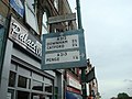
 Pre-Worboys sign, Aldwych - geograph.org.uk - 1085471.jpg 640 × 480; 123 KB
-
 Pre-worboys sign, London E5. 2009.jpg 864 × 1,152; 175 KB
-

-
 Repainted no entry sign by Kenton Library - geograph.org.uk - 3956809.jpg 1,600 × 1,200; 527 KB
-
 Road sign at Vestry House Museum, Walthamstow.jpg 2,448 × 3,264; 6.46 MB
-
-
 Road sign, A206 - geograph.org.uk - 3851647.jpg 640 × 430; 82 KB
-
 Road sign, Chase Side, London N14 - geograph.org.uk - 1230745.jpg 640 × 480; 159 KB
-
 Road Sign, The Ridgeway, Enfield - geograph.org.uk - 1761542.jpg 768 × 1,024; 394 KB
-
 Road signs, Cockfosters - geograph.org.uk - 1230490.jpg 640 × 480; 118 KB
-
 Road signs, Cockfosters - geograph.org.uk - 1230533.jpg 640 × 487; 75 KB
-
 Sign - Wood Lane - geograph.org.uk - 678916.jpg 640 × 480; 73 KB
-
 Sign for Lady Margaret Road, NW(5) - geograph.org.uk - 1440083.jpg 640 × 480; 90 KB
-
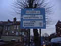
 Sign for Whidborne Street, WC1 - geograph.org.uk - 1219780.jpg 640 × 480; 90 KB
-
 Signpost at Palmers Green - geograph.org.uk - 1779927.jpg 1,280 × 856; 211 KB
-
 Signpost, North End Road NW11 - geograph.org.uk - 1652005.jpg 480 × 640; 62 KB
-
 Street sign for Busby Place, NW5 - geograph.org.uk - 1404647.jpg 640 × 480; 80 KB
-
 SUTTON (Surrey), Greater London - Westmead Road (2) - Flickr - tonymonblat.jpg 3,956 × 2,464; 3.07 MB
-
 Thames Path at Albert Embankment - geograph.org.uk - 271146.jpg 640 × 437; 109 KB
-
 The Green - geograph.org.uk - 1512284.jpg 640 × 430; 181 KB
-
 The WAACs marching in London,1918.jpg 647 × 517; 262 KB
-
 Trinity Road N2 - geograph.org.uk - 158006.jpg 640 × 480; 77 KB
-
 View of an old pre-Worboys road sign on Theobalds Road - geograph.org.uk - 5541573.jpg 3,872 × 2,592; 1.74 MB
-
 Vintage road signs on the A206, West Heath - geograph.org.uk - 3908989.jpg 3,488 × 2,616; 2.66 MB
-
 Wall in Bramley Close - geograph.org.uk - 1207525.jpg 640 × 360; 108 KB
-
 West Ealing Station 2047831.jpg 640 × 420; 140 KB


.jpg)


_-_geograph.org.uk_-_1440083.jpg)


,_Greater_London_-_Westmead_Road_(2)_-_Flickr_-_tonymonblat.jpg)


