Category:Prielmayerstraße (München)
Jump to navigation
Jump to search
| Object location | | View all coordinates using: OpenStreetMap |
|---|
street in Munich, Germany .jpg) | |||||
| Upload media | |||||
| Instance of | |||||
|---|---|---|---|---|---|
| Named after |
| ||||
| Location | Maxvorstadt, Munich, Upper Bavaria, Bavaria, Germany | ||||
| Length |
| ||||
 | |||||
Subcategories
This category has the following 2 subcategories, out of 2 total.
J
N
Media in category "Prielmayerstraße (München)"
The following 15 files are in this category, out of 15 total.
-
 0x12A - Flickr - 0x FF.jpg 1,600 × 1,067; 1.77 MB
-

-
 2303 MVG - Flickr - antoniovera1.jpg 2,493 × 1,870; 1.37 MB
-
 AK - München - Blick vom Karlsplatz - 1902.jpg 3,342 × 4,301; 11.23 MB
-
 Block House 19-05-21 362.jpg 4,608 × 3,072; 2.92 MB
-
 Block House 19-05-21 363.jpg 4,608 × 3,072; 3.07 MB
-

-
 Muenchen-mvg-sl-19-r22-1207841.jpg 1,200 × 846; 276 KB
-
 Munich early winter morning (2156135290).jpg 2,547 × 3,805; 3.24 MB
-
 Munich Oct 2020 17 23 13 486000.jpeg 3,024 × 4,032; 4.13 MB
-
 München, Prielmayerstrasse 01.jpg 1,418 × 997; 445 KB
-
 München, Prielmayerstrasse 02.jpg 1,473 × 1,026; 558 KB
-
 München, Prielmayerstrasse 03.jpg 1,719 × 1,343; 848 KB
-
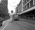 Tram at Stachus, Munich - geo.hlipp.de - 3778.jpg 640 × 537; 77 KB
-
 Tram in Munich.jpg 3,622 × 2,687; 2.42 MB

_2021.jpg)


