Category:Prinsessegracht 23, The Hague
Jump to navigation
Jump to search
| Object location | | View all coordinates using: OpenStreetMap |
|---|
building in The Hague, Netherlands  | |||||
| Upload media | |||||
| Instance of | |||||
|---|---|---|---|---|---|
| Location | The Hague, South Holland, Netherlands | ||||
| Street address |
| ||||
| Located on street | |||||
| Heritage designation |
| ||||
 | |||||
|
This is a category about rijksmonument number 17951
|
| Address |
|
Media in category "Prinsessegracht 23, The Hague"
The following 28 files are in this category, out of 28 total.
-
 Betimmering - 's-Gravenhage - 20090131 - RCE.jpg 1,200 × 859; 114 KB
-
 Betimmering - 's-Gravenhage - 20090132 - RCE.jpg 855 × 1,200; 166 KB
-
 Betimmering - 's-Gravenhage - 20090133 - RCE.jpg 1,200 × 856; 170 KB
-
 Betimmering - 's-Gravenhage - 20090134 - RCE.jpg 1,200 × 844; 120 KB
-
 Betimmering - 's-Gravenhage - 20090135 - RCE.jpg 1,200 × 855; 159 KB
-
 Betimmering - 's-Gravenhage - 20090136 - RCE.jpg 1,200 × 848; 172 KB
-
 Betimmering - 's-Gravenhage - 20090137 - RCE.jpg 1,200 × 848; 122 KB
-
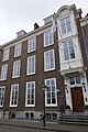
 Den Haag - Prinsessegracht 23-25.JPG 3,056 × 4,592; 3.9 MB
-
 Ingang - 's-Gravenhage - 20090124 - RCE.jpg 857 × 1,200; 199 KB
-
 Interieur, schoorsteenmantel - 's-Gravenhage - 20411047 - RCE.jpg 1,200 × 818; 168 KB
-

-
 Overzicht - 's-Gravenhage - 20090123 - RCE.jpg 1,200 × 803; 199 KB
-
 Plafonds - 's-Gravenhage - 20090125 - RCE.jpg 849 × 1,200; 80 KB
-
 Plafonds - 's-Gravenhage - 20090126 - RCE.jpg 845 × 1,200; 110 KB
-
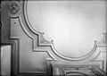 Plafonds - 's-Gravenhage - 20090140 - RCE.jpg 1,200 × 852; 117 KB
-
 Plafonds - 's-Gravenhage - 20090141 - RCE.jpg 1,200 × 854; 151 KB
-
 Plafonds - 's-Gravenhage - 20090144 - RCE.jpg 848 × 1,200; 89 KB
-
 Plafonds - 's-Gravenhage - 20090145 - RCE.jpg 843 × 1,200; 135 KB
-
 Plafonds - 's-Gravenhage - 20090146 - RCE.jpg 1,200 × 855; 172 KB
-
 Plafonds - 's-Gravenhage - 20090147 - RCE.jpg 1,200 × 856; 155 KB
-
 Prinsessegracht 23, Den Haag.JPG 2,592 × 3,888; 2.99 MB
-
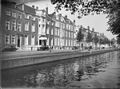 Stadsbeeld - 's-Gravenhage - 20090060 - RCE.jpg 1,200 × 894; 242 KB
-
 Stucwerk - 's-Gravenhage - 20090127 - RCE.jpg 844 × 1,200; 132 KB
-
 Stucwerk - 's-Gravenhage - 20090128 - RCE.jpg 860 × 1,200; 156 KB
-
 Stucwerk - 's-Gravenhage - 20090129 - RCE.jpg 1,200 × 812; 149 KB
-
 Stucwerk - 's-Gravenhage - 20090130 - RCE.jpg 1,200 × 812; 127 KB
-
 Stucwerk - 's-Gravenhage - 20090142 - RCE.jpg 846 × 1,200; 147 KB
-
 Stucwerk - 's-Gravenhage - 20090143 - RCE.jpg 1,200 × 850; 167 KB


