<nowiki>Kirche (mit Ausstattung), Kirchhof mit Kirchhofstor, Leichenhalle und Grabmal an der äußeren Kirchturmwand Obere Hauptstraße -; Protestant Church; church building in Auerbach, Erzgebirgskreis, Germany; Kleine Saalkirche mit polygonalem Chorschluss und barockem Turm, baugeschichtlich und ortsgeschichtlich von Bedeutung. * Kirche: kleiner Emporensaal, wohl gotischen Ursprungs, Umbau 1744–1746, dabei der Turm und die Sakristei errichtet. Innenerneue; церква в Німеччині; kerkgebouw in Duitsland</nowiki>
Protestant Church
church building in Auerbach, Erzgebirgskreis, Germany


 AuerbachErz – Kirche (8430).jpg 1,973 × 1,480; 1.56 MB
 Kirche Auerbach Erzg.JPG 1,944 × 2,592; 2.22 MB
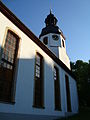 Kirche Auerbach im Erzg.JPG 1,944 × 2,592; 1.73 MB
.jpg)
