Category:Ptolemy's 1st European Map
Jump to navigation
Jump to search
Media in category "Ptolemy's 1st European Map"
The following 72 files are in this category, out of 72 total.
-
 Add 19391 19-20.png 2,512 × 1,828; 5.69 MB
-
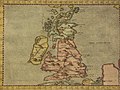
 Ptolemaic Britain.jpg 596 × 466; 93 KB
-
 Map after Ptolemy's Geographia (Burney MS 111, f.15r) (detail of Ireland).jpeg 3,144 × 2,584; 8.57 MB
-
 Map after Ptolemy's Geographia (Burney MS 111, f.15r).jpeg 5,207 × 6,832; 38.67 MB
-
 Map after Ptolemy's Geographia (Burney MS 111, f.15v).jpeg 5,259 × 6,887; 39.37 MB
-
 Map after Ptolemy's Geographia (Burney MS 111, f.16r) (North Sea).jpeg 3,926 × 4,335; 19.2 MB
-
 Map after Ptolemy's Geographia (Burney MS 111, f.16r).jpeg 5,207 × 6,832; 40.52 MB
-
 Europe Tabula Prima.png 1,388 × 900; 2.49 MB
-
 Iouernia kai Alouionos Nesoi B.jpg 459 × 600; 72 KB
-
 Iouernia kai Alouionos Nesoi.jpg 459 × 608; 91 KB
-
 First map of Europe (Britain and Ireland). Full gold border (NYPL b12455533-427013).tif 4,824 × 3,836; 53.16 MB
-
 Ptolemy Cosmographia 1467 - Great Britain and Ireland.jpg 1,551 × 1,106; 1.2 MB
-
 Ptolemys WM 002.jpg 1,600 × 1,152; 463 KB
-
 Descriptio Prime Tabulae Europae.jpg 1,500 × 960; 412 KB
-
 Bodleian Libraries, British Isles.jpg 1,000 × 703; 95 KB
-
 Bodleian Library Auct.K1.17 roll279.1 frame14.jpg 1,000 × 743; 724 KB
-
 Prima Europe Tabula (1478).jpg 3,231 × 2,133; 1.21 MB
-
 Ptolemaic Scotland.jpg 1,000 × 628; 942 KB
-
 Tabula Prima dEuropa.jpg 500 × 388; 59 KB
-
 Prima Europe tabula.jpg 6,000 × 4,293; 9.63 MB
-
 Prima Europe Tabula.jpg 919 × 673; 224 KB
-
 Ptolemy-british-isles (edited).jpg 1,644 × 1,432; 3.74 MB
-
 Ptolemy-british-isles.jpg 2,283 × 1,650; 1.77 MB
-

-
 Prima Europae tabula (7537877008).jpg 2,000 × 1,528; 2.91 MB
-
 Waldseemüllers Scotland.jpg 980 × 440; 132 KB
-
 Tabula Prima Europae.jpg 1,600 × 1,169; 524 KB
-
 Tabula I Europae.jpg 1,599 × 1,064; 375 KB
-
 UBBasel Map 1550 Kartenslg Mappe 237-1 Britannische Inseln (cropped).tiff 2,832 × 1,889; 15.33 MB
-
 UBBasel Map 1550 Kartenslg Mappe 237-1 Britannische Inseln.tiff 4,234 × 4,113, 2 pages; 49.85 MB
-
 Geographiae Claudii Ptolemaei Alexandrini (Münster, 1552) 06.jpg 10,474 × 6,538; 5.71 MB
-
 Tabula Europae I (1552).jpg 1,567 × 1,200; 2.05 MB
-
 Tabula Europae I (1561).jpg 775 × 606; 153 KB
-
 Firenze.PalVecchio.England.JPG 429 × 499; 149 KB
-
 Bodleian Libraries, Ptolemy, the British Isles.jpg 1,000 × 675; 152 KB
-
 Bodleian Library SavileQ5 roll279.1 frame17.jpg 1,000 × 830; 865 KB
-
 Europae I tab. - btv1b53225445h (2 of 3).jpg 8,903 × 6,389; 8.81 MB
-
 Tabula Europae I.jpg 8,140 × 5,260; 8.02 MB
-
-
 Ptolemys Map of the British Isles.png 2,680 × 2,540; 12.81 MB
-
 Карта Птолемея.jpg 7,146 × 5,970; 13.09 MB
-
 Anglia et Hibernia Nova (Britain) northwest.jpg 800 × 600; 136 KB
-
 Anglia et Hibernia Nova (Britain).jpg 800 × 600; 152 KB
-
 Anglia et Hibernia Nova southeast.jpg 800 × 600; 143 KB
-
 Anglia et Hibernia Nova" (Britain) northeast.jpg 800 × 600; 140 KB
-
 Anglia et Hibernia Nova" (Britain) southwest.jpg 800 × 600; 144 KB
-

-
 Claudii Ptolemaei Tabulae geographicae Orbis Terrarum veteribus cogniti (1704) 25.jpg 9,879 × 7,342; 7.31 MB
-

-

-

-
 Europe I britain.jpg 1,600 × 1,200; 373 KB
-

-

-

-

-

-

-

-

-
-

-
 Mercator's Orbis Antiqui Tabulae Geographicae Secundum Cl. Ptolemaeum (1730) 23.jpg 6,645 × 5,166; 4.63 MB
-
 Print, title-page, map (BM 1865,0114.999).jpg 2,500 × 1,908; 1.15 MB
-
 Ptolemy, TABULA EUROPAE I (FL35475102 2582142).jpg 6,736 × 4,872; 46.83 MB
-
 Tabula Europae I (Britain) northeast.jpg 800 × 600; 131 KB
-
 Tabula Europae I (Britain) northwest.jpg 800 × 600; 125 KB
-
 Tabula Europae I (Britain) southeast.jpg 800 × 600; 114 KB
-
 Tabula Europae I (Britain) southwest.jpg 800 × 600; 130 KB
-
 Tabula Europae I (Britain).jpg 800 × 600; 148 KB
-
 UBBasel Map 1600-1699 Kartenslg AA 22 Britannia.tiff 9,932 × 7,014, 2 pages; 199.33 MB
-
 Claudii Ptolemaei Tabulae geographicaei 1695 (102835462).jpg 14,551 × 10,385; 24.24 MB


_(detail_of_Ireland).jpeg)
.jpeg)
.jpeg)
_(North_Sea).jpeg)
.jpeg)


.jpg)


.jpg)

_(14759469056).jpg)
.jpg)


_06.jpg)
.jpg)
.jpg)


.jpg)


_northwest.jpg)
.jpg)

_northeast.jpg)
_southwest.jpg)
.jpg)
_25.jpg)
.jpg)
_;_(%C3%A9d._G._Trechsel)_-_btv1b59637472_(1_of_2).jpg)
_;_(%C3%A9d._G._Trechsel)_-_btv1b59637472_(2_of_2).jpg)

_-_btv1b5963748g_(1_of_2).jpg)
_-_btv1b5963748g_(2_of_2).jpg)


_03.jpg)
_%E2%80%93_1st_European_map_%E2%80%93_the_British_Isles_(ff._106v%E2%80%93107r).png)
_%E2%80%93_1st_European_map_%E2%80%93_the_British_Isles_(ff._76v%E2%80%9377r).png)
_23.jpg)
.jpg)
.jpg)
_northeast.jpg)
_northwest.jpg)
_southeast.jpg)
_southwest.jpg)
.jpg)
.jpg)