Category:Ptolemy's 4th European Map
Jump to navigation
Jump to search
Subcategories
This category has only the following subcategory.
Media in category "Ptolemy's 4th European Map"
The following 43 files are in this category, out of 43 total.
-
 Map after Ptolemy's Geographia (Burney MS 111, f.28r).jpeg 5,207 × 6,832; 43.63 MB
-
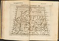
 Claudii Ptolomei Cosmographie IV.jpg 939 × 654; 579 KB
-

-
 Ptolemy Cosmographia 1467 - Germany.jpg 1,140 × 1,042; 1.17 MB
-
 Bodleian Libraries, Netherlands, Germany and Denmark.jpg 1,000 × 675; 103 KB
-
 Quarta Europe Tabula.jpg 3,231 × 2,133; 1.03 MB
-
 Tabula Quarta dEuropa.jpg 638 × 700; 137 KB
-
 Quarta Europe Tabula (1490).jpg 720 × 536; 279 KB
-
-
 Quarta Europae tabula (7537878198).jpg 2,000 × 1,518; 2.84 MB
-
 1511 Claudii Ptholemaei FLEVVM.jpg 1,041 × 1,085; 725 KB
-
 Quarta Europae Tabula.jpg 1,976 × 1,500; 640 KB
-
 1513 Quarta Europae Tabula FLEVVM.jpg 554 × 405; 295 KB
-
 Deutschlandkarte aus der Ausgabe der Cosmographia von 1538.jpg 1,543 × 1,325; 962 KB
-
 Geographiae Claudii Ptolemaei Alexandrini (Münster, 1552) 09.jpg 10,475 × 6,567; 6 MB
-
 Tabula Europae IV (Germany).jpg 800 × 600; 141 KB
-

-
 Germaniae Magnae Tabula ex Mente Ptolemei.jpg 1,157 × 1,389; 494 KB
-

-
 1700 New Map Ancient Germany FLEVVM.jpg 881 × 642; 448 KB
-
 Karta på "Octava Tabula Europe" och "Qvarta Europae Tabula", 1750-tal - Skoklosters slott - 99655.tif 4,417 × 3,453, 2 pages; 43.66 MB
-
 Germania Magna nach Ptolemaeus.jpg 666 × 748; 178 KB
-

-

-
 Claudii Ptolemaei Tabulae geographicae Orbis Terrarum veteribus cogniti (1704) 28.jpg 9,897 × 7,334; 6.13 MB
-
 Europ. IIII tab. - btv1b532386267 (2 of 3).jpg 11,241 × 8,505; 14.42 MB
-

-

-
 Europae Tabula IIII - Germania magna - (Ptolémée) - btv1b5963809q (1 of 2).jpg 6,040 × 4,288; 3.28 MB
-
 Europae Tabula IIII - Germania magna - (Ptolémée) - btv1b5963809q (2 of 2).jpg 6,008 × 3,976; 3.61 MB
-

-

-
 Europae, IV tabula - continet Germaniam magnam - btv1b84908180 (1 of 2).jpg 6,683 × 5,663; 6.58 MB
-
 Europae, IV tabula - continet Germaniam magnam - btv1b84908180 (2 of 2).jpg 6,660 × 5,639; 4.52 MB
-
 Europe IV germany.jpg 1,600 × 1,200; 327 KB
-

-
-
 Mercator's Orbis Antiqui Tabulae Geographicae Secundum Cl. Ptolemaeum (1730) 26.jpg 6,636 × 5,197; 4.5 MB
-
 Ptolemy, QUARTA EUROPE TABULA (FL147394293 2566739).jpg 4,547 × 3,311; 13.8 MB
-
 Ptolemy, Tabula Europae IIII (FL155329330 2608532).jpg 7,120 × 4,995; 38.67 MB
-
 Quarta Europe Tabula - Rome Edition.jpg 11,936 × 9,507; 14.18 MB
-
 Tab. IV Europae Germaniam et Galliam Belgicam Exhibens.jpg 10,862 × 9,446; 17.95 MB
-
 Claudii Ptolemaei Tabulae geographicaei 1695 (102835503).jpg 14,531 × 10,350; 24.24 MB
.jpeg)


.jpg)
_(14802329133).jpg)
.jpg)


_09.jpg)
.jpg)


.jpg)


.jpg)
.jpg)
_28.jpg)
.jpg)
_-_btv1b5963810c_(1_of_2).jpg)
_-_btv1b5963810c_(2_of_2).jpg)
_-_btv1b5963809q_(1_of_2).jpg)
_-_btv1b5963809q_(2_of_2).jpg)
_;_(%C3%A9d._G._Trechsel)_-_btv1b59638089_(1_of_2).jpg)
_;_(%C3%A9d._G._Trechsel)_-_btv1b59638089_(2_of_2).jpg)
.jpg)
.jpg)


_06.jpg)
_26.jpg)
.jpg)
.jpg)


.jpg)
Categories:
- Ptolemy's European maps
- Old maps of Denmark
- Poland in the 2nd century
- Podkarpackie in the 2nd century
- Pomerania in the 2nd century
- Maps of Vistula
- Maps of San
- Maps of the history of Denmark
- Maps of the history of Poland
- Ptolemaic Germany
- Old maps of Poland
- Old maps of Czechia
- Old maps of Austria
- Old maps of the Holy Roman Empire
- Maps of Germania magna