Category:Public footpaths in Flintshire
Jump to navigation
Jump to search
Subcategories
This category has the following 6 subcategories, out of 6 total.
- Bridleways in Flintshire (50 F)
C
- Clwydian Way (163 F)
F
- Footbridges in Flintshire (22 F)
- Fords in Flintshire (2 F)
G
- Green Lane West (26 F)
S
- Stiles in Flintshire (2 F)
Media in category "Public footpaths in Flintshire"
The following 32 files are in this category, out of 32 total.
-
 Cilcain Trail - DSC06093.JPG 3,648 × 2,736; 3.56 MB
-
 Cilcain trail - DSC06096.JPG 2,736 × 3,648; 3.54 MB
-
 Cilcain Trail, near Loggerheads - DSC06106.JPG 3,648 × 2,736; 3.5 MB
-
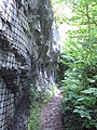
 Cliff on the Cilcain Trail - DSC06102.JPG 2,736 × 3,648; 3.56 MB
-
 Cows on the path, Shotton.JPG 4,000 × 3,000; 2.79 MB
-
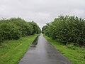
 Cycle paths near Hawarden Bridge railway station.JPG 4,320 × 3,240; 5.01 MB
-
 Footpath and Track at Nant Alyn - geograph.org.uk - 313847.jpg 640 × 480; 250 KB
-
 Footpath to Rhewl Mostyn - geograph.org.uk - 1145273.jpg 480 × 640; 108 KB
-
 Footpath to Shotton railway station (low level).JPG 4,320 × 3,240; 4.33 MB
-
 Hawarden Bridge walkway - geograph.org.uk - 1131777.jpg 640 × 480; 143 KB
-
 National Cycle Network route 5 sign, near Shotton.JPG 3,240 × 4,320; 5.54 MB
-
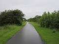
 National Cycle Network route 5, near Hawarden Bridge railway station (1).JPG 4,320 × 3,240; 3.57 MB
-
 National Cycle Network route 5, near Hawarden Bridge railway station (2).JPG 4,320 × 3,240; 3.41 MB
-
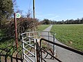
 Public footpath at Hope, Flintshire (1).JPG 4,608 × 3,456; 3.39 MB
-
 Public footpath at Hope, Flintshire (2).JPG 4,608 × 3,456; 3.39 MB
-
 Public footpath sign on the A549 at Dobshill, Flintshire - DSCF1280.JPG 3,000 × 4,000; 2.88 MB
-
 Public footpath, Gwernymynydd 1.JPG 2,736 × 3,648; 3.57 MB
-
 Public footpath, Gwernymynydd 2.JPG 3,648 × 2,736; 3.6 MB
-
 Public footpath, Gwernymynydd 3.JPG 2,736 × 3,648; 3.57 MB
-
 Public footpath, Gwernymynydd 4.JPG 2,736 × 3,648; 3.58 MB
-
 Public footpath, Gwernymynydd 5.JPG 3,648 × 2,736; 3.51 MB
-
 Sarn Lane footpath, Caergwrle (1).JPG 4,608 × 3,456; 3.39 MB
-
 Sarn Lane footpath, Caergwrle (3).JPG 4,608 × 3,456; 3.41 MB
-
 The Millennium Woods, Cilcain - DSC06083.JPG 3,648 × 2,736; 3.52 MB
-

-
 Footpath at Tre Eden Owain - geograph.org.uk - 182118.jpg 640 × 480; 79 KB
-
 Footpath in Nant y Ffrith Woodland - geograph.org.uk - 340189.jpg 480 × 640; 219 KB
-
 Path in Nant y Ffrith Woodland - geograph.org.uk - 340194.jpg 640 × 480; 281 KB
-
 Precipitous footpath by Lead Brook - geograph.org.uk - 222602.jpg 480 × 640; 150 KB
-
 Public footpath at Pant Glas - geograph.org.uk - 72218.jpg 576 × 432; 98 KB
-
 The Moor - geograph.org.uk - 217843.jpg 640 × 480; 80 KB
-
 Track and Path Junction near Bwlchgwyn - geograph.org.uk - 338616.jpg 640 × 480; 224 KB


.JPG)


.JPG)
.JPG)
.JPG)
.JPG)


.JPG)
.JPG)


