Category:Public footpaths in Hedon
Jump to navigation
Jump to search
Media in category "Public footpaths in Hedon"
The following 72 files are in this category, out of 72 total.
-
 'Cally' in Hedon - geograph.org.uk - 825212.jpg 480 × 640; 154 KB
-
 A Hedon Bridleway - geograph.org.uk - 1142521.jpg 640 × 466; 157 KB
-
 A1033 Burstwick Drain Flyover Bridge - geograph.org.uk - 479923.jpg 640 × 480; 139 KB
-
 At the end of Middle Lane - geograph.org.uk - 926623.jpg 491 × 640; 141 KB
-
 Autumnal Middle Lane, Hedon - geograph.org.uk - 600805.jpg 480 × 640; 135 KB
-
 Autumnal Trees down Middle Lane, Hedon - geograph.org.uk - 600809.jpg 480 × 640; 156 KB
-
 Bridleway in Hedon - geograph.org.uk - 825210.jpg 640 × 480; 197 KB
-
 Bridleway north west of Hedon - geograph.org.uk - 566035.jpg 640 × 480; 156 KB
-
 Bridleway on the outskirts of Hedon - geograph.org.uk - 566038.jpg 640 × 480; 183 KB
-
 Burstwick Drain and the June 2007 Floods - geograph.org.uk - 479939.jpg 640 × 460; 124 KB
-
 Burstwick Drain Bridleway - geograph.org.uk - 407229.jpg 640 × 480; 140 KB
-
 Burstwick Drain from Thorn Road in Hedon - geograph.org.uk - 1201860.jpg 480 × 640; 119 KB
-
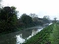
 Burstwick Drain, Hedon - geograph.org.uk - 723609.jpg 640 × 480; 86 KB
-
 Burstwick Drain, Hedon - geograph.org.uk - 746448.jpg 640 × 453; 164 KB
-
 Burstwick Line across Magdalen Lane - geograph.org.uk - 670138.jpg 640 × 488; 76 KB
-
 Cally in the Morning - geograph.org.uk - 553259.jpg 640 × 480; 137 KB
-
 Cycle Track to Hedon over B1362 - geograph.org.uk - 1094002.jpg 640 × 480; 85 KB
-
 Drainage in Hedon - geograph.org.uk - 667403.jpg 640 × 480; 127 KB
-
 Drainside Path - geograph.org.uk - 278362.jpg 640 × 480; 106 KB
-
 Elsie Gate - geograph.org.uk - 278285.jpg 640 × 480; 169 KB
-
 Footpath and Drain, Hedon - geograph.org.uk - 667731.jpg 640 × 480; 130 KB
-

-
 Footpath from Ivy Lane to New Road - geograph.org.uk - 842045.jpg 640 × 480; 110 KB
-
 Footpath north of Burstwick Drain - geograph.org.uk - 638783.jpg 640 × 478; 83 KB
-
 Grape Lane - geograph.org.uk - 1067362.jpg 480 × 640; 107 KB
-
 Green Lane near Ketwell Lane - geograph.org.uk - 278284.jpg 640 × 480; 121 KB
-
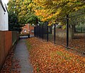
 Hedon Footpath - geograph.org.uk - 857635.jpg 640 × 480; 107 KB
-
 Hedon Haven - geograph.org.uk - 274412.jpg 640 × 480; 139 KB
-
 Hedon Haven - geograph.org.uk - 783182.jpg 640 × 480; 199 KB
-
 Hedon Meadow - geograph.org.uk - 566040.jpg 640 × 480; 98 KB
-
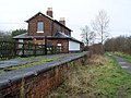
 Hedon Railway Station - geograph.org.uk - 253575.jpg 437 × 640; 102 KB
-
 Hedon Railway Station.jpg 640 × 480; 90 KB
-
 Hedon to Burstwick Line.jpg 640 × 480; 141 KB
-
 Love Lane - geograph.org.uk - 777334.jpg 640 × 480; 121 KB
-
 Love Lane Bridleway - geograph.org.uk - 792413.jpg 480 × 640; 121 KB
-
 Love Lane Bridleway - geograph.org.uk - 792436.jpg 480 × 640; 166 KB
-
 Love Lane Bridleway Green Fence - geograph.org.uk - 659055.jpg 640 × 480; 123 KB
-
 Love Lane Bridleway, Hedon - geograph.org.uk - 318897.jpg 640 × 480; 143 KB
-
 Love Lane Bridleway, Hedon - geograph.org.uk - 318903.jpg 640 × 480; 98 KB
-
 Love Lane Bridleway, Hedon - geograph.org.uk - 777346.jpg 640 × 480; 214 KB
-
 Love Lane, Hedon - geograph.org.uk - 299790.jpg 640 × 545; 131 KB
-
 Love Lane, Hedon - geograph.org.uk - 318899.jpg 640 × 457; 133 KB
-
 Love Lane, Hedon - geograph.org.uk - 582557.jpg 640 × 480; 113 KB
-

-
 Middle Lane, Hedon - geograph.org.uk - 1283015.jpg 640 × 480; 151 KB
-
 Middle Lane, Hedon - geograph.org.uk - 726096.jpg 640 × 496; 100 KB
-
 Middle Lane, Hedon - geograph.org.uk - 759723.jpg 480 × 640; 101 KB
-
 Middle Lane, Hedon - geograph.org.uk - 759726.jpg 501 × 640; 161 KB
-
 Middle Lane, Hedon - geograph.org.uk - 760437.jpg 640 × 480; 116 KB
-
 Mist on Burstwick Drain, Hedon - geograph.org.uk - 617743.jpg 640 × 480; 78 KB
-

-
 Night Footpath - geograph.org.uk - 1550513.jpg 640 × 480; 129 KB
-

-
 Path beside Burstwick Drain - geograph.org.uk - 574678.jpg 640 × 507; 196 KB
-
 Public Footpath to Thorn Road - geograph.org.uk - 777349.jpg 480 × 640; 150 KB
-

-
 Puddled Track - geograph.org.uk - 1311779.jpg 480 × 640; 153 KB
-
 Red Flats, Green Track and Grey Sky - geograph.org.uk - 1702698.jpg 3,442 × 2,692; 2.87 MB
-
 The Church Lane to Ketwell Lane Footpath - geograph.org.uk - 1029527.jpg 640 × 550; 204 KB
-
 The end of Love Lane Bridleway - geograph.org.uk - 777337.jpg 640 × 480; 126 KB
-
 The Footbridge, and Path to Ivy Lane - geograph.org.uk - 667734.jpg 640 × 480; 131 KB
-

-
 The Footway's Back^ - geograph.org.uk - 482631.jpg 640 × 480; 86 KB
-
 The Long and Straight Wooden Fence - geograph.org.uk - 639013.jpg 640 × 480; 77 KB
-
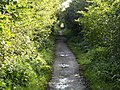
 The long and winding ex-(rail)road - geograph.org.uk - 1013649.jpg 480 × 640; 177 KB
-
 The Old Hedon Haven - geograph.org.uk - 278332.jpg 640 × 480; 65 KB
-
 The old Hull to Withernsea Railway - geograph.org.uk - 574769.jpg 640 × 480; 177 KB
-
 The old Hull to Withernsea Railway - geograph.org.uk - 774297.jpg 480 × 640; 118 KB
-
 The old Hull to Withernsea Railway Line - geograph.org.uk - 574675.jpg 640 × 480; 186 KB
-

-
 Underneath the Arch - geograph.org.uk - 1460263.jpg 476 × 640; 117 KB
-
 Waste of Paint - geograph.org.uk - 394191.jpg 480 × 640; 106 KB


road_-_geograph.org.uk_-_1013649.jpg)


