Category:Public transport maps of Karlsruhe
Jump to navigation
Jump to search
Urban districts (cities): Freiburg · Heidelberg · Heilbronn · Karlsruhe · Mannheim · Stuttgart · Ulm
Subcategories
This category has the following 2 subcategories, out of 2 total.
G
- Gleispläne der Stadtbahn Karlsruhe (1 P, 24 F)
T
- Tram maps of Karlsruhe (6 F)
Media in category "Public transport maps of Karlsruhe"
The following 23 files are in this category, out of 23 total.
-
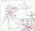
AVG-Netz2006 de.png 865 × 671; 61 KB
-
Albtalbahn Streckenplan 1901.png 1,164 × 1,111; 481 KB
-
AlbtalbahnNetzentwicklung.png 4,873 × 5,760; 774 KB
-
AVG-Netz2011.png 1,414 × 1,054; 55 KB
-
AVG-Netz2011.svg 1,593 × 1,188; 37 KB
-
AVG-Netz2024.svg 1,699 × 1,267; 45 KB
-
AVG-Netz2006 en.png 865 × 671; 67 KB
-
Karte Stadtbahn Karlsruhe 2.jpg 5,942 × 5,151; 4.35 MB
-
Karte Stadtbahn Karlsruhe.png 11,391 × 9,877; 38.36 MB
-
Kombilösung Karlsruhe Liniennetz 1996.svg 1,011 × 596; 101 KB
-
Kombilösung Karlsruhe Liniennetz Endzustand.svg 1,011 × 596; 117 KB
-
Kombilösung Karlsruhe Liniennetz Mitfall.svg 1,011 × 596; 107 KB
-
Kombilösung Karlsruhe Liniennetz Ohnefall.svg 1,011 × 596; 102 KB
-
Kombilösung Karlsruhe Liniennetz Zwischenzustand.svg 1,011 × 596; 105 KB
-
S-Bahn RheinNeckar Netzplan Kraichgau.png 1,000 × 693; 183 KB
-
S-Bahn RheinNeckar Netzplan Kraichgau.svg 1,597 × 1,101; 50 KB
-
S-Bahn RheinNeckar Netzplan Nordbaden.png 1,000 × 445; 150 KB
-
S-Bahn RheinNeckar Netzplan.png 1,000 × 400; 134 KB
-
Stadt-undStraßenbahnGleisplanKarlsruhe2019.png 8,463 × 10,490; 2.69 MB
-
Stadt-undStraßenbahnGleisplanKarlsruhe2022.png 8,462 × 10,490; 2.77 MB
-
Stadt-undStraßenbahnNetzentwicklungKarlsruhe.png 6,994 × 7,867; 2.22 MB
-
Tram-Liniennetz VBK Stadtkreis Karlsruhe 2009.png 2,246 × 2,121; 1.95 MB
-
Tram-Liniennetz VBK Stadtkreis Karlsruhe 2009.svg 1,078 × 1,018; 4.01 MB


