Category:Pubs in Merthyr Tydfil County Borough
Jump to navigation
Jump to search

Subcategories
This category has the following 3 subcategories, out of 3 total.
Media in category "Pubs in Merthyr Tydfil County Borough"
The following 15 files are in this category, out of 15 total.
-
 BelleVueMerthyrTydfil.jpg 1,024 × 768; 489 KB
-
 Glantaff Inn, Quakers Yard - geograph.org.uk - 4813644.jpg 800 × 613; 117 KB
-
 Y Pant Cad Ifor Public House - geograph.org.uk - 806491.jpg 640 × 480; 85 KB
-
 Quakers Yard Inn, Quakers Yard - geograph.org.uk - 4809299.jpg 800 × 562; 95 KB
-
 Railway Inn, Bedlinog (geograph 6067457).jpg 1,024 × 749; 142 KB
-
 Silver Bullet in Troedyrhiw (geograph 6077456).jpg 959 × 1,024; 220 KB
-
 South side of the Bedlinog Inn, Bedlinog (geograph 6067709).jpg 1,024 × 734; 145 KB
-
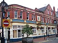
 The Belle Vue pub in Merthyr Tydfil town centre (geograph 6074093).jpg 1,024 × 838; 224 KB
-
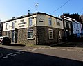 The Colliers Arms, Abercanaid (geograph 6073652).jpg 1,024 × 809; 182 KB
-
 The Crown Inn, High Street, Merthyr Tydfil - geograph.org.uk - 6075655.jpg 1,024 × 1,003; 277 KB
-
 The Quarryman's Arms, Tai-yr-efail, Pant - geograph.org.uk - 2791339.jpg 3,296 × 2,472; 1.87 MB
-
 The Red Cow (geograph 5467789).jpg 2,051 × 1,724; 814 KB
-
 The Red Cow - geograph.org.uk - 5371284.jpg 3,264 × 2,448; 1.92 MB
-
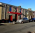 The Richards Arms, Abercanaid (geograph 6073641).jpg 1,024 × 948; 298 KB
-
 The Twyn Carmel Inn - geograph.org.uk - 634051.jpg 640 × 480; 65 KB


.jpg)
.jpg)
.jpg)
.jpg)
.jpg)


.jpg)

.jpg)
