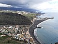
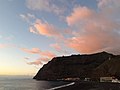
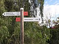
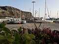
Category:Puerto de Tazacorte
Jump to navigation
Jump to search
| Object location | | View all coordinates using: OpenStreetMap |
|---|
human settlement in Tazacorte, Canary Islands, Spain  | |||||
| Upload media | |||||
| Instance of | |||||
|---|---|---|---|---|---|
| Location | Tazacorte, Canary Islands, Spain | ||||
 | |||||
Media in category "Puerto de Tazacorte"
The following 121 files are in this category, out of 121 total.
-
 Barranco de Tenisque.jpg 4,608 × 2,272; 2.55 MB
-
 Cauce del Barranco de las Angustias.jpg 4,608 × 2,272; 3.18 MB
-
 Cocos nucifera Palma.jpg 1,745 × 1,183; 1.03 MB
-
 Desembocadura del Barranco de las Angustias.jpg 4,608 × 2,272; 2.49 MB
-
 Direkt in den Fels (Lava) gebaut - panoramio.jpg 1,976 × 2,720; 1.73 MB
-
 Esperando A Su Amor (188287211).jpeg 1,024 × 1,536; 223 KB
-
 Fajana del volcán de Cumbre Vieja.jpg 4,608 × 2,272; 1.67 MB
-
 Fischzucht Puerto de Tazacorte 2007-03.JPG 2,288 × 1,720; 1.05 MB
-
 Grilled Pompano, Puerto de Tazacorte, La Palma.jpg 3,684 × 2,763; 2.23 MB
-
 La Palma - Tazacorte (Avenida de la Constitución) 01 ies.jpg 5,616 × 3,744; 17.63 MB
-
 La Palma - Tazacorte + Tarajal - Puerto (Fancy II) 01 ies.jpg 5,616 × 3,744; 15.21 MB
-
 La Palma - Tazacorte - El Puerto - Avenida El Emigrante - Playa + Puerto 01 ies.jpg 5,616 × 3,744; 18.46 MB
-
 La Palma - Tazacorte - El Puerto - Avenida El Emigrante - Playa + Puerto 02 ies.jpg 5,616 × 3,744; 13.35 MB
-
 La Palma - Tazacorte - Tarajal + Puerto (Mirador del Time) 01 ies.jpg 5,616 × 3,744; 17.98 MB
-
 La Palma - Tazacorte - Tarajal - Avenida El Emigrante - Playa + Puerto 01 ies.jpg 5,616 × 3,744; 15.45 MB
-
 La Palma - Tazacorte - Tarajal - Puerto (Fancy II) 01 ies.jpg 5,616 × 3,744; 15.78 MB
-
 La Palma - Tazacorte - Tarajal - Puerto (Fancy II) 02 ies.jpg 5,616 × 3,744; 20.7 MB
-
 La Palma - Tazacorte - Tarajal - Puerto (Fancy II) 03 ies.jpg 5,616 × 3,744; 14.11 MB
-
 La Palma - Tazacorte - Tarajal - Puerto (Fancy II) 04 ies.jpg 5,616 × 3,744; 8.39 MB
-
 La Palma - Tazacorte - Tarajal - Puerto (Fancy II) 05 ies.jpg 5,616 × 3,744; 13.19 MB
-
 La Palma - Tazacorte - Tarajal - Puerto (Fancy II) 06 ies.jpg 5,616 × 3,744; 15.52 MB
-
 La Palma - Tazacorte - Tarajal - Puerto (Fancy II) 07 ies.jpg 5,616 × 3,744; 14.98 MB
-
 La Palma - Tazacorte - Tarajal - Puerto (Fancy II) 08 ies.jpg 5,616 × 3,744; 12 MB
-
 La Palma - Tazacorte - Tarajal - Puerto (Fancy II) 09 ies.jpg 5,616 × 3,744; 13.13 MB
-
 La Palma - Tazacorte - Tarajal - Puerto (Fancy II) 10 ies.jpg 5,616 × 3,744; 20.28 MB
-
 La Palma - Tazacorte - Tarajal - Puerto (Fancy II) 11 ies.jpg 5,616 × 3,744; 17.3 MB
-
 La Palma - Tazacorte - Tarajal - Puerto (Fancy II) 12 ies.jpg 5,616 × 3,744; 14.7 MB
-
 La Palma - Tazacorte - Tarajal - Puerto (Mirador del Time) 01 ies.jpg 5,616 × 3,744; 16.97 MB
-
 La Palma - Tazacorte - Tarajal - Puerto - Fancy 01 ies.jpg 5,616 × 3,744; 10 MB
-
 La Palma - Tazacorte - Tarajal - Puerto - Fancy 02 ies.jpg 5,616 × 3,744; 15.94 MB
-
 La Palma - Tazacorte - Tarajal - Puerto - Fancy 03 ies.jpg 5,616 × 3,744; 14.49 MB
-
 La Palma - Tazacorte - Tarajal - Puerto - Fancy 04 ies.jpg 5,616 × 3,744; 15.23 MB
-
La Palma - Tazacorte - Tarajal - Puerto - Fancy II v01 ies.webm 2 min 23 s, 1,920 × 1,080; 93.62 MB
-
 La Palma - Tazacorte - Tarajal - Puerto 01 ies.jpg 5,616 × 3,744; 10.05 MB
-
 La Palma - Tazacorte - Tarajal - Puerto 02 ies.jpg 5,616 × 3,744; 15.27 MB
-
 La Palma - Tazacorte - Tarajal - Puerto 03 ies.jpg 5,616 × 3,744; 16.81 MB
-
 La Palma - Tazacorte - Tarajal - Puerto 04 ies.jpg 5,616 × 3,744; 15.4 MB
-
 La Palma - Tazacorte - Tarajal - Puerto 05 ies.jpg 5,616 × 3,744; 18.47 MB
-
 La Palma - Tazacorte - Tarajal - Puerto 06 ies.jpg 5,616 × 3,744; 15.5 MB
-
 La Palma - Tazacorte - Tarajal - Puerto 07 ies.jpg 5,616 × 3,744; 17.52 MB
-
 La Palma - Tazacorte - Tarajal - Puerto 08 ies.jpg 5,616 × 3,744; 16.29 MB
-
 La Palma - Tazacorte - Tarajal - Puerto 09 ies.jpg 5,616 × 3,744; 13 MB
-
 La Palma - Tazacorte - Tarajal - Puerto 10 ies.jpg 5,616 × 3,744; 12.77 MB
-
 La Palma - Tazacorte - Tarajal - Puerto 11 ies.jpg 5,616 × 3,744; 18.13 MB
-
 La Palma - Tazacorte - Tarajal - Puerto 12 ies.jpg 5,616 × 3,744; 14.31 MB
-
 La Palma - Tazacorte - Tarajal - Puerto 13 ies.jpg 5,616 × 3,744; 13.1 MB
-
 La Palma - Tazacorte - Tarajal - Puerto 14 ies.jpg 5,616 × 3,744; 13.04 MB
-
 La Palma - Tazacorte - Tarajal - Puerto 15 ies.jpg 5,616 × 3,744; 13.67 MB
-
 La Palma - Tazacorte - Tarajal - Puerto 16 ies.jpg 5,784 × 3,856; 14.3 MB
-
 La Palma - Tazacorte - Tarajal - Puerto 17 ies.jpg 5,616 × 3,744; 11.77 MB
-
 La Palma - Tazacorte - Tarajal - Puerto 18 ies.jpg 5,616 × 3,744; 12.81 MB
-
 La Palma - Tazacorte - Tarajal - Puerto 19 ies.jpg 5,616 × 3,744; 13.24 MB
-
 La Palma - Tazacorte - Tarajal - Puerto 20 ies.jpg 5,616 × 3,744; 13.53 MB
-
 La Palma - Tazacorte - Tarajal - Puerto 21 ies.jpg 5,616 × 3,744; 13 MB
-
 La Palma - Tazacorte - Tarajal - Puerto 22 ies.jpg 5,616 × 3,744; 14.74 MB
-
 La Palma - Tazacorte - Tarajal - Puerto 23 ies.jpg 5,616 × 3,744; 15.1 MB
-
 La Palma - Tazacorte - Tarajal - Puerto 24 ies.jpg 5,616 × 3,744; 12.95 MB
-
 La Palma - Tazacorte - Tarajal - Puerto 25 ies.jpg 5,616 × 3,744; 12.04 MB
-
 La Palma - Tazacorte - Tarajal - Puerto 26 ies.jpg 5,616 × 3,744; 12.84 MB
-
 La Palma - Tazacorte - Tarajal - Puerto 27 ies.jpg 5,616 × 3,744; 13.54 MB
-
 La Palma - Tazacorte - Tarajal - Puerto 28 ies.jpg 5,616 × 3,744; 16.64 MB
-
 La Palma - Tazacorte - Tarajal - Puerto 29 ies.jpg 5,616 × 3,744; 15.18 MB
-
 La Palma - Tazacorte - Tarajal - Puerto 30 ies.jpg 5,616 × 3,744; 13.53 MB
-
 La Palma - Tazacorte - Tarajal - Puerto 31 ies.jpg 5,616 × 3,744; 16.3 MB
-
 La Palma - Tazacorte - Tarajal - Puerto 32 ies.jpg 5,616 × 3,744; 16.81 MB
-
 La Palma - Tazacorte - Tarajal - Puerto 33 ies.jpg 5,616 × 3,744; 16.91 MB
-
 La Palma - Tazacorte - Tarajal - Puerto 34 ies.jpg 5,616 × 3,744; 19.42 MB
-
 La Palma - Tazacorte - Tarajal - Puerto 35 ies.jpg 5,616 × 3,744; 17.15 MB
-
 La Palma - Tazacorte - Tarajal - Puerto 36 ies.jpg 5,616 × 3,744; 16.26 MB
-
 La Palma - Tazacorte - Tarajal - Puerto 37 ies.jpg 5,616 × 3,744; 13.72 MB
-
 La Palma - Tazacorte - Tarajal - Puerto 38 ies.jpg 5,616 × 3,744; 15.7 MB
-
 La Palma - Tazacorte - Tarajal - Puerto 41 ies.jpg 5,616 × 3,744; 17 MB
-
 La Palma - Tazacorte - Tarajal - Puerto 42 ies.jpg 5,616 × 3,744; 20.7 MB
-
 La Palma - Tazacorte - Tarajal - Puerto 43 ies.jpg 5,616 × 3,744; 16.23 MB
-
 La Palma - Tazacorte - Tarajal - Puerto 44 ies.jpg 5,616 × 3,744; 18.15 MB
-
La Palma - Tazacorte - Tarajal - Puerto v01 ies.webm 1 min 14 s, 1,920 × 1,080; 48.73 MB
-
 La Palma - Tazacorte.jpg 11,392 × 2,019; 11.89 MB
-
 La Palma lava flows into the sea ESA23490653.jpeg 1,181 × 885; 1.14 MB
-

-
 LaPTazacortePuerto.jpg 1,723 × 2,892; 765 KB
-
 Mirador el Time, La Palma, Atlantic.jpg 3,430 × 2,672; 2.13 MB
-
 NO Puerto Naos beach- Playa TARAJAL.jpg 4,608 × 2,272; 2.06 MB
-
 Placa identificativa del Barranco de Tenisque.jpg 4,608 × 2,272; 1.61 MB
-
 Puerto de Tazacorte al anochecer.JPG 4,000 × 3,000; 4.34 MB
-
 Puerto de Tazacorte Fancy 2014-10 01.JPG 4,608 × 3,456; 7.02 MB
-
 Puerto de Tazacorte Fancy 2014-10 02.JPG 4,608 × 3,456; 5.54 MB
-
 Puerto de Tazacorte La Palma-1.jpg 2,592 × 1,944; 906 KB
-
 Puerto de Tazacorte La Palma-2.jpg 2,592 × 1,944; 1.01 MB
-
 Puerto de Tazacorte La Palma-3.jpg 1,944 × 2,592; 1 MB
-
 Puerto de Tazacorte La Palma-4.jpg 2,592 × 1,944; 1.22 MB
-
 Puerto de Tazacorte La Palma-6.jpg 2,592 × 1,752; 975 KB
-
 Puerto de Tazacorte La Palma-7.jpg 2,592 × 1,944; 747 KB
-
 Puerto de Tazacorte La Palma-8.jpg 2,592 × 1,944; 1.02 MB
-
 Puerto de Tazacorte Mai 2018.jpg 2,976 × 3,968; 1.97 MB
-
 Puerto de Tazacorte, La Palma, almond blossom.jpg 3,363 × 2,522; 2.1 MB
-
 Puerto de Tazacorte, La Palma, bougainvilla.jpg 3,739 × 2,804; 1.52 MB
-
 Puerto de Tazacorte, La Palma, Canary Islands, 2015 - panoramio.jpg 3,292 × 1,852; 3.21 MB
-
 Puerto de Tazacorte, La Palma, fish platter.jpg 3,773 × 2,829; 1.62 MB
-
 Puerto de Tazacorte, La Palma, from trail.jpg 4,000 × 3,000; 3.48 MB
-
 Puerto de Tazacorte, La Palma, goat.jpg 2,610 × 1,957; 1,002 KB
-
 Puerto de Tazacorte, La Palma, park.jpg 4,000 × 3,000; 4.27 MB
-
 Puerto de Tazacorte, La Palma, sunset clouds.jpg 4,000 × 3,000; 2.23 MB
-
 Puerto de Tazacorte, La Palma, trail signs.jpg 3,706 × 2,780; 3.94 MB
-
 Puerto de Tazacorte, La Palma.jpg 3,735 × 2,815; 2.38 MB
-
 Puerto Tazacorte 1999-03.jpg 794 × 1,098; 255 KB
-
 Puerto Tazacorte 2000-11.jpg 745 × 1,169; 145 KB
-
 Puerto Tazacorte 2007-03 Blick von Paseo Litural del Tazacorte.JPG 2,288 × 1,720; 1,003 KB
-
 Puerto Tazacorte 2007-03.JPG 2,288 × 1,720; 1.2 MB
-
 Puerto Tazacorte 2010-04.jpg 3,072 × 2,304; 1.49 MB
-
 Puerto Tazacorte 2012-03 01.jpg 3,072 × 2,304; 1.64 MB
-
 Puerto Tazacorte 2012-03 03.jpg 3,072 × 2,304; 1.48 MB
-
 Puerto Tazacorte 2014-05.JPG 3,072 × 2,304; 1.75 MB
-
 Puerto Tazacorte 2018-11.jpg 3,264 × 1,840; 1.53 MB
-
 Puerto Tazacorte 2019-11-13.jpg 3,264 × 1,840; 1.36 MB
-
 Puerto Tazacorte Lager & Zuckerrohrmühle 2014-12 01.JPG 4,608 × 3,456; 2.93 MB
-
 Puerto Tazacorte Zuckerrohrmühle 2014-12 02.JPG 4,608 × 3,456; 4.05 MB
-
 RK 1202 1020420 Puerto de Tazacorte.jpg 2,400 × 1,800; 1.91 MB
-
 RK 1202 1020442 Puerto de Tazacorte.jpg 2,400 × 1,800; 1.8 MB
-
 Tazacorte - Betonfigur - B.JPG 2,628 × 1,955; 1.46 MB
-
 Tazacorte - Betonfigur.JPG 1,752 × 2,631; 1.21 MB
-
 Tazacorte - Scultura del porto.jpg 4,302 × 3,228; 5.44 MB


_gebaut_-_panoramio.jpg)
.jpeg)


_01_ies.jpg)
_01_ies.jpg)


_01_ies.jpg)

_01_ies.jpg)
_02_ies.jpg)
_03_ies.jpg)
_04_ies.jpg)
_05_ies.jpg)
_06_ies.jpg)
_07_ies.jpg)
_08_ies.jpg)
_09_ies.jpg)
_10_ies.jpg)
_11_ies.jpg)
_12_ies.jpg)
_01_ies.jpg)


