Category:RAF Knettishall
Jump to navigation
Jump to search
| Object location | | View all coordinates using: OpenStreetMap |
|---|
former airfield  | |||||
| Upload media | |||||
| Instance of |
| ||||
|---|---|---|---|---|---|
| Location | England | ||||
| Operator | |||||
| Inception |
| ||||
| Dissolved, abolished or demolished date |
| ||||
 | |||||
Subcategories
This category has the following 2 subcategories, out of 2 total.
Media in category "RAF Knettishall"
The following 9 files are in this category, out of 9 total.
-
 Knettishallairfield-12may1951.png 600 × 385; 242 KB
-
 B-17F "Tom Paine" of the 388th Bomb Group, WW2.jpg 600 × 760; 267 KB
-
 Former runway of RAF Knettishall - geograph.org.uk - 1412556.jpg 640 × 427; 64 KB
-
 Former runway of RAF Knettishall - geograph.org.uk - 1412562.jpg 427 × 640; 92 KB
-
 Former runway of RAF Knettishall - geograph.org.uk - 221440.jpg 640 × 427; 67 KB
-
 Old Runway - geograph.org.uk - 1456706.jpg 640 × 480; 60 KB
-
 Runway - geograph.org.uk - 32238.jpg 640 × 355; 174 KB
-

-
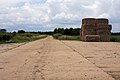
 Track to Golden Close - geograph.org.uk - 1412551.jpg 640 × 427; 91 KB


