Category:RAF Goxhill
Jump to navigation
Jump to search
| Object location | | View all coordinates using: OpenStreetMap |
|---|
former Air Force station  | |||||
| Upload media | |||||
| Instance of |
| ||||
|---|---|---|---|---|---|
| Location | England | ||||
| Operator | |||||
| Inception |
| ||||
| Dissolved, abolished or demolished date |
| ||||
 | |||||
Subcategories
This category has the following 4 subcategories, out of 4 total.
Media in category "RAF Goxhill"
The following 28 files are in this category, out of 28 total.
-
 Goxhill-092146.png 524 × 700; 391 KB
-
 1st Fighter Group P-38 Lightning 41-7631 at RAF Goxhill.jpg 5,488 × 3,813; 2.81 MB
-
 354th Fighter Group - P-51B Mustang at RAF Goxhill.jpg 5,782 × 3,685; 2.08 MB
-
 356th Fighter Group - P-47 Thunderbolt 42-74702 at RAF Goxhill.jpg 1,242 × 985; 240 KB
-
 496th Fighter Training Group - Spitfire Mk V at RAF Goxhill.jpg 1,557 × 974; 324 KB
-
 A Relic of Goxhill Airfield - geograph.org.uk - 542202.jpg 640 × 432; 159 KB
-
 Control Desk (RAF Goxhill) At Military Aviation Museum.jpg 3,648 × 2,736; 2.68 MB
-
 Equestrian Facility - Goxhill Airfield - geograph.org.uk - 923244.jpg 640 × 480; 107 KB
-
 Goxhill Airfield - Battle Headquarters - geograph.org.uk - 41308.jpg 640 × 480; 163 KB
-
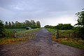
 Goxhill Airfield Entrance - geograph.org.uk - 57562.jpg 640 × 480; 102 KB
-
 Old Dispersal Area for Goxhill Airfield - geograph.org.uk - 906293.jpg 640 × 425; 107 KB
-

-

-

-
 Old Taxi-strip at Goxhill - geograph.org.uk - 168191.jpg 640 × 426; 98 KB
-

-
 Public Footpath to Goxhill - geograph.org.uk - 922187.jpg 640 × 479; 135 KB
-
 RAF Goxhill - 29 April 1947 - Airfield.jpg 1,317 × 1,369; 659 KB
-
 RAF Goxhill - Flags.jpg 1,437 × 913; 277 KB
-
 Recreation of RAF Goxhill Control tower at the Military Aviation Museum.jpg 3,648 × 2,736; 2.81 MB
-
 The Hooded Horse, Goxhill - geograph.org.uk - 885747.jpg 640 × 594; 132 KB
-
 The Public Footpath to Goxhill - geograph.org.uk - 884413.jpg 640 × 427; 118 KB
-

-
 Tramlines in the Wheat - geograph.org.uk - 922200.jpg 640 × 508; 148 KB
-
 Wartime Relic - College Road, Goxhill - geograph.org.uk - 564274.jpg 640 × 480; 139 KB
-
 Wheat Crop on the former Goxhill Airfield - geograph.org.uk - 885715.jpg 640 × 426; 108 KB
-
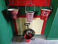 WW2 Fire equipment at the Military Aviation Museum.jpg 3,648 × 2,736; 2.74 MB
-
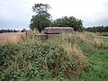
 Old Defence Post at Goxhill Airfield - geograph.org.uk - 293004.jpg 640 × 372; 125 KB


_At_Military_Aviation_Museum.jpg)


