Category:RAF Llanbedr
Jump to navigation
Jump to search
| Object location | | View all coordinates using: OpenStreetMap |
|---|
airport in the United Kingdom  | |||||
| Upload media | |||||
| Instance of | |||||
|---|---|---|---|---|---|
| Location | |||||
| Operator | |||||
| Date of official opening |
| ||||
| Elevation above sea level |
| ||||
| ICAO airport code |
| ||||
 | |||||
Media in category "RAF Llanbedr"
The following 29 files are in this category, out of 29 total.
-
-
 Display Plinth at Llanbedr Airfield - geograph.org.uk - 1079325.jpg 640 × 480; 319 KB
-
 Disused Hangar - geograph.org.uk - 193191.jpg 640 × 480; 63 KB
-

-
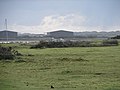
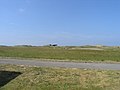
 Farmland beside Llanbedr Airfield - geograph.org.uk - 1079379.jpg 640 × 480; 221 KB
-

-
 Llanbedr Airfield - geograph.org.uk - 817647.jpg 640 × 457; 39 KB
-
 Llanbedr Airfield - geograph.org.uk - 817652.jpg 640 × 456; 27 KB
-
 Llanbedr airfield hangar - geograph.org.uk - 1079344.jpg 640 × 480; 162 KB
-
 Llanbedr control tower - geograph.org.uk - 419640.jpg 640 × 480; 58 KB
-
 Llanbedr Hangars - geograph.org.uk - 420619.jpg 640 × 480; 63 KB
-
 Llanbedr Hangars - geograph.org.uk - 420891.jpg 599 × 448; 171 KB
-

-
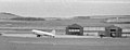 RAF Llanbedr.jpg 640 × 245; 40 KB
-
 Redundant sign at a redundant airfield - geograph.org.uk - 1080212.jpg 640 × 480; 206 KB
-
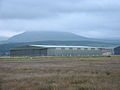
 Storage sheds at Llanbedr Airfield - geograph.org.uk - 1079384.jpg 640 × 480; 187 KB
-
 The control tower at Llanbedr Airfield - geograph.org.uk - 1079401.jpg 640 × 480; 160 KB
-
 The Empty Barracks - geograph.org.uk - 193183.jpg 640 × 480; 60 KB
-
 The south end of Llanbedr Airfield - geograph.org.uk - 1080240.jpg 640 × 480; 158 KB
-
 A view over Llanbedr airfield - geograph.org.uk - 1079355.jpg 640 × 480; 169 KB
-
 A view over Llanbedr airfield - geograph.org.uk - 1080200.jpg 640 × 480; 136 KB
-

-
 Flat Ground - geograph.org.uk - 499515.jpg 640 × 427; 68 KB
-
 Llanbedr Airfield - geograph.org.uk - 420691.jpg 640 × 480; 35 KB
-
 Llanbedr Airfield - geograph.org.uk - 420935.jpg 640 × 480; 57 KB
-
 Llanbedr Airfield - geograph.org.uk - 421606.jpg 640 × 480; 36 KB
-
 Llanbedr Airfield OPS Building - geograph.org.uk - 420721.jpg 640 × 480; 64 KB
-
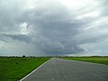
 Llanbedr Runway 18-36 - geograph.org.uk - 419647.jpg 640 × 480; 51 KB
-
 Runway 36 Llanbedr - geograph.org.uk - 420927.jpg 640 × 480; 34 KB


