Category:RAF Lyneham
Jump to navigation
Jump to search
| Object location | | View all coordinates using: OpenStreetMap |
|---|
former Royal Air Force station in Lyneham, Wiltshire, United Kingdom  | |||||
| Upload media | |||||
| Instance of |
| ||||
|---|---|---|---|---|---|
| Location | Lyneham, Lyneham and Bradenstoke, Wiltshire, South West England, England | ||||
| Operator | |||||
| Inception |
| ||||
| Dissolved, abolished or demolished date |
| ||||
| Significant event |
| ||||
| Replaced by | |||||
 | |||||
Subcategories
This category has only the following subcategory.
L
Media in category "RAF Lyneham"
The following 41 files are in this category, out of 41 total.
-
 2010 , Perimeter fence and footpath, R.A.F. Lyneham - geograph.org.uk - 2165517.jpg 1,600 × 1,232; 1,010 KB
-
 2010 , Perimeter of RAF Lyneham - geograph.org.uk - 2170344.jpg 1,600 × 1,093; 493 KB
-

-

-
-

-
 AW Albemarle - Lyneham - Royal Air Force Transport Command, 1943-1945. CH12049.jpg 2,361 × 1,772; 873 KB
-
 Big lift MOD 45147046.jpg 2,273 × 3,600; 762 KB
-
 Boundary fence, RAF Lyneham airfield - geograph.org.uk - 4292180.jpg 3,264 × 2,448; 3.63 MB
-
 British Generals 1939-1945 CL120.jpg 800 × 604; 70 KB
-
 Building, RAF Lyneham - geograph.org.uk - 412627.jpg 640 × 480; 88 KB
-
 Communications tower, RAF Lyneham - geograph.org.uk - 313073.jpg 640 × 480; 45 KB
-
 Communications tower, RAF Lyneham - geograph.org.uk - 410507.jpg 640 × 453; 46 KB
-
-
 Douglas Skymaster RAF VIP transport c1945.jpg 800 × 520; 152 KB
-
 Entrance sign - geograph.org.uk - 301395.jpg 608 × 397; 187 KB
-
 Hangar at RAF Lyneham - geograph.org.uk - 301279.jpg 640 × 384; 50 KB
-
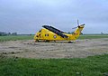 Helicopter, RAF Lyneham - geograph.org.uk - 410511.jpg 640 × 446; 54 KB
-
 Housing for RAF staff - geograph.org.uk - 301401.jpg 640 × 419; 83 KB
-
 Kestrel - RAF Lyneham (4326302032).jpg 2,048 × 1,365; 138 KB
-

-
 Last Hercules Aircraft from Lyneham.jpg 1,920 × 1,080; 229 KB
-
 Little Park close - geograph.org.uk - 339227.jpg 640 × 480; 87 KB
-
 Main entrance, RAF Lyneham - geograph.org.uk - 1187171.jpg 640 × 480; 119 KB
-
 On the M4, crossing the River Avon - geograph.org.uk - 88074.jpg 640 × 480; 56 KB
-
 RAF Lyneham - geograph.org.uk - 301387.jpg 640 × 385; 53 KB
-
 RAF Lyneham - geograph.org.uk - 317378.jpg 577 × 386; 84 KB
-
 RAF Lyneham 01.JPG 3,648 × 2,736; 7.91 MB
-
 RAF Lyneham 02.JPG 3,648 × 2,736; 6.26 MB
-
 RAF Lyneham 03.JPG 3,648 × 2,736; 6.86 MB
-
 RAF Lyneham airfield - geograph.org.uk - 4292187.jpg 3,264 × 2,448; 2 MB
-
 RAF Lyneham airfield - geograph.org.uk - 4292191.jpg 3,204 × 2,337; 4.3 MB
-

-
 Rotary Wing Training Facilitator MOD 45149768.jpg 2,250 × 1,500; 1,003 KB
-
 Royal Air Force Ferry Command, 1941-1943. CH8550.jpg 3,275 × 2,480; 2.16 MB
-
 Runway 24 RAF Lyneham - geograph.org.uk - 523875.jpg 640 × 480; 83 KB
-
 Service houses at RAF Lyneham - geograph.org.uk - 301373.jpg 620 × 416; 187 KB
-
 Service houses near RAF Lyneham - geograph.org.uk - 339223.jpg 640 × 480; 63 KB
-
 Sign on fence, RAF Lyneham - geograph.org.uk - 412614.jpg 640 × 480; 101 KB
-

-
 Vulcan XH558 - M1DLG.jpg 2,048 × 1,536; 1 MB


_-_geograph.org.uk_-_2165507.jpg)
1323.jpg)


.jpg)


