Category:RAF Membury
Jump to navigation
Jump to search
| Object location | | View all coordinates using: OpenStreetMap |
|---|
former World War II airfield built in the civil parish of Lambourn, Berkshire  | |||||
| Upload media | |||||
| Instance of |
| ||||
|---|---|---|---|---|---|
| Location | England | ||||
| Operator | |||||
| Inception |
| ||||
| Dissolved, abolished or demolished date |
| ||||
| Replaced by | |||||
 | |||||
Media in category "RAF Membury"
The following 6 files are in this category, out of 6 total.
-
 Membury-8aug44.png 600 × 713; 457 KB
-
 George Peck Collection Photo (16326654791).jpg 1,000 × 683; 226 KB
-
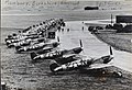
 Memb-436tcg-2.jpg 600 × 269; 44 KB
-
 Memb-f5-67rg.jpg 600 × 467; 80 KB
-
 Memb-f6-67rg.jpg 600 × 341; 35 KB
-
 Old shed, Membury Airfield - geograph.org.uk - 256782.jpg 640 × 478; 159 KB
.jpg)


