Category:Radway
Jump to navigation
Jump to search
village in Warwickshire, England, UK  | |||||
| Upload media | |||||
| Instance of | |||||
|---|---|---|---|---|---|
| Location | Stratford-on-Avon, Warwickshire, West Midlands, England | ||||
| Population |
| ||||
| Area |
| ||||
| Different from | |||||
 | |||||
Български: Изглед с църкавта на село Радуей

Subcategories
This category has the following 3 subcategories, out of 3 total.
Media in category "Radway"
The following 88 files are in this category, out of 88 total.
-
 'I think they mean it' - geograph.org.uk - 1491994.jpg 640 × 428; 77 KB
-
 A gap in Castle Wood - geograph.org.uk - 1833860.jpg 640 × 480; 502 KB
-
 A large garden, Radway - geograph.org.uk - 1833931.jpg 640 × 480; 368 KB
-
 A Path to Radway - geograph.org.uk - 3222482.jpg 4,000 × 3,000; 2.55 MB
-
 Battle of Edge Hill Monument - geograph.org.uk - 37621.jpg 480 × 640; 144 KB
-
 Castle Inn car park, Edgehill - geograph.org.uk - 1833846.jpg 640 × 480; 346 KB
-
 Cows and calves near Radway - geograph.org.uk - 1833928.jpg 640 × 480; 312 KB
-
 Cricket field at Radway - geograph.org.uk - 185664.jpg 640 × 480; 75 KB
-
 Cricket Field at Radway - geograph.org.uk - 6007983.jpg 640 × 427; 191 KB
-
 Edge Hill - geograph.org.uk - 3174634.jpg 640 × 480; 72 KB
-
 Edge Hill - geograph.org.uk - 3174650.jpg 640 × 480; 74 KB
-
 Edge Hill Light Railway embankment - geograph.org.uk - 110168.jpg 640 × 480; 79 KB
-
 Edgehill and Edgehill Tower - geograph.org.uk - 5061910.jpg 680 × 1,024; 217 KB
-
 Edgehill panorama - geograph.org.uk - 3433590.jpg 800 × 300; 72 KB
-
 Farm Building by the path to Radway - geograph.org.uk - 6446642.jpg 815 × 1,024; 331 KB
-
 Farnborough Road, Radway - geograph.org.uk - 1833936.jpg 640 × 480; 351 KB
-
 Field north of B4086 Banbury Road near Kineton - geograph.org.uk - 1864300.jpg 2,000 × 1,510; 151 KB
-
 Field Pond North of Radway - geograph.org.uk - 6010650.jpg 640 × 427; 203 KB
-
 Field south of B4086 Banbury Road near Kineton - geograph.org.uk - 1862335.jpg 2,000 × 1,498; 167 KB
-
 Fields at Arnolds Farm - geograph.org.uk - 3174591.jpg 640 × 480; 89 KB
-
 Footpath by the old churchyard - geograph.org.uk - 1833597.jpg 640 × 480; 457 KB
-
 Footpath heads into Radway from Edge Hill - geograph.org.uk - 6446638.jpg 1,024 × 768; 145 KB
-
 Footpath in Castle Wood - geograph.org.uk - 461628.jpg 640 × 477; 160 KB
-
 Footpath to Knowle End Wood - geograph.org.uk - 2836330.jpg 1,500 × 2,250; 668 KB
-
 Footpath up the hill to Radway Tower - geograph.org.uk - 1850250.jpg 640 × 480; 74 KB
-
 From Edgehill towards Radway, 2000 - geograph.org.uk - 5561867.jpg 569 × 627; 39 KB
-

-
 Hedge laying on footpath to Edgehill - geograph.org.uk - 3438562.jpg 2,000 × 1,394; 513 KB
-
 House at top of Sunrising Hill - geograph.org.uk - 461651.jpg 640 × 477; 120 KB
-
 House on King John's Lane - geograph.org.uk - 6007978.jpg 640 × 427; 178 KB
-
 Houses by the Green - geograph.org.uk - 1833559.jpg 640 × 480; 377 KB
-
 Houses on Langdon Lane - geograph.org.uk - 6010644.jpg 640 × 427; 197 KB
-
 Jacob's Ladder from below - geograph.org.uk - 1833909.jpg 640 × 480; 633 KB
-

-
 Kineton to Edgehill Road B4086 - geograph.org.uk - 2836344.jpg 2,000 × 1,333; 412 KB
-

-
 Knowle End Wood - geograph.org.uk - 2836313.jpg 2,000 × 1,456; 511 KB
-
 Lane to Church Farm - geograph.org.uk - 1833579.jpg 640 × 480; 480 KB
-
 Lane to Radway - geograph.org.uk - 184795.jpg 640 × 480; 66 KB
-
 Level crossing at a bend - geograph.org.uk - 1825265.jpg 640 × 480; 412 KB
-
 Level Crossing on the B4086 - geograph.org.uk - 6010659.jpg 640 × 438; 167 KB
-
 Long distance paths at Edge Hill - geograph.org.uk - 461633.jpg 640 × 477; 159 KB
-
 MOD Keep Out Signs - geograph.org.uk - 6010654.jpg 640 × 427; 298 KB
-
 MOD Railway Track - geograph.org.uk - 6010664.jpg 640 × 427; 220 KB
-
 Muck Pile - geograph.org.uk - 6012176.jpg 640 × 427; 205 KB
-
 No Admission signs at DSDA Kineton - geograph.org.uk - 1864315.jpg 2,000 × 1,497; 229 KB
-
 North end of the Green, Radway - geograph.org.uk - 1833939.jpg 640 × 480; 489 KB
-
 Obelisk - geograph.org.uk - 5861329.jpg 1,024 × 768; 253 KB
-

-
-

-

-
 Old lane to Kineton - geograph.org.uk - 2836260.jpg 2,000 × 1,333; 573 KB
-
 One man and his dog, Edge Hill - geograph.org.uk - 1833918.jpg 640 × 480; 379 KB
-
 Pond by West End, Radway - geograph.org.uk - 3441249.jpg 2,000 × 1,500; 571 KB
-

-
 Radway - geograph.org.uk - 37616.jpg 640 × 480; 84 KB
-
 Radway - geograph.org.uk - 37618.jpg 640 × 480; 113 KB
-
 Radway playing fields - geograph.org.uk - 37617.jpg 640 × 480; 68 KB
-
 Radway, MoD railway - geograph.org.uk - 1275069.jpg 640 × 480; 108 KB
-
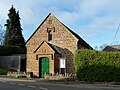 Radway-Old Chapel - geograph.org.uk - 4747979.jpg 1,600 × 1,200; 506 KB
-
 Radway-The Old Schoolhouse - geograph.org.uk - 4748024.jpg 1,600 × 1,200; 565 KB
-
 Radway-West End - geograph.org.uk - 4748030.jpg 1,600 × 1,200; 530 KB
-
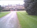
 Rear drive, Radway Grange - geograph.org.uk - 1833588.jpg 640 × 480; 563 KB
-
 RMD Kineton - geograph.org.uk - 410469.jpg 639 × 481; 43 KB
-
 Seven Shires Way - geograph.org.uk - 2694901.jpg 640 × 480; 150 KB
-
 Stables at Sunrising - geograph.org.uk - 461653.jpg 640 × 477; 128 KB
-
 Stone built shed in churchyard - geograph.org.uk - 2849347.jpg 2,000 × 1,500; 513 KB
-
 Thatched Cottages in Radway - geograph.org.uk - 6007987.jpg 640 × 427; 177 KB
-
 Thatching in progress in Radway - geograph.org.uk - 1850295.jpg 640 × 480; 121 KB
-
 The Castle Inn ^ Gatehouse, Edgehill - geograph.org.uk - 6631530.jpg 1,000 × 1,702; 1.34 MB
-
 The Edgehill battlefield in Warwickshire - geograph.org.uk - 2741339.jpg 4,752 × 3,168; 3.16 MB
-
 The Green by Farnborough Road, Radway - geograph.org.uk - 1833942.jpg 640 × 480; 429 KB
-

-
 Upton House - geograph.org.uk - 16501.jpg 640 × 480; 77 KB
-
 View towards The Grange - geograph.org.uk - 3441553.jpg 2,000 × 1,447; 535 KB
-
 Windflowers, Edge Hill - geograph.org.uk - 1833901.jpg 640 × 480; 647 KB
-
 Woodland below Edge Hill in spring - geograph.org.uk - 1833925.jpg 640 × 480; 456 KB
-
 Battleton Holt - geograph.org.uk - 326099.jpg 640 × 480; 83 KB
-
 Brick watchtower - geograph.org.uk - 343623.jpg 640 × 480; 65 KB
-
 Bridleway to Westcote Farm - geograph.org.uk - 343620.jpg 640 × 480; 97 KB
-
 Crop at Arnold's Farm - geograph.org.uk - 141789.jpg 640 × 480; 298 KB
-
 Disused outbuildings at Westcote Farm - geograph.org.uk - 343628.jpg 640 × 480; 89 KB
-
 Fence - geograph.org.uk - 475465.jpg 640 × 480; 140 KB
-
 Fence - geograph.org.uk - 475466.jpg 640 × 480; 101 KB
-
 King John's Lane - geograph.org.uk - 343351.jpg 640 × 480; 110 KB
-
 One field away - geograph.org.uk - 475460.jpg 640 × 480; 96 KB
-
 Westcote Farm - geograph.org.uk - 343356.jpg 640 × 480; 88 KB


_and_the_very_old_walls_-_geograph.org.uk_-_2817935.jpg)


