Category:Rail transport maps of Berkshire
Jump to navigation
Jump to search
Subcategories
This category has only the following subcategory.
Media in category "Rail transport maps of Berkshire"
The following 13 files are in this category, out of 13 total.
-
Ascot-Guildford line.png 1,506 × 1,930; 2.52 MB
-
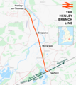
Henley branch line.png 1,596 × 1,794; 1.05 MB
-
Marlow branch line.png 1,498 × 1,838; 1.47 MB
-
Crossrail extensions.png 664 × 525; 563 KB
-
North Downs Line route diagram - December 2024.jpg 480 × 780; 64 KB
-
Rail transport infrastructure map - UK - South East England.svg 1,247 × 983; 8.83 MB
-
Reading-Basingstoke Line.jpg 569 × 424; 49 KB
-
Reading–Basingstoke line.png 1,812 × 1,494; 1.97 MB
-
Reading–Taunton line.png 3,900 × 1,547; 4.37 MB
-
Slough–Windsor & Eton line.png 1,255 × 1,377; 1.21 MB
-
Staines–Windsor line.png 1,808 × 1,417; 1.53 MB
-
Waterloo–Reading line.png 2,391 × 1,368; 3.36 MB
-
Windsor lines 1922.gif 1,566 × 619; 89 KB


