Category:Rail transport maps of Bretagne
Jump to navigation
Jump to search
Administrative regions and territorial collectivity of Metropolitan France (‡ since start of 2016):
Auvergne-Rhône-Alpes‡ · Bourgogne-Franche-Comté‡ · Brittany · Centre-Val de Loire · Corsica · Grand Est‡ · Hauts-de-France‡ · Île-de-France · Normandy‡ · New Aquitaine‡ · Occitania‡ · Pays de la Loire · Provence-Alpes-Côte d'Azur
Overseas departments and regions: Réunion
Auvergne-Rhône-Alpes‡ · Bourgogne-Franche-Comté‡ · Brittany · Centre-Val de Loire · Corsica · Grand Est‡ · Hauts-de-France‡ · Île-de-France · Normandy‡ · New Aquitaine‡ · Occitania‡ · Pays de la Loire · Provence-Alpes-Côte d'Azur
Overseas departments and regions: Réunion
Subcategories
This category has the following 4 subcategories, out of 4 total.
Media in category "Rail transport maps of Bretagne"
The following 44 files are in this category, out of 44 total.
-
 Cancale - Tracé du tramway.png 920 × 514; 63 KB
-
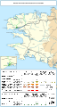
 Carte LGV Sud-Loire.png 546 × 435; 55 KB
-
 Carte Réseau Breton.jpg 1,000 × 593; 122 KB
-
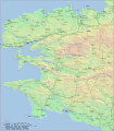 Finistère.gif 1,500 × 1,709; 1.14 MB
-
 Gare-Carhaix.svg 656 × 320; 51 KB
-
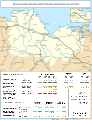
 Plan Saint-Brieuc CdN.jpg 1,000 × 766; 57 KB
-
 Plan voie gare RB.jpg 1,000 × 240; 24 KB
-
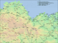
 Plan-reseau-Morbihan.gif 1,833 × 1,327; 1.04 MB
-
 Plan-réseau-CFCdN.gif 1,897 × 1,420; 1.13 MB
-

-
 Railway map of France - 22 - 1900 - fr - small.svg 705 × 914; 7.52 MB
-
 Railway map of France - 22 - 1928 - fr - small.svg 705 × 914; 7.92 MB
-
 Railway map of France - 22 - 1933 - fr - small.svg 705 × 914; 7.92 MB
-
 Railway map of France - 22 - 1950 - fr - small.svg 705 × 914; 7.76 MB
-
 Railway map of France - 22 - 1980 - fr - small.svg 705 × 914; 7.73 MB
-
 Railway map of France - 22 - 2020 - fr - small.svg 705 × 914; 8.96 MB
-
 Railway map of France - 22 - animated - fr.gif 1,558 × 2,020; 5.16 MB
-
 Railway map of France - 29 - 1900 - fr - small.svg 564 × 1,056; 6.21 MB
-
 Railway map of France - 29 - 1913 - fr - small.svg 564 × 1,056; 6.39 MB
-
 Railway map of France - 29 - 1930 - fr - small.svg 564 × 1,056; 6.26 MB
-
 Railway map of France - 29 - 1950 - fr - small.svg 564 × 1,056; 6.31 MB
-
 Railway map of France - 29 - 1980 - fr - small.svg 564 × 1,056; 6.29 MB
-
 Railway map of France - 29 - 2020 - fr - small.svg 564 × 1,056; 5.95 MB
-
 Railway map of France - 29 - animated - fr.gif 1,246 × 2,335; 5.02 MB
-
 Railway map of France - 35 - 1900 - fr - small.svg 564 × 1,056; 7.83 MB
-
 Railway map of France - 35 - 1913 - fr - small.svg 564 × 1,056; 8.06 MB
-
 Railway map of France - 35 - 1928 - fr - small.svg 564 × 1,056; 8.13 MB
-
 Railway map of France - 35 - 1950 - fr - small.svg 564 × 1,056; 7.96 MB
-
 Railway map of France - 35 - 1980 - fr - small.svg 564 × 1,056; 7.95 MB
-
 Railway map of France - 35 - 2020 - fr - small.svg 564 × 1,056; 7.8 MB
-
 Railway map of France - 35 - animated - fr.gif 1,246 × 2,335; 5.48 MB
-
 Railway map of France - 56 - 1900 - fr - small.svg 705 × 950; 7.01 MB
-
 Railway map of France - 56 - 1913 - fr - small.svg 705 × 950; 7.25 MB
-
 Railway map of France - 56 - 1930 - fr - small.svg 705 × 950; 7.48 MB
-
 Railway map of France - 56 - 1950 - fr - small.svg 705 × 950; 7.2 MB
-
 Railway map of France - 56 - 1980 - fr - small.svg 705 × 950; 7.18 MB
-
 Railway map of France - 56 - 2020 - fr - small.svg 705 × 950; 7.13 MB
-
 Railway map of France - 56 - animated - fr.gif 1,558 × 2,100; 5.66 MB
-
 Railway map of France - Brest - animated - fr.gif 1,566 × 1,691; 7.65 MB
-
 Railway map of France - BZH - 1930 - fr.svg 564 × 709; 6.89 MB
-
 Railway map of France - BZH - 2020 - fr.svg 564 × 709; 6.76 MB
-
 Railway map of France - Rennes - animated - fr.gif 1,566 × 1,691; 8 MB
-
 Réseaux ferrés en Bretagne.svg 1,044 × 712; 41 KB
-
 Train patates.jpg 1,000 × 741; 308 KB


