Category:Rail transport maps of Haute-Saône
Jump to navigation
Jump to search
Media in category "Rail transport maps of Haute-Saône"
The following 8 files are in this category, out of 8 total.
-
 Carte puits - réseaux ferré - projet canal - Ronchamp.jpg 2,700 × 1,280; 687 KB
-
 Carte réseau ferré des houillères de Ronchamp.svg 3,185 × 2,438; 170 KB
-
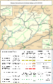
 Railway map of France - 70 - 1900 - fr - small.svg 564 × 896; 6.61 MB
-
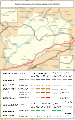
 Railway map of France - 70 - 1930 - fr - small.svg 564 × 896; 6.85 MB
-
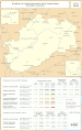
 Railway map of France - 70 - 1980 - fr - small.svg 564 × 896; 6.73 MB
-
 Railway map of France - 70 - 2020 - fr - small.svg 564 × 896; 6.54 MB
-
 Railway map of France - 70 - animated - fr.gif 1,252 × 1,991; 4.82 MB
-
 Voies ferrées puits Notre-Dame.jpg 1,515 × 1,789; 971 KB


