Category:Rail transport maps of Moselle
Jump to navigation
Jump to search
Media in category "Rail transport maps of Moselle"
The following 15 files are in this category, out of 15 total.
-

-
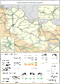
 Railway map of France - 54-57 - 1870 - fr - small.svg 811 × 1,126; 10.61 MB
-
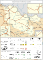
 Railway map of France - 54-57 - 1900 - fr - small.svg 811 × 1,126; 10.68 MB
-
 Railway map of France - 54-57 - 1913 - fr - small.svg 811 × 1,126; 10.97 MB
-
 Railway map of France - 54-57 - 1919 - fr - small.svg 811 × 1,126; 11.32 MB
-
 Railway map of France - 54-57 - animated - fr.gif 1,802 × 2,502; 9.57 MB
-
 Railway map of France - 57 - 1900 - fr - small.svg 705 × 985; 8.21 MB
-
 Railway map of France - 57 - 1913 - fr - small.svg 705 × 985; 8.42 MB
-
 Railway map of France - 57 - 1919 - fr - small.svg 705 × 985; 8.74 MB
-
 Railway map of France - 57 - 1930 - fr - small.svg 705 × 985; 8.77 MB
-
 Railway map of France - 57 - 1939 - fr - small.svg 705 × 985; 8.75 MB
-
 Railway map of France - 57 - 1980 - fr - small.svg 705 × 985; 8.67 MB
-
 Railway map of France - 57 - 2020 - fr - small.svg 705 × 985; 8.51 MB
-
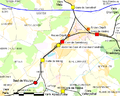 Système ferroviaire Sarrebourg Réding.png 756 × 605; 107 KB
-
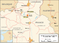 Zoufftgen rail crash map-fr.svg 1,255 × 910; 364 KB


