Category:Rail transport maps of New Zealand
Jump to navigation
Jump to search
Media in category "Rail transport maps of New Zealand"
The following 17 files are in this category, out of 17 total.
-
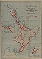
 1944 one inch map showing Glen Massey branch railway.jpg 1,129 × 354; 316 KB
-
 Karte May Morn Estates Tramway.png 1,998 × 1,969; 3.24 MB
-
 Karte Piha Tramway.png 1,332 × 2,355; 3.83 MB
-
 KiwiRail passenger train map north island.png 554 × 616; 357 KB
-
 KiwiRail passenger train map south island.png 780 × 786; 603 KB
-
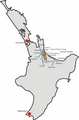
 KiwiRail passenger train map.png 645 × 778; 315 KB
-
 Map of North Island Main Trunk Line, March 2016.png 393 × 599; 78 KB
-
 NewZealandRailNetwork.png 376 × 462; 29 KB
-
 North Island New Zealand Rail Map (10469569543).jpg 4,087 × 5,703; 2.21 MB
-
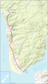
 Northisland NZ East-Coast-Main-Trunk.png 328 × 500; 42 KB
-
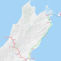
 Northisland NZ NIMT.png 600 × 915; 118 KB
-
 NorthIsland rrMap v02.svg 744 × 1,000; 110 KB
-
 NorthIsland rrMap.svg 744 × 1,000; 109 KB
-
 South Island New Zealand Rail Map (10469556503).jpg 4,379 × 5,376; 2.12 MB
-
 SouthIsland rrMap v02.svg 744 × 1,000; 70 KB
-
 TranzMetroSchematic.png 400 × 764; 61 KB
-
 WellingtonRailMap.png 950 × 525; 61 KB


.jpg)


.jpg)


